Cepoy
Cepoy | |
|---|---|
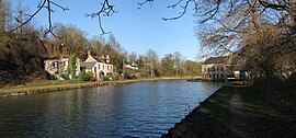 The Loing Canal at the south west of Cepoy | |
 Coat of arms | |
show Location of Cepoy | |
 Cepoy | |
| Coordinates: 48°02′50″N 2°44′16″E / 48.0472°N 2.7378°ECoordinates: 48°02′50″N 2°44′16″E / 48.0472°N 2.7378°E | |
| Country | France |
| Region | Centre-Val de Loire |
| Department | Loiret |
| Arrondissement | Montargis |
| Canton | Châlette-sur-Loing |
| Intercommunality | |
| Government | |
| • Mayor (2020–2026) | Régis Guerin |
| Area 1 | 8.52 km2 (3.29 sq mi) |
| Population (Jan. 2018)[1] | 2,381 |
| • Density | 280/km2 (720/sq mi) |
| Demonym(s) | Cepoyennes, Cepoyens[2] |
| Time zone | UTC+01:00 (CET) |
| • Summer (DST) | UTC+02:00 (CEST) |
| INSEE/Postal code | 45061 /45120 |
| Elevation | 77–114 m (253–374 ft) |
| Website | www.ville-cepoy.fr |
| 1 French Land Register data, which excludes lakes, ponds, glaciers > 1 km2 (0.386 sq mi or 247 acres) and river estuaries. | |


The church.
Cepoy (French pronunciation: [səpwa]) is a commune in the Loiret department in north-central France.
See also[]
- Communes of the Loiret department
References[]
- ^ "Populations légales 2018". INSEE. 28 December 2020.
- ^ Gentilés des communes du Loiret
| Wikimedia Commons has media related to Cepoy. |
| show Communes of the Loiret department |
|---|
| show Authority control |
|---|
This Loiret geographical article is a stub. You can help Wikipedia by . |
Categories:
- Communes of Loiret
- Loiret geography stubs