Chartierville, Quebec
Chartierville | |
|---|---|
Municipality | |
 | |
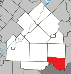 Location within Le Haut-Saint-François RCM | |
 Chartierville Location in southern Quebec | |
| Coordinates: 45°18′N 71°12′W / 45.3°N 71.2°WCoordinates: 45°18′N 71°12′W / 45.3°N 71.2°W[1] | |
| Country | |
| Province | |
| Region | Estrie |
| RCM | Le Haut-Saint-François |
| Constituted | January 1, 1879 |
| Government | |
| • Mayor | Jean Belhumeur |
| • Federal riding | Compton—Stanstead |
| • Prov. riding | Mégantic |
| Area | |
| • Total | 142.60 km2 (55.06 sq mi) |
| • Land | 140.93 km2 (54.41 sq mi) |
| Population | |
| • Total | 307 |
| • Density | 2.2/km2 (6/sq mi) |
| • Pop 2006-2011 | |
| Time zone | UTC−5 (EST) |
| • Summer (DST) | UTC−4 (EDT) |
| Postal code(s) | J0B 1K0 |
| Area code(s) | 819 |
| Highways | |
| Website | www |

Chartierville is a small municipality of about 300 people in Le Haut-Saint-François Regional County Municipality, in the Estrie region of Quebec, Canada, on the Canada–United States border.
Chartierville is located on Route 257 South. Prior to its founding in 1870 by colonists from Saint-Hyacinthe, gold-seekers flocked to the area. This patch of land, 139 square kilometers (54 square miles) and 505 meters (1657 feet) in altitude, is one of the highest regions in Quebec.
Magnetic Hill[]
A local attraction of interest is Magnetic Hill (Côte Magnétique), a gravity hill.[4]

Magnetic Hill in Chartierville, Quebec
References[]
- ^ Reference number 12580 of the Commission de toponymie du Québec (in French)
- ^ Jump up to: a b Geographic code 41020 in the official Répertoire des municipalités (in French)
- ^ Jump up to: a b "(Code 2441020) Census Profile". 2011 census. Statistics Canada. 2012.
- ^ Rogers, Barbar Radcliffe (August 2015). New Hampshire's Northern Tip, nhmagazine.com
External links[]
 Media related to Chartierville at Wikimedia Commons
- Official website of the Municipality of Chartierville
| show Places adjacent to Chartierville, Quebec |
|---|
| show |
|---|
| Authority control |
|
|---|
This Estrie location article is a stub. You can help Wikipedia by . |
Categories:
- Municipalities in Quebec
- Incorporated places in Estrie
- Le Haut-Saint-François Regional County Municipality
- Estrie geography stubs