East Angus, Quebec
show This article may be expanded with text translated from the corresponding article in French. (October 2020) Click [show] for important translation instructions. |
East Angus | |
|---|---|
City | |
 | |
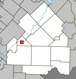 Location within Le Haut-Saint-François RCM | |
 East Angus Location in southern Quebec | |
| Coordinates: 45°29′N 71°40′W / 45.483°N 71.667°WCoordinates: 45°29′N 71°40′W / 45.483°N 71.667°W[1] | |
| Country | |
| Province | |
| Region | Estrie |
| RCM | Le Haut-Saint-François |
| Constituted | March 14, 1912 |
| Government | |
| • Mayor | Robert G. Roy |
| • Federal riding | Compton—Stanstead |
| • Prov. riding | Mégantic |
| Area | |
| • Total | 8.30 km2 (3.20 sq mi) |
| • Land | 7.91 km2 (3.05 sq mi) |
| Population | |
| • Total | 3,741 |
| • Density | 472.7/km2 (1,224/sq mi) |
| • Pop 2006-2011 | |
| Time zone | UTC−5 (EST) |
| • Summer (DST) | UTC−4 (EDT) |
| Postal code(s) | J0B 1R0 |
| Area code(s) | 819 |
| Highways | |
| Website | www |

East Angus (French pronunciation: [istɛ̃ɡys]) is a city in Le Haut-Saint-François Regional County Municipality, in Quebec, Canada. The city had a population of 3,741 as of the Canada 2011 Census.
References[]
- ^ Reference number 142194 of the Commission de toponymie du Québec (in French)
- ^ Jump up to: a b Geographic code 41060 in the official Répertoire des municipalités (in French)
- ^ Jump up to: a b "(Code 2441060) Census Profile". 2011 census. Statistics Canada. 2012.
External links[]
 Media related to East Angus, Quebec at Wikimedia Commons
| show Places adjacent to East Angus, Quebec |
|---|
| show |
|---|
| show Authority control |
|---|
This Estrie location article is a stub. You can help Wikipedia by . |
Categories:
- Incorporated places in Estrie
- Cities and towns in Quebec
- Le Haut-Saint-François Regional County Municipality
- Estrie geography stubs