La Patrie, Quebec
La Patrie | |
|---|---|
Municipality | |
 | |
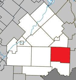 Location within Le Haut-Saint-François RCM. | |
 La Patrie Location in southern Quebec. | |
| Coordinates: 45°24′N 71°15′W / 45.400°N 71.250°WCoordinates: 45°24′N 71°15′W / 45.400°N 71.250°W[1] | |
| Country | |
| Province | |
| Region | Estrie |
| RCM | Le Haut-Saint-François |
| Constituted | December 24, 1997 |
| Government | |
| • Mayor | Jacques Blais |
| • Federal riding | Compton—Stanstead |
| • Prov. riding | Mégantic |
| Area | |
| • Total | 206.70 km2 (79.81 sq mi) |
| • Land | 205.82 km2 (79.47 sq mi) |
| Population | |
| • Total | 749 |
| • Density | 3.6/km2 (9/sq mi) |
| • Pop 2006-2011 | |
| Time zone | UTC−5 (EST) |
| • Summer (DST) | UTC−4 (EDT) |
| Postal code(s) | J0B 1Y0 |
| Area code(s) | 819 |
| Highways | |
| Website | www |

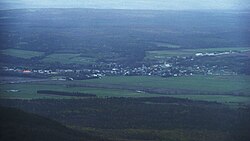
La Patrie is a municipality of about 750 people in Le Haut-Saint-François Regional County Municipality, in Quebec, Canada. It is located at the base of Mont Mégantic.
Some industries specializing in the field of forestry have settled in La Patrie. The company Guitabec, which produces guitars under the label Godin, has a manufacturing facility in La Patrie.
Light pollution[]
Participating in a program initiated and established by the Mont-Mégantic National Park in collaboration with Hydro-Québec, the village of La Patrie has greatly reduced its light pollution, which strongly affects the Mont Mégantic Observatory.
References[]
- ^ Reference number 339393 of the Commission de toponymie du Québec (in French)
- ^ Jump up to: a b Geographic code 41027 in the official Répertoire des municipalités (in French)
- ^ Jump up to: a b "(Code 2441027) Census Profile". 2011 census. Statistics Canada. 2012.
External links[]
 Media related to La Patrie at Wikimedia Commons
| show Places adjacent to La Patrie, Quebec |
|---|
| show |
|---|
This Estrie location article is a stub. You can help Wikipedia by . |
Categories:
- Municipalities in Quebec
- Incorporated places in Estrie
- Designated places in Quebec
- Le Haut-Saint-François Regional County Municipality
- Estrie geography stubs