Hampden, Quebec
Hampden | |
|---|---|
Township municipality | |
 | |
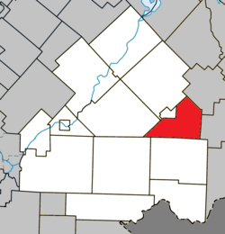 Location within Le Haut-Saint-François RCM | |
 Hampden Location in southern Quebec | |
| Coordinates: 45°30′N 71°15′W / 45.5°N 71.25°WCoordinates: 45°30′N 71°15′W / 45.5°N 71.25°W[1] | |
| Country | |
| Province | |
| Region | Estrie |
| RCM | Le Haut-Saint-François |
| Constituted | January 1, 1874 |
| Government | |
| • Mayor | Bertrand Prévost |
| • Federal riding | Compton—Stanstead |
| • Prov. riding | Mégantic |
| Area | |
| • Total | 111.80 km2 (43.17 sq mi) |
| • Land | 112.70 km2 (43.51 sq mi) |
| There is an apparent contradiction between two authoritative sources | |
| Population | |
| • Total | 214 |
| • Density | 1.9/km2 (5/sq mi) |
| • Pop 2006-2011 | |
| Time zone | UTC−5 (EST) |
| • Summer (DST) | UTC−4 (EDT) |
| Postal code(s) | J0B 1Y0 |
| Area code(s) | 819 |
| Highways | |
| Website | www |

Hampden is a township municipality of about 200 people in Le Haut-Saint-François Regional County Municipality, in the Estrie region of Quebec, Canada.
References[]
- ^ Reference number 27855 of the Commission de toponymie du Québec (in French)
- ^ a b Geographic code 41075 in the official Répertoire des municipalités (in French)
- ^ a b "(Code 2441075) Census Profile". 2011 census. Statistics Canada. 2012.
External links[]
 Media related to Hampden, Quebec at Wikimedia Commons
Places adjacent to Hampden, Quebec | |
|---|---|
| Cities & Towns | |
|---|---|
| Municipalities | |
| Townships | |
| |
This Estrie location article is a stub. You can help Wikipedia by . |
Categories:
- Township municipalities in Quebec
- Incorporated places in Estrie
- Le Haut-Saint-François Regional County Municipality
- Estrie geography stubs