Newport, Quebec
Newport | |
|---|---|
Municipality | |
 | |
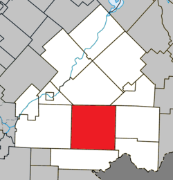 Location within Le Haut-Saint-François RCM | |
 Newport Location in southern Quebec | |
| Coordinates: 45°23′N 71°29′W / 45.383°N 71.483°WCoordinates: 45°23′N 71°29′W / 45.383°N 71.483°W[1] | |
| Country | |
| Province | |
| Region | Estrie |
| RCM | Le Haut-Saint-François |
| Constituted | January 1, 2006 |
| Government | |
| • Mayor | Thérèse Ménard-Théroux |
| • Federal riding | Compton—Stanstead |
| • Prov. riding | Mégantic |
| Area | |
| • Total | 272.50 km2 (105.21 sq mi) |
| • Land | 271.88 km2 (104.97 sq mi) |
| Population | |
| • Total | 720 |
| • Density | 2.6/km2 (7/sq mi) |
| • Pop 2006-2011 | |
| Time zone | UTC−5 (EST) |
| • Summer (DST) | UTC−4 (EDT) |
| Postal code(s) | J0B 1M0 |
| Area code(s) | 819 |
| Highways | |

Newport is a municipality of about 700 people in Le Haut-Saint-François Regional County Municipality, in Quebec, Canada. Newport has a small town called Island Brook.
On July 24, 2002, the then-township of Newport was amalgamated into the city of Cookshire-Eaton as part of the early 2000s municipal reorganization in Quebec. After a referendum, Newport de-merged and became an independent municipality on January 1, 2006. However, it remains part of the urban agglomeration of Cookshire-Eaton.
References[]
- ^ Reference number 388447 of the Commission de toponymie du Québec (in French)
- ^ Jump up to: a b Geographic code 41037 in the official Répertoire des municipalités (in French)
- ^ Jump up to: a b "(Code 2441037) Census Profile". 2011 census. Statistics Canada. 2012.
External links[]
 Media related to Newport, Estrie, Quebec at Wikimedia Commons
| show Places adjacent to Newport, Quebec |
|---|
| show |
|---|
| show Authority control |
|---|
This Estrie location article is a stub. You can help Wikipedia by . |
Categories:
- Municipalities in Quebec
- Incorporated places in Estrie
- Le Haut-Saint-François Regional County Municipality
- Estrie geography stubs