Cher (department)
show This article may be expanded with text translated from the corresponding article in French. (January 2009) Click [show] for important translation instructions. |
Cher | |
|---|---|
 Prefecture of Cher, in Bourges | |
 Flag | |
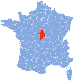 Location of Cher in France | |
| Coordinates: 47°0′N 2°35′E / 47.000°N 2.583°ECoordinates: 47°0′N 2°35′E / 47.000°N 2.583°E | |
| Country | France |
| Region | Centre-Val de Loire |
| Prefecture | Bourges |
| Subprefectures | Saint-Amand-Montrond Vierzon |
| Government | |
| • President of the General Council | (LR) |
| Area | |
| • Total | 7,235 km2 (2,793 sq mi) |
| Population (2016) | |
| • Total | 307,110 |
| • Rank | 73rd |
| • Density | 42/km2 (110/sq mi) |
| Time zone | UTC+1 (CET) |
| • Summer (DST) | UTC+2 (CEST) |
| Department number | 18 |
| Arrondissements | 3 |
| Cantons | 19 |
| Communes | 287 |
| ^1 French Land Register data, which exclude estuaries, and lakes, ponds, and glaciers larger than 1 km2 | |


Cher (/ʃɛər/; French: [ʃɛʁ]; Berrichon: Char) is a department in the administrative region of Centre-Val de Loire, France. It is named after the Cher River.
History[]
Cher is one of the original 83 departments created during the French Revolution on 4 March 1790. Most of it was created, along with the adjacent department of Indre from the former province of Berry. The southeastern corner of the department, however, was part of the Duchy of Bourbon.
Geography[]
The department is part of the current administrative region of Centre-Val de Loire. It is surrounded by the departments of Indre, Loir-et-Cher, Loiret, Nièvre, Allier, and Creuse.
Demographics[]
| Year | Pop. | ±% p.a. |
|---|---|---|
| 1791 | 207,541 | — |
| 1801 | 217,785 | +0.48% |
| 1806 | 228,158 | +0.93% |
| 1821 | 239,561 | +0.33% |
| 1831 | 256,059 | +0.67% |
| 1841 | 273,645 | +0.67% |
| 1851 | 306,261 | +1.13% |
| 1861 | 323,393 | +0.55% |
| 1872 | 335,392 | +0.33% |
| 1881 | 351,405 | +0.52% |
| 1891 | 359,276 | +0.22% |
| 1901 | 345,543 | −0.39% |
| 1911 | 337,810 | −0.23% |
| 1921 | 304,800 | −1.02% |
| 1931 | 293,918 | −0.36% |
| 1936 | 288,695 | −0.36% |
| 1946 | 286,070 | −0.09% |
| 1954 | 284,376 | −0.07% |
| 1962 | 293,514 | +0.40% |
| 1968 | 304,601 | +0.62% |
| 1975 | 316,350 | +0.54% |
| 1982 | 320,174 | +0.17% |
| 1990 | 321,559 | +0.05% |
| 1999 | 314,428 | −0.25% |
| 2006 | 314,676 | +0.01% |
| 2016 | 307,110 | −0.24% |
| source:[1] | ||
The inhabitants of the department are called Berrichons from the former province of Berry.
Politics[]
The President of the General Council is of the Socialist Party.
| Party | seats | |
|---|---|---|
| Union for a Popular Movement | 10 | |
| • | Socialist Party | 9 |
| • | French Communist Party | 7 |
| Miscellaneous Right | 5 | |
| • | Miscellaneous Left | 4 |
Current National Assembly representatives[]
| Constituency | Member[2] | Party | |
|---|---|---|---|
| 1st | François Cormier-Bouligeon | La République En Marche! | |
| 2nd | Nadia Essayan | MoDem | |
| 3rd | Loïc Kervran | La République En Marche! | |
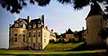
Tourism[]
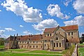
The Bourges Cathedral of St. Étienne is a major tourist attraction.
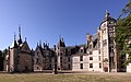
Château de Meillant


See also[]
- Cantons of the Cher department
- Communes of the Cher department
- Arrondissements of the Cher department
- Coat of arms of Cher
Languages[]
The historical languages are Berrichon and the northern version of Bourbonnais. These are both dialects of French, or the Langues d'oïl. They are named respectively after the former Province of Berry and the former Duchy of Bourbon. Some 11 communes in the extreme South used to speak Occitan.
The old dialects were in widespread use until the middle decades of the twentieth century and incorporated major regional variations within the department, influenced by the dialects of adjacent regions near the departmental frontiers. During the twentieth century government educational policy promoted a more standardised version of the French language.
In the extreme south of the department influence from the southern Occitan language begins to appear, with "chambrat" being used in place of "grenier a foin" (hayloft), "betoulle" in place of "bouleau" (birch tree) and "aigue" in place of "eau" (water).
References[]
External links[]
- (in French) General Council of Cher
- (in French) Prefecture of Cher
- (in English) Cher at Curlie
- https://web.archive.org/web/20051203082547/http://www.bc.edu/bc_org/avp/cas/fnart/arch/bourges.html
- https://web.archive.org/web/20041204220326/http://www.sitesatlas.com/Europe/France/Bourges.htm
- http://berrichou.free.fr/
| show Authority control |
|---|
- Cher (department)
- 1790 establishments in France
- Departments of Centre-Val de Loire
- States and territories established in 1790