Chilleurs-aux-Bois
Chilleurs-aux-Bois | |
|---|---|
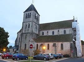 The church in Chilleurs-aux-Bois | |
 Coat of arms | |
show Location of Chilleurs-aux-Bois | |
 Chilleurs-aux-Bois | |
| Coordinates: 48°04′23″N 2°08′09″E / 48.0731°N 2.1358°ECoordinates: 48°04′23″N 2°08′09″E / 48.0731°N 2.1358°E | |
| Country | France |
| Region | Centre-Val de Loire |
| Department | Loiret |
| Arrondissement | Pithiviers |
| Canton | Malesherbes |
| Intercommunality | Pithiverais |
| Government | |
| • Mayor (2020–2026) | Gérard Legrand[1] |
| Area 1 | 52.22 km2 (20.16 sq mi) |
| Population (Jan. 2018)[2] | 2,027 |
| • Density | 39/km2 (100/sq mi) |
| Demonym(s) | Chilleurois |
| Time zone | UTC+01:00 (CET) |
| • Summer (DST) | UTC+02:00 (CEST) |
| INSEE/Postal code | 45095 /45170 |
| Elevation | 114–150 m (374–492 ft) |
| Website | www.chilleurs-aux-bois.fr |
| 1 French Land Register data, which excludes lakes, ponds, glaciers > 1 km2 (0.386 sq mi or 247 acres) and river estuaries. | |


Chilleurs-aux-Bois is a commune in the Loiret department in north-central France.
See also[]
- Communes of the Loiret department
References[]
- ^ "Répertoire national des élus: les maires". data.gouv.fr, Plateforme ouverte des données publiques françaises (in French). 2 December 2020.
- ^ "Populations légales 2018". INSEE. 28 December 2020.
| Wikimedia Commons has media related to Chilleurs-aux-Bois. |
| show Communes of the Loiret department |
|---|
| show Authority control |
|---|
This Loiret geographical article is a stub. You can help Wikipedia by . |
Categories:
- Communes of Loiret
- Loiret geography stubs