Chinchaga Wildland Park
| Chinchaga Wildland Park | |
|---|---|
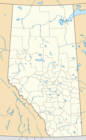 Location of Chinchaga Wildland Park in Alberta | |
| Location | Clear Hills County, Alberta, Canada |
| Nearest city | Manning |
| Coordinates | 57°07′59″N 119°32′59″W / 57.13306°N 119.54972°WCoordinates: 57°07′59″N 119°32′59″W / 57.13306°N 119.54972°W |
| Area | 803 km² |
| Established | 2000 |
| Governing body | Alberta Tourism, Parks and Recreation |

Chinchaga Wildland Park is a protected 800 km2 (310 sq mi) (80,000 hectares) tract of land in the 5,000 km2 (1,900 sq mi) of the greater Chinchaga wilderness area[1] in a disjunct outlier of the ,[2] in a remote area of northwest Alberta, Canada, about 140 kilometres (87 mi) west of Manning. It was designated as a Wildlife Park in December 1999.[2] The greater Chinchaga area was identified in 1995 as an Environmentally Significant Area.[3] It was designated by the Alberta Government as a protected area in 2000, under the "Special Places" program.[4] "Elevations in the Park range from 650 m adjacent to the Chinchaga River to 915 m at the height of land atop Halverson Ridge."[3]
The upper course of the Chinchaga River, which forms the Park's northern border, is a provincially Environmentally Significant Area (ESA).[5] The Park extends south to the slopes of Halverson Ridge.[2] The only road that provides access is the Chinchaga Forestry Road, a high grade gravel road running west from the Mackenzie Highway.
History[]
The Chinchaga area was mainly used by small populations of First Nations and Métis for hunting.
Chinchaga Firestorm 1950[]
In the spring of 1950 the watershed of the Chinchaga River experienced drought conditions that extended over boreal regions of northern Canada.[6] At the time of the fire Imperial Oil surveying crew were on site. The fire was caused by human activity.[7] Other sources theorize that slash burning from agricultural clearing could have been the initial spark.[6]
On 1 June 1950 human activity caused a forest fire in the Chinchaga area, one of the largest if not the largest in modern North American history.[8] The ignition point was north of Fort St. John, British Columbia. The fire burned north-eastward nearly to Keg River, Alberta and continued to burn throughout the summer and early fall until the end of October.[6] It destroyed 10,000 m2 (110,000 sq ft) of the Chinchaga area.[9] Size estimates have varied due to the imprecise measurement techniques of the time period. Estimates at the time ranged from 1,000,000 to 1,400,000 hectares (2,500,000 to 3,500,000 acres).[6] In 2008 and 2009 the final size was considerably larger than previous estimates, placing the total burned area at 1,700,000 hectares (4,200,000 acres).[10] While most likely not the largest fire in the history of the North American boreal forest, it produced the largest burned area of any recorded fire on the continent.[6]
1997[]
In the 1997 report commissioned by the Alberta Environmental Protection the Chinchaga Diversity Area[11] and the Chinchaga River[12] were designated as an (ESAs).[13]
Senate Committee Report on Boreal Forest 1999[]
In June 1999, the Senate Committee on Agriculture and Forestry’s Subcommittee on the Boreal Forest published their report Competing Realities: The Boreal Forest at Risk which contained 35 recommendations intended to ensure that Canada adopt "a natural forest landscape-based approach to managing a boreal forest that is coming increasingly under siege."[14][9]
Special Places 2000[]
Under the 2000 "Special Places" program.[4] the natural state of the area is intended to be protected, however, other uses are permitted under provincial law. Concerns have been raised about oil and gas development in parts of this wilderness area.[15]
In 2000 both the Alberta Wildlife Society (AWS) and the Canadian Parks and Wilderness Society were disappointed with the small size and poor quality of the Chinchaga wilderness region chosen by the province of Alberta to be protected. The proposed protected section only protects 800 km2 (310 sq mi) of the 5,000 km2 (1,900 sq mi) of Chinchaga wilderness area. The area protected by the province is mostly "peatland and unproductive, burned-over deciduous forest."[1]
The area protected by the province is mostly "peatland and unproductive, burned-over deciduous forest."[1]
The Alberta Land and Forest Division leased an additional 450 sq mi (1,200 km2) of the land set aside as the Chinchaga Special Place to Manning Diversified Forest Products Ltd. as a timber license.[9] In 2000, the provincial government authorized logging by Daishowa-Marubeni and Manning Diversified Forest Products in another part of Chinchaga shortly after giving the wildpark area protected status.[9]
The Biophysical Inventory of Chinchaga Wildland Park was released in March 2002.[3][9]
In June 2002 the Alberta Government claimed it had "no plans to re-open discussion" about enlarging the Chinchaga Special Place.
the Special Places program fully achieved it target with regards to the protection of the Central Mixedwood natural sub-region, established a total of 81 new and 13 expanded sites, and brought Alberta’s total protected land base to 12.5%, which he called "... a significant environmental achievement for all Albertans." In reply to the Minister’s response, AWA points out that Chinchaga lies in the Foothills Region rather than the Central Mixedwood subregion of the Boreal Region. Only 2% of the Foothills region is protected. Additionally, AWA notes that 2/3 of the 12.5% of protected land in Alberta is federally protected. A meager 4% of provincially protected area represents "a slightly less 'significant achievement for all Albertans.'
— AWS 2014a
In 2003 the Alberta Wilderness Association, the , the Sierra Club of Canada, Canadian Nature Federation and the Natural Resources Defense Council in the U.S. called for a "moratorium on further development in Chinchaga until permanent protection is established."[16]
Ecology[]
The environment consists of diverse landscapes and vegetation ecosystems including boreal forests and muskeg, with deciduous and coniferous forests mixed with wetlands and fens. This provides habitat for woodland caribou (Rangifer tarandus) and trumpeter swan (Cygnus buccinator) which are Endangered Species in Alberta[17][18] and grizzly bear (Ursus arctos). These along beaver (Castor canadensis) and northern goshawk (Accipiter gentiles), are considered to be the focal wildlife species in the Park.[19] Other species include including, muskrat (Ondatra zibethicus), marten (Martes americana), fisher (Martes pennant), moose (Alces laces), wolf (Canis lupus), lynx (Lynx canadensis), pileated woodpecker (Dryocopus pileatus), and numerous other small mammals, furbearers, raptors, songbirds, and waterfowl.[18]
Boreal woodland caribou[]
Caribou considered a "species "at risk" of declining due to non-viable population levels, and are designated as "threatened" under the Alberta Wildlife Act (Alberta Environment 2001). Nationally, the status of woodland caribou varies considerably across the species’ range, with Alberta populations listed as "threatened" (Gray 1999, COSEWIC 2001)."[20] The boreal ecotype of woodland caribou that inhabit Chinchaga Wildland Park and adjacent areas are largely restricted to peatland complexes.[20] They require large home ranges and distinct calving and wintering areas that extend beyond the current Park boundaries.[20] The 2002 report recommended that "habitat units that have been identified as Caribou Habitat ESAs within Chinchaga Wildland Park should also be extrapolated and managed accordingly in areas outside and adjacent to the Park."[20]
See also[]
- List of Alberta provincial parks
- List of Canadian provincial parks
- List of National Parks of Canada
Footnotes[]
- ^ Jump up to: a b c International Journal of Wilderness 2000, p. 41-42.
- ^ Jump up to: a b c O’Leary, Saxena & DeCoursey 2002, p. i.
- ^ Jump up to: a b c O’Leary, Saxena & DeCoursey 2002.
- ^ Jump up to: a b Natural resources Canada Archived 2003-07-24 at the Wayback Machine - The state of Canadian Forests 1999-2000
- ^ O’Leary, Saxena & DeCoursey 2002, p. ii.
- ^ Jump up to: a b c d e Pyne, Stephen J. (2007). Awful Splendour: A Fire History of Canada. Vancouver, BC: UBC Press. pp. 61–63. ISBN 9780774813914.
- ^ Sinnema, Jodie (Jul 3, 2001). "Smoke in the Sky and Darkness at Noon: Chinchaga River Fire Spread Haze as Far Away as Europe". Edmonton Journal.
- ^ Tymstra 2014.
- ^ Jump up to: a b c d e Alberta Wilderness Association 2014a.
- ^ Goodenough, David G.; Hao, Chen; Hobart, Geordie; Richardson, Ashlin (2009). "Investigating Historical Fire Scars using Polarimetric SAR" (PDF). Victoria, British Columbia: " Natural Resources Canada/University of Victoria. Cite journal requires
|journal=(help)[permanent dead link] - ^ Sweetgrass Consultants 1997, p. 91.
- ^ Sweetgrass Consultants 1997, p. 92.
- ^ Sweetgrass Consultants 1997.
- ^ Lee 2004, p. 39.
- ^ Alberta Wilderness Association Archived 2007-09-28 at the Wayback Machine - Conservation Groups Take Action to Stop Oil & Gas Lease Sales in Milk River and Chinchaga Protected Areas - July 10, 2000
- ^ EcoWeek 2003.
- ^ Alberta Community Development Archived 2005-03-16 at the Wayback Machine - Chinchaga Wildland Park webpage
- ^ Jump up to: a b International Journal of Wilderness 2000, p. 12-13.
- ^ International Journal of Wilderness 2000, p. 48.
- ^ Jump up to: a b c d O’Leary, Saxena & DeCoursey 2002, p. 50.
References[]
- "Chinchaga", Alberta Wilderness Association, 2014, retrieved 6 November 2014
- "Chinchaga - History", Alberta Wilderness Association, 2014, archived from the original on 7 November 2014, retrieved 6 November 2014
- "Environmental groups urge protection for Alberta's Chinchaga Wilderness forest", EcoWeek, 27 October 2003, retrieved 7 November 2014
- Hervieux, David; et al. (July 2005), "Alberta Woodland Caribou Recovery Plan 2004/5 - 2013/14" (PDF), The Alberta Woodland Caribou Recovery Team, archived from the original (PDF) on 4 March 2016, retrieved 3 November 2014
- Lee, Peter (2004), Gysbers, Jeannette (ed.), "Boreal Canada: State of the Ecosystem, State of Industry, Emerging Issues, and Projections" (PDF), Global Forest Watch Canada, Report to the National Roundtable on the Environment and the Economy, Edmonton, Alberta, Canada, ISBN 0-9734210-4-5, archived from the original (PDF) on 7 November 2014, retrieved 6 November 2014
- "Announcements & Wilderness Calendar", International Journal of Wilderness, 6 (2), August 2000
- Latham, A. David M.; Latham, M. Cecilia; McCutchen, Nicole A.; Boutina, Stan (2011), "Invading White-Tailed Deer Change Wolf-Caribou Dynamics in Northeastern Alberta", Journal of Wildlife Management, 75 (1): 204–212, doi:10.1002/jwmg.28, S2CID 85255272
- O’Leary, Dennis; Saxena, Amit; DeCoursey, Craig (15 March 2002), The Biophysical Inventory of Chinchaga Wildland Park (PDF), retrieved 7 November 2014 Commissioned by Alberta Community Development, Parks and Protected Areas, Valleyview, AB
- Seip, D.R. (1992), "Factors limiting caribou populations and their interrelationships with wolves and moose in southeastern British Columbia", Canadian Journal of Zoology, 70: 1494–1503, doi:10.1139/z92-206
- "Environmentally Significant Areas of Alberta" (PDF), Sweetgrass Consultants, Calgary, AB, 2, March 1997, retrieved 7 November 2014 Report commissioned by the Resource Data Division, Alberta Environmental Protection, Edmonton, Alberta
- Tymstra, Cordy (1 November 2014), The Chinchaga Firestorm: When the Moon and Sun Turned Blue, Edmonton, Alberta: University of Alberta Press, p. 248, ISBN 978-1772120035

- IUCN Category Ib
- Clear Hills County
- Parks in Alberta
- 1999 establishments in Alberta
- 2000 establishments in Alberta