Chkhorotsqu Municipality
Chkhorotsqu Municipality | |
|---|---|
 Ochkhomuri River | |
 Flag  Seal | |
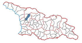 Location of the municipality within Georgia | |
| Country | |
| Region | Samegrelo |
| Administrative centre | Chkhorotsqu |
| Government | |
| • Body | Chkhorotsqu Municipal Assembly |
| • Mayor | Dato Gogua |
| Area | |
| • Total | 619.4 km2 (239.2 sq mi) |
| Population (2014) | |
| • Total | 22,309 |
| • Density | 36.0/km2 (93/sq mi) |
| Population by ethnicity[1] | |
| • Georgians | 99,70 % |
| • Russians | 0,17 % |
| • Armenians | 0,03 % |
| • Ukrainians | 0.04 % |
| Time zone | UTC+4 (Georgian Standard Time) |
| Website | http://www.chkhorotsku.gov.ge/ge |
Chkhorots'q'u (Georgian: ჩხოროწყუს მუნიციპალიტეტი, Çxoroċqus municiṗaliṫeṫi) is a district of Georgia, in the region of Samegrelo-Zemo Svaneti. Its main town is Chkhorots'q'u.
Population: 22,309 (2014 census)
Area: 619 km2

Politics[]
Chkhorotsqu Municipal Assembly (Georgian: ჩხოროწყუს საკრებულო) is a representative body in Chkhorotsqu Municipality. The council assembles into session regularly, to consider subject matters such as code changes, utilities, taxes, city budget, oversight of Municipal government and more. Chkhorotsqu Sakrebulo is elected every four year. The last election was held in October 2021. [2] [3]
| Party | Seats (27) | Current Municipal Assembly | ||||||||||||||||||||||||
|---|---|---|---|---|---|---|---|---|---|---|---|---|---|---|---|---|---|---|---|---|---|---|---|---|---|---|
| Opposition coalition[a] | 15 | |||||||||||||||||||||||||
| Georgian Dream | 12 | |||||||||||||||||||||||||
Municipal Assembly 2017-2021[]
| Party | Seats (28) | Current Municipal Assembly | ||||||||||||||||||||
|---|---|---|---|---|---|---|---|---|---|---|---|---|---|---|---|---|---|---|---|---|---|---|
| Georgian Dream | 19 | |||||||||||||||||||||
| UNM | 4 | |||||||||||||||||||||
| Development Movement | 2 | |||||||||||||||||||||
| European Georgia | 1 | |||||||||||||||||||||
| For Georgia | 1 | |||||||||||||||||||||
| Alliance of Patriots | 1 | |||||||||||||||||||||
Administrative divisions[]
Chkhorotsqu municipality is divided into one borough (დაბა, daba) and 12 villages (სოფელი, sopeli):[4]
Boroughs[]
Villages[]
- Mukhuri
- Zumi
- Taia
- Khabume
- Kveda chkhorots'q'u
- Lesich'ine
- Lets'urts'ume
- K'irtskhi
- Nak'iani
- Akhuti
- Napichkhovo
- Ch'ogha
See also[]
- Districts of Georgia (country)
References[]
- ^ http://pop-stat.mashke.org/georgia-ethnic-loc2014.htm
- ^ https://cesko.ge/res/docs/2021sakrebuloswevraddameradarcheulipirebi.pdf
- ^ https://civil.ge/archives/463872
- ^ "ჩხოროწყუს მუნიციპალიტეტის საკრებულო". www.chkhorotsku-sakrebulo.ge. Archived from the original on 2017-02-27. Retrieved 2017-02-27.
- Notes
- ^ Coalition of United National Movement (Georgia)-For Georgia-Lelo.
External links[]
- Districts of Georgia, Statoids.com
Coordinates: 42°30′37″N 42°07′45″E / 42.51028°N 42.12917°E

This Georgia location article is a stub. You can help Wikipedia by . |
- Municipalities of Samegrelo-Zemo Svaneti
- Georgia (country) geography stubs