Chokhatauri Municipality
Chokatauri Municipality
ჩოხატაურის მუნიციპალიტეტი | |
|---|---|
 Chokatauri Municipality | |
 Flag  Seal | |
 | |
| Country | |
| Mkhare | Guria |
| Capital City | Chokhatauri |
| Government | |
| • mayor | Irakli Kuchava [1] |
| Area | |
| • Total | 825.1 km2 (318.6 sq mi) |
| Population (2014) | |
| • Total | 19,001 |
| Time zone | UTC+4 (Georgian Time) |
| Website | http://chokhatauri.ge/ |

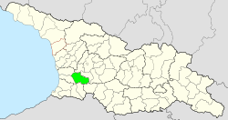
Chokhatauri (Georgian: ჩოხატაურის მუნიციპალიტეტი) is a district of Georgia, in the region of Guria. Its largest city and administrative centre is Chokhatauri.
Population[]
The population of the municipality is 24 903 people; Density - 29.86 people / sq. km. Georgians live there. The majority of the population is Gurians, as well as Adjarans. A large part of the population is Orthodox Christian, a certain part - Muslim. There are 61 settlements in the municipality: 1 small town and 60 villages.[2]
Politics[]
Chokhatauri Municipal Assembly (Georgian: ჩოხატაურის საკრებულო) is a representative body in Chokhatauri Municipality. currently consisting of 40 members. The council is assembles into session regularly, to consider subject matters such as code changes, utilities, taxes, city budget, oversight of city government and more. Chokhatauri sakrebulo is elected every four year. The last election was held in October 2017.[3]
The executive body of the municipality and the highest official of the municipality is the mayor. The representative body of the municipality is a collegial administrative body - the municipal council. Chokhatauri Municipality includes the following territorial units: Chokhatauri, Amagleba, Bukistsikhe, Gogolesubani, Goraberezhouli, Guturi, Dablatsikhe, Didi Vani, Erketi, Zomleti, Zemo Surebi, Zemokheti, Zoti, Kokhnari, Nabetshabi, Nabetshabi Surebi, Jvartskha, Khevi, Khidistavi.
| Party | Seats (40) | Current Municipal Assembly | |||||||||||||||||||||||||||||||||
|---|---|---|---|---|---|---|---|---|---|---|---|---|---|---|---|---|---|---|---|---|---|---|---|---|---|---|---|---|---|---|---|---|---|---|---|
| Georgian Dream | 30 | ||||||||||||||||||||||||||||||||||
| European Georgia | 2 | ||||||||||||||||||||||||||||||||||
| Alliance of Patriots | 2 | ||||||||||||||||||||||||||||||||||
| UNM | 1 | ||||||||||||||||||||||||||||||||||
| For Georgia | 1 | ||||||||||||||||||||||||||||||||||
| Alliance of Patriots | 1 | ||||||||||||||||||||||||||||||||||
| Development Movement | 1 | ||||||||||||||||||||||||||||||||||
| Independent | 2 | ||||||||||||||||||||||||||||||||||
Economy[]

Leading fields are agriculture, including fruit growing, grain farming, viticulture, animal husbandry. JSC Margebeli JSC (Nabeghlavi Mineral Water Bottling Plant) is an important enterprise in the municipality, with Bakhmaro and Nabeghlavi mountain-climatic resorts. The municipality is 296 km away from the capital, 24 km away from Ozurgeti, and 25 km away from the nearest railway junction. Samtredia-Kobuleti - 25 km section passes through the territory of the municipality.
Education and Culture[]
There are 31 public and 1 private schools in the municipality, art (music, art) schools, student-youth house, libraries and museums: Niko Berdzenishvili Local Lore, Niko Mari, Mose Gogiberidze, Nodar Dumbadze, Eristavi Palace.
Tourist attractions[]

- Tamar Castle (Bukistsikhe)
- Erketi Convent (Erketi)
- Eristavi Palace (Goraberezhouli)
- Desert Monastery (middle elevation)
- Ghomi Castle (Zoti)
- St. George Church in Shuban [1]
Villages in the district[]
Villages in the Chokhatauri district include:
- Bukistsikhe
- Chaisubani
- Chokhatauri
- Dablatsikhe
- Didivani
- Erketi
- Ganakhleba
- Gogolesubani
- Goraberezhouli
- Guturi
- Khevi
- Khidistavi
- Kokhnari
- Kvenobani
- Nabeghlavi
- Partskhma
- Sachamiaseri
- Shuaganakhleba
- Shuasurebi
- Vazimleti
- Zemokheti
- Zemosurebi
- Zoti
- Janeuli
See also[]
- Districts of Georgia (country)
References[]
- ^ a b "სიახლეები - Chokhatauri.GOV.GE - ჩოხატაურის მუნიციპალიტეტი". chokhatauri.ge.
- ^ "სტატისტიკა - Chokhatauri.GOV.GE - ჩოხატაურის მუნიციპალიტეტი". chokhatauri.ge.
- ^ https://cesko.ge/res/docs/danOK47.pdf
External links[]
- Districts of Georgia, Statoids.com
- chokhautari.ge - Chokhatauri Municipality's official web site
Coordinates: 42°01′03″N 42°15′20″E / 42.01750°N 42.25556°E

This Georgia location article is a stub. You can help Wikipedia by . |
- Municipalities of Guria
- Georgia (country) geography stubs