Choctaw County, Mississippi
Choctaw County | |
|---|---|
U.S. county | |
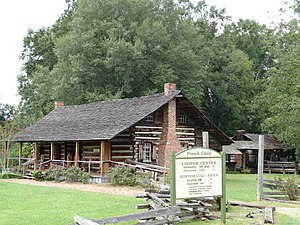 French Camp. Historic Mississippi cabin. | |
 Location within the U.S. state of Mississippi | |
 Mississippi's location within the U.S. | |
| Coordinates: 33°21′N 89°15′W / 33.35°N 89.25°W | |
| Country | |
| State | |
| Founded | 1833 |
| Named for | Choctaw people |
| Seat | Ackerman |
| Largest town | Ackerman |
| Area | |
| • Total | 420 sq mi (1,100 km2) |
| • Land | 418 sq mi (1,080 km2) |
| • Water | 1.7 sq mi (4 km2) 0.4% |
| Population (2010) | |
| • Total | 8,547 |
| • Estimate (2018) | 8,278 |
| • Density | 20/sq mi (7.9/km2) |
| Time zone | UTC−6 (Central) |
| • Summer (DST) | UTC−5 (CDT) |
| Congressional district | 1st |
| Website | choctawcountyms |

Choctaw County is a county located in the central part of the U.S. state of Mississippi. As of the 2010 census, the population was 8,547.[1] Its northern border is the Big Black River, which flows southwest into the Mississippi River south of Vicksburg. The county seat is Ackerman.[2]
The county is named after the Choctaw tribe of Native Americans. They had long occupied this territory as their homeland before European exploration. Under the Indian Removal Act of 1830, they were forced by the United States to cede their lands and to move west of the Mississippi River to what became Indian Territory (today's state of Oklahoma).
History[]
This was one of the first counties organized in central Mississippi after Indian Removal, and it was originally much larger in geography. As the population increased in the Territory, additional counties were organized. For instance, in 1874 Webster County was formed from some of this county, as were Montgomery and Grenada counties.
The first county seat was Greensboro, which was later assigned to the territory of Webster County and designated as its county seat. Eventually Walthall, Mississippi was designated as the county seat of that county, resulting in the decline and abandonment of Greensboro.
Geography[]
According to the U.S. Census Bureau, the county has a total area of 420 square miles (1,100 km2), of which 418 square miles (1,080 km2) is land and 1.7 square miles (4.4 km2) (0.4%) is water. The Big Black River forms the county's northern border.[3]
Adjacent counties[]
- Webster County, Mississippi - north
- Oktibbeha County, Mississippi - east
- Winston County, Mississippi - southeast
- Attala County, Mississippi - southwest
- Montgomery County, Mississippi - west
National protected areas[]
- Natchez Trace Parkway (part)
- Tombigbee National Forest (part)
Demographics[]
The adjacent table reflects major decreases in population from 1910 to 1920, and from 1940 to 1960. These were periods of the Great Migration from the South by African Americans, who first moved to jobs in industrial cities in the North and Midwest. In the 1940s and after, they moved to the West Coast for jobs in the rapidly growing defense industry. Farm work declined with mechanization of agriculture. But blacks also migrated to escape the violence and social repression of Mississippi, where they had been essentially disenfranchised since 1890 and lived under Jim Crow laws and the threat of violence; the state had a high rate of lynchings.
| Historical population | |||
|---|---|---|---|
| Census | Pop. | %± | |
| 1840 | 6,010 | — | |
| 1850 | 11,402 | 89.7% | |
| 1860 | 15,722 | 37.9% | |
| 1870 | 16,988 | 8.1% | |
| 1880 | 9,036 | −46.8% | |
| 1890 | 10,847 | 20.0% | |
| 1900 | 13,036 | 20.2% | |
| 1910 | 14,357 | 10.1% | |
| 1920 | 12,491 | −13.0% | |
| 1930 | 12,339 | −1.2% | |
| 1940 | 13,548 | 9.8% | |
| 1950 | 11,009 | −18.7% | |
| 1960 | 8,423 | −23.5% | |
| 1970 | 8,440 | 0.2% | |
| 1980 | 8,996 | 6.6% | |
| 1990 | 9,071 | 0.8% | |
| 2000 | 9,758 | 7.6% | |
| 2010 | 8,543 | −12.5% | |
| 2018 (est.) | 8,278 | [4] | −3.1% |
| U.S. Decennial Census[5] 1790-1960[6] 1900-1990[7] 1990-2000[8] 2010-2013[1] | |||
As of the 2010 United States Census, there were 8,543 people living in the county. 68.1% were White, 30.2% African American, 0.3% Native American, 0.2% Asian, 0.1% Pacific Islander, 0.1% from some other race and 1.1% of two or more races. 1.4% were Hispanic or Latino of any race.
As of the census[9] of 2000, there were 9,758 people, 3,686 households, and 2,668 families living in the county. The population density was 23 people per square mile (9/km2). There were 4,249 housing units at an average density of 10 per square mile (4/km2). The racial makeup of the county was 68.03% White, 30.68% Black or African American, 0.31% Native American, 0.13% Asian, 0.01% Pacific Islander, 0.42% from other races, and 0.42% from two or more races. 0.81% of the population were Hispanic or Latino of any race.
There were 3,686 households, out of which 32.60% had children under the age of 18 living with them, 53.30% were married couples living together, 14.60% had a female householder with no husband present, and 27.60% were non-families. 25.00% of all households were made up of individuals, and 12.20% had someone living alone who was 65 years of age or older. The average household size was 2.56 and the average family size was 3.06.
In the county, the population was spread out, with 27.80% under the age of 18, 8.80% from 18 to 24, 24.90% from 25 to 44, 23.50% from 45 to 64, and 15.00% who were 65 years of age or older. The median age was 37 years. For every 100 females there were 91.90 males. For every 100 females age 18 and over, there were 88.40 males.
The median income for a household in the county was $27,020, and the median income for a family was $31,095. Males had a median income of $26,966 versus $17,798 for females. The per capita income for the county was $13,474. About 17.70% of families and 24.70% of the population were below the poverty line, including 33.80% of those under age 18 and 21.30% of those age 65 or over.
Education[]
Primary and secondary schools[]
Choctaw County School District operates public schools, including Choctaw County High School, Ackerman Elementary, French Camp Elementary, and Weir Elementary.[10]
French Camp Academy, which provides in-house private education in grades 7 through 12, is located in French Camp.[11] [12]
Colleges and universities[]
Colleges and universities within a 60-mile (97 km) radius of the center of the county include:[11]
- East Mississippi Community College (campuses in Columbus, Mayhew, and Scooba)
- Holmes Community College (campuses in Goodman and Grenada)
- Mississippi State University (Starkville)
- Mississippi University for Women (Columbus)
Communities[]
Towns[]
- Ackerman (county seat)
- French Camp
- Mathiston (mostly in Webster County)
- Weir
Unincorporated communities[]
Ghost towns[]
Notable people[]
- James Blackwood, American Gospel singer and one of the founding members of legendary Southern Gospel quartet The Blackwood Brothers.
- Turner Catledge, Managing editor of The New York Times from 1952 to 1964 and the paper's first executive editor.
- David A. Chandler, Former Associate Justice of the Supreme Court of Mississippi.
- James Plemon "J.P." Coleman 52nd Governor of Mississippi and a United States Circuit Judge of the United States Court of Appeals for the Fifth Circuit.
- Thomas Fulton, Former conductor of the New York Metropolitan Opera
- Dennis Johnson Fullback for Mississippi State University who played for the New York Giants and Buffalo Bills in the NFL.[13]
- Kenneth Johnson, NFL defensive back for the Green Bay Packers[14]
- Tony Kimbrough, Former professional football quarterback[15]
- Raymond Edwin "Ray" Mabus Jr., 60th Governor of Mississippi and 75th United States Secretary of the Navy.
- Hoyt Ming, old-time fiddler.
- Alvin McKinley, NFL defensive tackle who played for the Carolina Panthers, Cleveland Browns, Denver Broncos and New Orleans Saints.
- Roy Oswalt, a major league pitcher for the Colorado Rockies, and his wife Nicole live in Weir.
- Cheryl Prewitt, Miss America 1980 and Miss Mississippi 1979
- Kristi M. Fondren, Author "Walking on the Wild Side: Long-Distance Hiking on the Appalachian Trail"
In popular culture[]
The song "Choctaw County Affair" from Carrie Underwood's 2015 album Storyteller is set in Choctaw County, Mississippi.
Politics[]
See also[]
- National Register of Historic Places listings in Choctaw County, Mississippi
References[]
- ^ Jump up to: a b "State & County QuickFacts". United States Census Bureau. Archived from the original on July 8, 2011. Retrieved September 3, 2013.
- ^ "Find a County". National Association of Counties. Archived from the original on 2015-05-09. Retrieved 2011-06-07.
- ^ "2010 Census Gazetteer Files". United States Census Bureau. August 22, 2012. Archived from the original on September 28, 2013. Retrieved November 3, 2014.
- ^ "Population and Housing Unit Estimates". Retrieved June 4, 2019.
- ^ "U.S. Decennial Census". United States Census Bureau. Retrieved November 3, 2014.
- ^ "Historical Census Browser". University of Virginia Library. Retrieved November 3, 2014.
- ^ "Population of Counties by Decennial Census: 1900 to 1990". United States Census Bureau. Retrieved November 3, 2014.
- ^ "Census 2000 PHC-T-4. Ranking Tables for Counties: 1990 and 2000" (PDF). United States Census Bureau. Retrieved November 3, 2014.
- ^ "U.S. Census website". United States Census Bureau. Retrieved 2008-01-31.
- ^ Choctaw County Public School District. http://www.choctaw.k12.ms.us/ Retrieved on January 3, 2019.
- ^ Jump up to: a b "Education Archived 2011-04-30 at the Wayback Machine." Choctaw County Economic Development Foundation. Retrieved on March 1, 2011.
- ^ Choctaw Plain Dealer; French Camp Today
- ^ "Dennis Johnson". NFL.com. Retrieved 2018-03-04.
- ^ "Archived copy". Archived from the original on 2014-02-02. Retrieved 2014-01-26.CS1 maint: archived copy as title (link)
- ^ "Archived copy". Archived from the original on 2014-01-03. Retrieved 2014-01-26.CS1 maint: archived copy as title (link)
- ^ Leip, David. "Dave Leip's Atlas of U.S. Presidential Elections". uselectionatlas.org. Retrieved 2018-03-04.
External links[]
Coordinates: 33°21′N 89°15′W / 33.35°N 89.25°W
| show Places adjacent to Choctaw County, Mississippi |
|---|
| show Municipalities and communities of Choctaw County, Mississippi, United States |
|---|


| show Authority control |
|---|
- Mississippi counties
- Choctaw County, Mississippi
- Counties of Appalachia
- 1833 establishments in Mississippi
- Populated places established in 1833