Clay County, Mississippi
Clay County | |
|---|---|
U.S. county | |
 West Point City Hall at West Point Central City Historic District. | |
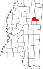 Location within the U.S. state of Mississippi | |
 Mississippi's location within the U.S. | |
| Coordinates: 33°39′N 88°46′W / 33.65°N 88.77°W | |
| Country | |
| State | |
| Founded | 1871 |
| Named for | Henry Clay |
| Seat | West Point |
| Largest city | West Point |
| Area | |
| • Total | 416 sq mi (1,080 km2) |
| • Land | 410 sq mi (1,100 km2) |
| • Water | 5.9 sq mi (15 km2) 1.4% |
| Population (2010) | |
| • Total | 20,634 |
| • Estimate (2018) | 19,386 |
| • Density | 50/sq mi (19/km2) |
| Time zone | UTC−6 (Central) |
| • Summer (DST) | UTC−5 (CDT) |
| Congressional district | 1st |
| Website | www |

Clay County is a county located in the U.S. state of Mississippi. As of the 2010 census, the population was 20,634.[1] Its county seat is West Point.[2] Its name is in honor of American statesman Henry Clay,[3] member of the United States Senate from Kentucky and United States Secretary of State in the 19th century.
The federal government formerly designated Clay County as the West Point Micropolitan Statistical Area, but the county lost that status in 2013.[4] It is part of the Golden Triangle region of the state.[5]
Geography[]
According to the U.S. Census Bureau, the county has a total area of 416 square miles (1,080 km2), of which 410 square miles (1,100 km2) is land and 5.9 square miles (15 km2) (1.4%) is water.[6]
Major highways[]

 Mississippi Highway 25
 Mississippi Highway 46
 Mississippi Highway 47
 Mississippi Highway 50
Adjacent counties[]
- Chickasaw County (north)
- Monroe County (northeast)
- Lowndes County (southeast)
- Oktibbeha County (south)
- Webster County (west)
National protected area[]
- Natchez Trace Parkway (part)
Demographics[]
| Historical population | |||
|---|---|---|---|
| Census | Pop. | %± | |
| 1880 | 17,367 | — | |
| 1890 | 18,607 | 7.1% | |
| 1900 | 19,563 | 5.1% | |
| 1910 | 20,203 | 3.3% | |
| 1920 | 17,490 | −13.4% | |
| 1930 | 17,931 | 2.5% | |
| 1940 | 19,030 | 6.1% | |
| 1950 | 17,757 | −6.7% | |
| 1960 | 18,933 | 6.6% | |
| 1970 | 18,840 | −0.5% | |
| 1980 | 21,082 | 11.9% | |
| 1990 | 21,120 | 0.2% | |
| 2000 | 21,979 | 4.1% | |
| 2010 | 20,634 | −6.1% | |
| 2018 (est.) | 19,386 | [7] | −6.0% |
| U.S. Decennial Census[8] 1790-1960[9] 1900-1990[10] 1990-2000[11] 2010-2013[1] | |||
As of the 2010 United States Census, there were 20,634 people living in the county. 58.2% were Black or African American, 40.5% White, 0.2% Asian, 0.1% Native American, 0.3% of some other race and 0.6% of two or more races. 1.0% were Hispanic or Latino (of any race).
As of the census[12] of 2000, there were 21,979 people, 8,152 households, and 5,885 families living in the county. The population density was 54 people per square mile (21/km2). There were 8,810 housing units at an average density of 22 per square mile (8/km2). The racial makeup of the county was 56.33% Black or African American, 42.82% White, 0.05% Native American, 0.16% Asian, 0.01% Pacific Islander, 0.21% from other races, and 0.42% from two or more races. 0.86% of the population were Hispanic or Latino of any race.
According to the census[12] of 2000, the largest ancestry groups in Clay County were African 56.3%, English 35% and Scots-Irish 4.5%.
There were 8,152 households, out of which 35.70% had children under the age of 18 living with them, 45.80% were married couples living together, 22.40% had a female householder with no husband present, and 27.80% were non-families. 25.50% of all households were made up of individuals, and 11.00% had someone living alone who was 65 years of age or older. The average household size was 2.64 and the average family size was 3.19.
In the county, the population was spread out, with 28.80% under the age of 18, 10.40% from 18 to 24, 26.50% from 25 to 44, 21.10% from 45 to 64, and 13.10% who were 65 years of age or older. The median age was 34 years. For every 100 females there were 89.10 males. For every 100 females age 18 and over, there were 83.60 males.
The median income for a household in the county was $27,372, and the median income for a family was $35,461. Males had a median income of $30,038 versus $19,473 for females. The per capita income for the county was $14,512. About 19.20% of families and 23.50% of the population were below the poverty line, including 34.20% of those under age 18 and 21.90% of those age 65 or over.
Education[]
Clay County is within the service area of the East Mississippi Community College system.[13]
Public school districts[]
Communities[]
Cities[]
- West Point (county seat)
Census-designated place[]
Unincorporated communities[]
Ghost town[]
Politics[]
See also[]
References[]
- ^ Jump up to: a b "State & County QuickFacts". United States Census Bureau. Archived from the original on July 8, 2011. Retrieved September 3, 2013.
- ^ "Find a County". National Association of Counties. Archived from the original on 2011-05-31. Retrieved 2011-06-07.
- ^ Gannett, Henry (1905). The Origin of Certain Place Names in the United States. Govt. Print. Off. p. 83.
- ^ "OMB Bulletin No. 13-01: Revised Delineations of Metropolitan Statistical Areas, Micropolitan Statistical Areas, and Combined Statistical Areas, and Guidance on Uses of the Delineations of These Areas" (PDF). United States Office of Management and Budget. February 28, 2013. Retrieved April 3, 2013.
- ^ "Golden Triangle economic development model could be emulated across state". Retrieved 2014-05-20.
- ^ "2010 Census Gazetteer Files". United States Census Bureau. August 22, 2012. Archived from the original on September 28, 2013. Retrieved November 3, 2014.
- ^ "Population and Housing Unit Estimates". Retrieved June 4, 2019.
- ^ "U.S. Decennial Census". United States Census Bureau. Retrieved November 3, 2014.
- ^ "Historical Census Browser". University of Virginia Library. Retrieved November 3, 2014.
- ^ "Population of Counties by Decennial Census: 1900 to 1990". United States Census Bureau. Retrieved November 3, 2014.
- ^ "Census 2000 PHC-T-4. Ranking Tables for Counties: 1990 and 2000" (PDF). United States Census Bureau. Retrieved November 3, 2014.
- ^ Jump up to: a b "U.S. Census website". United States Census Bureau. Retrieved 2008-01-31.
- ^ "CATALOG 2007-2009 Archived 2010-12-18 at the Wayback Machine." East Mississippi Community College. 3 (3/147). Retrieved on March 1, 2011.
- ^ Leip, David. "Dave Leip's Atlas of U.S. Presidential Elections". uselectionatlas.org. Retrieved 2018-03-04.
| show Municipalities and communities of Clay County, Mississippi, United States |
|---|


Coordinates: 33°39′N 88°46′W / 33.65°N 88.77°W
| show Authority control |
|---|
- Mississippi counties
- Clay County, Mississippi
- Counties of Appalachia
- 1871 establishments in Mississippi
- Populated places established in 1871