Christian County, Missouri
Christian County | |
|---|---|
U.S. county | |
 | |
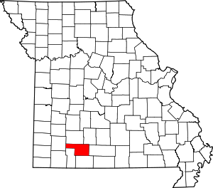 Location within the U.S. state of Missouri | |
 Missouri's location within the U.S. | |
| Coordinates: 36°58′N 93°11′W / 36.97°N 93.19°W | |
| Country | |
| State | |
| Founded | March 8, 1859[1] |
| Named for | William Christian |
| Seat | Ozark |
| Largest city | Nixa |
| Area | |
| • Total | 564 sq mi (1,460 km2) |
| • Land | 563 sq mi (1,460 km2) |
| • Water | 1.2 sq mi (3 km2) 0.2% |
| Population (2010) | |
| • Total | 77,422 |
| • Estimate (2019) | 88,595 |
| • Density | 140/sq mi (53/km2) |
| Time zone | UTC−6 (Central) |
| • Summer (DST) | UTC−5 (CDT) |
| Congressional district | 7th |
| Website | christiancountymo |

Christian County is located in the southwestern part of the U.S. state of Missouri. As of the 2010 census, its population was 77,422.[2] Its county seat is Ozark.[3] The county was organized in 1859 and is named after William Christian, a Kentucky soldier of the American Revolutionary War.[4]
Christian County is part of the Springfield, MO Metropolitan Statistical Area. Between 2000 and 2010, it was the fastest-growing county in the state and one of the fastest growing ones in the nation as the county became more suburban due to the booming growth in Springfield.[5]
Geography[]
According to the U.S. Census Bureau, the county has a total area of 564 square miles (1,460 km2), of which 563 square miles (1,460 km2) is land and 1.2 square miles (3.1 km2) (0.2%) is water.[6] The county is drained by James River and branches of the White River. The surface is undulating or hilly.[7]
Adjacent counties[]
- Greene County (north)
- Webster County (northeast)
- Douglas County (east)
- Taney County (south)
- Stone County (southwest)
- Lawrence County (west)
Major highways[]
National protected area[]
- Mark Twain National Forest (part)
Demographics[]
| Historical population | |||
|---|---|---|---|
| Census | Pop. | %± | |
| 1860 | 5,491 | — | |
| 1870 | 6,707 | 22.1% | |
| 1880 | 9,628 | 43.6% | |
| 1890 | 14,017 | 45.6% | |
| 1900 | 16,939 | 20.8% | |
| 1910 | 15,832 | −6.5% | |
| 1920 | 15,252 | −3.7% | |
| 1930 | 13,169 | −13.7% | |
| 1940 | 13,538 | 2.8% | |
| 1950 | 12,412 | −8.3% | |
| 1960 | 12,359 | −0.4% | |
| 1970 | 15,124 | 22.4% | |
| 1980 | 22,402 | 48.1% | |
| 1990 | 32,644 | 45.7% | |
| 2000 | 54,285 | 66.3% | |
| 2010 | 77,422 | 42.6% | |
| 2019 (est.) | 88,595 | [8] | 14.4% |
| U.S. Decennial Census[9] 1790–1960[10] 1900–1990[11] 1990–2000[12] 2010–2015[2] | |||
As of the census[13] of 2000, there were 54,285 people, 20,425 households, and 15,645 families residing in the county. The population density was 96 people per square mile (37/km2). There were 21,827 housing units at an average density of 39 per square mile (15/km2). The racial makeup of the county was 97.31% White, 0.27% Black or African American, 0.56% Native American, 0.29% Asian, 0.03% Pacific Islander, 0.42% from other races, and 1.13% from two or more races. Approximately 1.32% of the population were Hispanic or Latino of any race. 23.7% were of American, 21.1% German, 12.3% English and 11.3% Irish ancestry.
There were 20,425 households, out of which 38.60% had children under the age of 18 living with them, 64.00% were married couples living together, 9.30% had a female householder with no husband present, and 23.40% were non-families. 19.10% of all households were made up of individuals, and 7.00% had someone living alone who was 65 years of age or older. The average household size was 2.63 and the average family size was 3.00.
In the county, the population was spread out, with 27.80% under the age of 18, 8.10% from 18 to 24, 31.70% from 25 to 44, 21.80% from 45 to 64, and 10.60% who were 65 years of age or older. The median age was 34 years. For every 100 females, there were 94.70 males. For every 100 females age 18 and over, there were 91.50 males.
The median income for a household in the county was $50,200, and the median income for a family was $58,806. Males had a median income of $31,929 versus $21,852 for females. The per capita income for the county was $23,873. About 7.10% of families and 9.10% of the population were below the poverty line, including 13.20% of those under age 18 and 7.80% of those age 65 or over.
Politics[]
This section does not cite any sources. (June 2014) |
Local[]
| Christian County, Missouri | |||
|---|---|---|---|
| Elected countywide officials | |||
| Assessor | Danny Gray | Republican | |
| Auditor | Amy Dent | Republican | |
| Circuit Clerk | Barbie Barnett-Stillings | Republican | |
| County Clerk | Kay Brown | Republican | |
| Collector | Ted Nichols | Republican | |
| Commissioner (Presiding) | Ralph Phillips | Republican | |
| Commissioner (District 1) | Mike Robertson | Republican | |
| Commissioner (District 2) | Hosea Bilyeu | Republican | |
| Coroner | Mandi Armintage | Republican | |
| Prosecuting Attorney | Amy Fite | Republican | |
| Public Administrator | Ken Davis | Republican | |
| Recorder | Kelly Hall | Republican | |
| Sheriff | Brad Cole | Republican | |
| Treasurer | Karen Matthews | Republican | |
The Republican Party controls politics at the local level in Christian County. The Republicans hold all of the elected positions in the county.
On May 20, 2015, Sheriff Joey Kyle plead guilty to embezzling county funds and participating in an illegal fraud scheme. As a part of a plea agreement, he immediately resigned as sheriff, was sentenced to one year plus one day in federal prison, and must repay more than $50,000 in restitution to Christian County.[14]
State[]
| Year | Republican | Democratic | Third Parties |
|---|---|---|---|
| 2016 | 68.97% 28,618 | 27.94% 11,593 | 3.09% 1,285 |
| 2012 | 58.01% 21,902 | 39.73% 15,000 | 2.26% 852 |
| 2008 | 49.65% 18,556 | 47.73% 17,840 | 2.61% 977 |
| 2004 | 68.61% 21,400 | 30.27% 9,443 | 1.12% 348 |
| 2000 | 58.90% 13,646 | 39.49% 9,148 | 1.61% 373 |
| 1996 | 56.69% 10,559 | 40.22% 7,491 | 3.10% 577 |
Christian County is divided into three legislative districts in the Missouri House of Representatives, all of which are represented by Republicans.
- District 138 — Don Phillips (R-Kimberling City). Consists of the communities of Billings and part of Republic.
| Party | Candidate | Votes | % | ±% | |
|---|---|---|---|---|---|
| Republican | Don Phillips | 1,865 | 100.00% | ||
| Party | Candidate | Votes | % | ±% | |
|---|---|---|---|---|---|
| Republican | Don Phillips | 856 | 100.00% | ||
| Party | Candidate | Votes | % | ±% | |
|---|---|---|---|---|---|
| Republican | Don Phillips | 1,625 | 100.00% | ||
- District 139 — Rep. Jered Taylor (R-Nixa). Consists of the communities of Clever, Highlandville, Nixa, and Spokane.
| Party | Candidate | Votes | % | ±% | |
|---|---|---|---|---|---|
| Republican | Jared Taylor | 16,991 | 100.00% | ||
| Party | Candidate | Votes | % | ±% | |
|---|---|---|---|---|---|
| Republican | Jered Taylor | 7,528 | 100.00% | +28.86 | |
| Party | Candidate | Votes | % | ±% | |
|---|---|---|---|---|---|
| Republican | Kevin Elmer | 12,375 | 71.14% | ||
| Democratic | Bob Rubino | 5,020 | 28.86% | ||
- District 140 — Rep. Lynn Morris (R-Ozark). Consists of the communities of Freemont Hills, Ozark, Saddlebrook, and Sparta.
| Party | Candidate | Votes | % | ±% | |
|---|---|---|---|---|---|
| Republican | Lynn Morris | 14,371 | 75.80% | +3.45 | |
| Democratic | Jim Billedo | 4,175 | 22.02% | +1.27 | |
| Green | Robert Debbaut | 413 | 2.18% | +2.18 | |
| Party | Candidate | Votes | % | ±% | |
|---|---|---|---|---|---|
| Republican | Lynn Morris | 7,151 | 79.25% | -20.75 | |
| Democratic | Jim Billedo | 1,872 | 20.75% | +20.75 | |
| Party | Candidate | Votes | % | ±% | |
|---|---|---|---|---|---|
| Republican | Lynn Morris | 15,284 | 100.00% | ||
All of Christian County is a part of Missouri's 20th District in the Missouri Senate and is currently represented by Eric Burlison (R-Battlefield).
| Party | Candidate | Votes | % | ±% | |
|---|---|---|---|---|---|
| Republican | Jay Wasson | 16,395 | 100.00% | ||
Federal[]
| Party | Candidate | Votes | % | ±% | |
|---|---|---|---|---|---|
| Republican | Roy Blunt | 27,812 | 66.93% | +12.53 | |
| Democratic | Jason Kander | 11,857 | 28.53% | -9.67 | |
| Libertarian | Jonathan Dine | 1,113 | 2.68% | -4.72 | |
| Green | Johnathan McFarland | 356 | 0.86% | +0.86 | |
| Constitution | Fred Ryman | 418 | 1.00% | +1.00 | |
| Party | Candidate | Votes | % | ±% | |
|---|---|---|---|---|---|
| Republican | Todd Akin | 20,383 | 54.40% | ||
| Democratic | Claire McCaskill | 14,312 | 38.20% | ||
| Libertarian | Jonathan Dine | 2,774 | 7.40% | ||
All of Christian County is included in Missouri's 7th Congressional District and is currently represented by Billy Long (R-Springfield) in the U.S. House of Representatives.
| Party | Candidate | Votes | % | ±% | |
|---|---|---|---|---|---|
| Republican | Billy Long | 28,849 | 70.50% | +6.41 | |
| Democratic | Genevieve Williams | 9,890 | 24.17% | -1.75 | |
| Libertarian | Benjamin T. Brixey | 2,179 | 5.33% | -4.66 | |
| Party | Candidate | Votes | % | ±% | |
|---|---|---|---|---|---|
| Republican | Billy Long | 12,261 | 64.09% | -2.08 | |
| Democratic | Jim Evans | 4,959 | 25.92% | -2.04 | |
| Libertarian | Kevin Craig | 1,910 | 9.99% | +4.12 | |
| Party | Candidate | Votes | % | ±% | |
|---|---|---|---|---|---|
| Republican | Billy Long | 24,505 | 66.17% | ||
| Democratic | Jim Evans | 10,353 | 27.96% | ||
| Libertarian | Kevin Craig | 2,174 | 5.87% | ||
Political culture[]
Like most counties situated in Southwest Missouri, Christian County is a Republican stronghold in presidential elections. George W. Bush carried Christian County in 2000 and 2004 by more than two-to-one margins, and like many other rural and exurban counties throughout Missouri, Christian County strongly favored John McCain over Barack Obama in 2008. The only Democratic Presidential candidate to win Christian County since the Civil War has been Franklin Delano Roosevelt in 1932.[17] In the 2016 presidential election, Donald Trump was the favored candidate receiving 30,941 votes.[18]
Like most areas throughout the Bible Belt in Southwest Missouri, voters in Christian County traditionally adhere to socially and culturally conservative principles which tend to strongly influence their Republican leanings. In 2004, Missourians voted on a constitutional amendment to define marriage as the union between a man and a woman—it overwhelmingly passed Christian County with 80.46 percent of the vote. The initiative passed the state with 71 percent of support from voters as Missouri became the first state to ban same-sex marriage. In 2006, Missourians voted on a constitutional amendment to fund and legalize embryonic stem cell research in the state—it failed in Christian County with 58.98 percent voting against the measure. The initiative narrowly passed the state with 51 percent of support from voters as Missouri became one of the first states in the nation to approve embryonic stem cell research. Despite Christian County’s longstanding tradition of supporting socially conservative platforms, voters in the county have a penchant for advancing populist causes like increasing the minimum wage. In 2006, Missourians voted on a proposition (Proposition B) to increase the minimum wage in the state to $6.50 an hour—it passed Christian County with 73.01 percent of the vote. The proposition strongly passed every single county in Missouri with 78.99 percent voting in favor as the minimum wage was increased to $6.50 an hour in the state. During the same election, voters in five other states also strongly approved increases in the minimum wage.
Missouri presidential preference primary (2008)[]
| Christian County, Missouri | |
|---|---|
| 2008 Republican primary in Missouri | |
| John McCain | 2,943 (24.37%) |
| Mike Huckabee | 5,852 (48.46%) |
| Mitt Romney | 2,748 (22.75%) |
| Ron Paul | 416 (3.44%) |
| Christian County, Missouri | |
|---|---|
| 2008 Democratic primary in Missouri | |
| Hillary Clinton | 4,308 (57.68%) |
| Barack Obama | 2,982 (39.93%) |
| John Edwards (withdrawn) | 145 (1.94%) |
Voters in Christian County from both political parties supported candidates who finished in second place in the state at large and nationally.
- Former Governor Mike Huckabee (R-Arkansas) received more votes, a total of 5,852, than any candidate from either party in Christian County during the 2008 Missouri Presidential Preference Primary.
Education[]
Public schools[]
- Billings R-IV School District - Billings
- Billings Elementary School (PK-06)
- Billings High School (07-12)
- Chadwick R-I School District - Chadwick
- Chadwick Elementary School (PK-06)
- Chadwick High School (07-12)
- Clever R-V School District - Clever
- Clever EleMiddle School (PK-08)
- Clever High School (09-12)
- Nixa R-II School District - Nixa
- High Pointe Elementary School (K-04)
- Main Street Elementary School (PK-06)
- Mathews Elementary School (K-04)
- Nicholas A. Inman Elementary School (05-06)
- Century Elementary School (K-04)
- Espy Elementary School (K-04)
- John Thomas Elementary School (K-04)
- Nixa Jr. High School (07-08)
- Nixa Public High School (09-12)
- Ozark R-VI School District - Ozark
- North Elementary School (K-04)
- East Elementary School (K-04)
- West Elementary School (K-04)
- South Elementary School (K-04)
- Upper Elementary School (05-06)
- Ozark Jr. High School (07-08)
- Ozark High School (09-12)
- Sparta R-III School District - Sparta
- Sparta Elementary School (PK-05)
- Sparta Middle School (06-08)
- Sparta High School (09-12)
- Spokane R-VII School District - Spokane
- Highlandville Elementary School (PK-05) - Highlandville
- Spokane Middle School (06-08)
- Spokane High School (09-12)
Private schools[]
- Faith Christian School - Spokane - (PK-12) - Baptist
Colleges and universities[]
- Ozarks Technical Community College - Richwood Valley Campus - Public
Public libraries[]
Christian County Library System[]
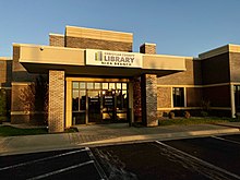
Christian County currently has three public library branches that serve the community. The Christian County Library (CCL) operates these branches. The library offers residents books, A/V materials, programming, printing, and WiFi access.[19] There is a branch in Ozark, Nixa, and Clever.[20] In August 2019, the library announced the continuation of their expansion to the public. Construction is set to begin on at least one new library branch by spring 2020.[21]
Tax Approval[]
On Tuesday, August 8, 2017, voters in Christian County approved to instate a 20-cent property tax levy. Sixty-eight percent of the voters approved the tax. Before this tax, the library was only able to operate one branch for the whole county. To accommodate new housing and population growth in the county, CCL announced their intentions to construct and/or open new branches around the county. The tax approval also allowed for a renovation of the original Ozark Branch. CCL expects eighty-five percent of the population in Christian County to be within a five mile radius of the library after all intended branches are opened. [22]
| Position Held | Name |
|---|---|
| President | Ken Barthelette |
| Vice President | Loretta Hermann |
| Treasurer | Maurine Myers |
| Secretary | Heather Davidson |
| Member at Large | Christa Mitchell |
Public safety[]
- Billings Fire Protection District
- Billings Police Department
- Chadwick Fire Protection District - Chadwick
- Christian County Ambulance District
- Christian County Sheriff's Department
- Clever Fire Protection District
- Clever Police Department
- Highlandville Fire Protection District
- Highlandville Police Department
- Nixa Fire Protection District
- Nixa Police Department
- Ozark Fire Protection District
- Ozark Police Department
- Sparta Fire Protection District
- Sparta Police Department
Communities[]
Cities[]
- Billings
- Clever
- Fremont Hills
- Highlandville
- Nixa (largest city)
- Ozark (county seat)
- Republic (mostly in Greene County)
- Sparta
- Springfield (mostly in Greene County)
Village[]
- Saddlebrooke (small portion in Taney County)
Census-designated place[]
Other unincorporated communities[]
Townships[]
In popular culture[]
The 2010 film Winter's Bone was filmed entirely in Taney County and Christian County. Many locals were cast in significant roles in the film.[25]
See also[]
- National Register of Historic Places listings in Christian County, Missouri
References[]
- ^ "History of Christian County". Christian County, Mo. Retrieved November 23, 2014.
- ^ Jump up to: a b "State & County QuickFacts". United States Census Bureau. Archived from the original on July 8, 2011. Retrieved September 7, 2013.
- ^ "Find a County". National Association of Counties. Archived from the original on May 31, 2011. Retrieved June 7, 2011.
- ^ Eaton, David Wolfe (1916). How Missouri Counties, Towns and Streams Were Named. The State Historical Society of Missouri. pp. 275.
- ^ Tang, Didi (11 February 2011). "New Census numbers: Christian County fastest growing in state". The Springfield News-Leader. Archived from the original on August 14, 2011. Retrieved February 18, 2013.
- ^ "2010 Census Gazetteer Files". United States Census Bureau. August 22, 2012. Archived from the original on October 21, 2013. Retrieved November 14, 2014.
- ^ Ripley, George; Dana, Charles A., eds. (1879). . The American Cyclopædia.
- ^ "Population and Housing Unit Estimates". Retrieved April 18, 2021.
- ^ "U.S. Decennial Census". United States Census Bureau. Retrieved November 14, 2014.
- ^ "Historical Census Browser". University of Virginia Library. Retrieved November 14, 2014.
- ^ "Population of Counties by Decennial Census: 1900 to 1990". United States Census Bureau. Retrieved November 14, 2014.
- ^ "Census 2000 PHC-T-4. Ranking Tables for Counties: 1990 and 2000" (PDF). United States Census Bureau. Retrieved November 14, 2014.
- ^ "U.S. Census website". United States Census Bureau. Retrieved May 14, 2011.
- ^ "Going to jail: Christian County Sheriff admits to fraud and embezzlement". news-leader.com. Retrieved February 1, 2018.
- ^ Jump up to: a b c d e "County Results - State of Missouri - 2016 General Election". Missouri Secretary of State. December 12, 2016. Retrieved April 22, 2017.
- ^ "Dave Leip's Atlas of U.S. Presidential Elections". uselectionatlas.org. Retrieved February 1, 2018.
- ^ Menendez, Albert J.; The Geography of Presidential Elections in the United States, 1868–2004, pp. 239, 241, 244 ISBN 0786422173
- ^ "Christian County Election Results". Springfield News-Leader. Retrieved 2019-10-08.
- ^ "Services at Christian County Library - Digital - Research and More". Christian County Library. 2016-08-26. Retrieved 2019-10-05.
- ^ "Locations". Christian County Library. 2019-03-01. Retrieved 2019-10-05.
- ^ "Your Library District is Growing: Sparta and Clever Branch Construction Timeline Announced". Christian County Library. 2019-08-30. Retrieved 2019-10-08.
- ^ "Christian County Voters Approve Library Tax". KOLR - OzarksFirst.com. 2017-08-09. Retrieved 2020-02-03.
- ^ "Trustees & Administration". Christian County Library. 2016-08-27. Retrieved 2019-10-08.
- ^ Breeding, Marshall. "Christian County Library". Libraries.org. Retrieved May 8, 2017.
- ^ "On Location: The Frozen Ozarks Of 'Winter's Bone'". NPR.org. Retrieved 2020-01-15.
External links[]
- Official Website
- Digitized 1930 Plat Book of Christian County Archived 2011-08-16 at the Wayback Machine from University of Missouri Division of Special Collections, Archives, and Rare Books
| show Places adjacent to Christian County, Missouri |
|---|
| show Municipalities and communities of Christian County, Missouri, United States |
|---|


Coordinates: 36°58′N 93°11′W / 36.97°N 93.19°W
| show Authority control |
|---|
- Missouri counties
- Christian County, Missouri
- Springfield metropolitan area, Missouri
- 1859 establishments in Missouri
- Populated places established in 1859