Cléguérec
Cléguérec
Klegereg | |
|---|---|
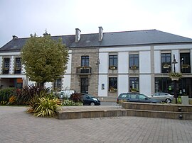 The town hall in Cléguérec | |
 Coat of arms | |
show Location of Cléguérec | |
 Cléguérec | |
| Coordinates: 48°07′30″N 3°04′10″W / 48.125°N 3.0694°WCoordinates: 48°07′30″N 3°04′10″W / 48.125°N 3.0694°W | |
| Country | France |
| Region | Brittany |
| Department | Morbihan |
| Arrondissement | Pontivy |
| Canton | Gourin |
| Intercommunality | Pontivy Communauté |
| Government | |
| • Mayor (2020–2026) | Marc Ropers[1] |
| Area 1 | 62.99 km2 (24.32 sq mi) |
| Population (Jan. 2018)[2] | 2,867 |
| • Density | 46/km2 (120/sq mi) |
| Time zone | UTC+01:00 (CET) |
| • Summer (DST) | UTC+02:00 (CEST) |
| INSEE/Postal code | 56041 /56480 |
| Elevation | 55–281 m (180–922 ft) |
| 1 French Land Register data, which excludes lakes, ponds, glaciers > 1 km2 (0.386 sq mi or 247 acres) and river estuaries. | |


Cléguérec (French pronunciation: [kleɡeʁɛk]; Breton: Klegereg) is a commune in the Morbihan department of Brittany in north-western France.
Demographics[]
Inhabitants of Cléguérec are called in French Cléguérecois.
Breton language[]
In 2008, 13,85% of children in the commune attended bilingual primary schools.[3]
See also[]
- Communes of the Morbihan department
- Gaston-Auguste Schweitzer Sculptor of Cléguérec war memorial
Notes[]
- ^ "Maires du Morbihan" (PDF). Préfecture du Morbihan. 7 July 2020.
- ^ "Populations légales 2018". INSEE. 28 December 2020.
- ^ (in French) Ofis ar Brezhoneg: Enseignement bilingue
References[]
External links[]
| Wikimedia Commons has media related to Cléguérec. |
- Official site (in French)
- Base Mérimée: Search for heritage in the commune, Ministère français de la Culture. (in French)
- Mayors of Morbihan Association (in French)
| show Authority control |
|---|
This Morbihan geographical article is a stub. You can help Wikipedia by . |
Categories:
- Communes of Morbihan
- Morbihan geography stubs