Moréac
Moréac
Mourieg | |
|---|---|
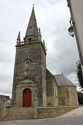 The , in Moréac | |
 Coat of arms | |
show Location of Moréac | |
 Moréac | |
| Coordinates: 47°55′N 2°49′W / 47.92°N 2.82°WCoordinates: 47°55′N 2°49′W / 47.92°N 2.82°W | |
| Country | France |
| Region | Brittany |
| Department | Morbihan |
| Arrondissement | Pontivy |
| Canton | Moréac |
| Government | |
| • Mayor (2020–2026) | Pascal Roselier[1] |
| Area 1 | 60.30 km2 (23.28 sq mi) |
| Population (Jan. 2018)[2] | 3,764 |
| • Density | 62/km2 (160/sq mi) |
| Time zone | UTC+01:00 (CET) |
| • Summer (DST) | UTC+02:00 (CEST) |
| INSEE/Postal code | 56140 /56500 |
| Elevation | 57–149 m (187–489 ft) |
| 1 French Land Register data, which excludes lakes, ponds, glaciers > 1 km2 (0.386 sq mi or 247 acres) and river estuaries. | |


Moréac (Breton: Mourieg) is a commune in the Morbihan department of Brittany in north-western France.
Geography[]
The Ruisseau de Kerropert forms part of the commune's eastern border, then flows into the Ével, which forms its northern border.
Demographics[]
Inhabitants of Moréac are called in French Moréacois.
Breton language[]
In 2008, there was 22,12% of the children attended the bilingual schools in primary education.[3]
See also[]
References[]
- ^ "Maires du Morbihan" (PDF). Préfecture du Morbihan. 7 July 2020.
- ^ "Populations légales 2018". INSEE. 28 December 2020.
- ^ (in French) Ofis ar Brezhoneg: Enseignement bilingue
External links[]
| Wikimedia Commons has media related to Moréac. |
- Official website (in French)
- Base Mérimée: Search for heritage in the commune, Ministère français de la Culture. (in French)
- Mayors of Morbihan Association (in French)
This Morbihan geographical article is a stub. You can help Wikipedia by . |
Categories:
- Communes of Morbihan
- Morbihan geography stubs