Le Palais
Le Palais
Porzh-Lae | |
|---|---|
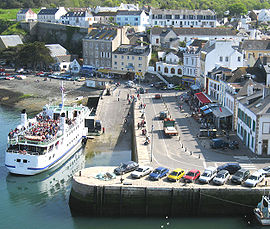 Ferry in the harbour | |
 Coat of arms | |
show Location of Le Palais | |
 Le Palais | |
| Coordinates: 47°20′50″N 3°09′15″W / 47.3472°N 3.1542°WCoordinates: 47°20′50″N 3°09′15″W / 47.3472°N 3.1542°W | |
| Country | France |
| Region | Brittany |
| Department | Morbihan |
| Arrondissement | Lorient |
| Canton | Quiberon |
| Intercommunality | Belle-Île-en-Mer |
| Government | |
| • Mayor (2020–2026) | Tibault Grollemund[1] |
| Area 1 | 17.43 km2 (6.73 sq mi) |
| Population (Jan. 2018)[2] | 2,552 |
| • Density | 150/km2 (380/sq mi) |
| Time zone | UTC+01:00 (CET) |
| • Summer (DST) | UTC+02:00 (CEST) |
| INSEE/Postal code | 56152 /56360 |
| Elevation | 0–58 m (0–190 ft) |
| 1 French Land Register data, which excludes lakes, ponds, glaciers > 1 km2 (0.386 sq mi or 247 acres) and river estuaries. | |


Le Palais (Breton: Porzh-Lae) is a commune in the Morbihan department of Brittany in northwestern France.
It is one of the four communes on the island of Belle Île.
Demographics[]
Inhabitants of Le Palais are called in French Palantins.
See also[]
References[]
- ^ "Maires du Morbihan" (PDF). Préfecture du Morbihan. 7 July 2020.
- ^ "Populations légales 2018". INSEE. 28 December 2020.
External links[]
| Wikimedia Commons has media related to Le Palais. |
- Base Mérimée: Search for heritage in the commune, Ministère français de la Culture. (in French)
- Mayors of Morbihan Association (in French)
| show Authority control |
|---|
This Morbihan geographical article is a stub. You can help Wikipedia by . |
Categories:
- Communes of Morbihan
- Vauban fortifications in France
- Morbihan geography stubs