Séglien
Séglien
Seglian | |
|---|---|
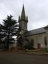 The church in Séglien | |
show Location of Séglien | |
 Séglien | |
| Coordinates: 48°06′28″N 3°09′30″W / 48.1078°N 3.1583°WCoordinates: 48°06′28″N 3°09′30″W / 48.1078°N 3.1583°W | |
| Country | France |
| Region | Brittany |
| Department | Morbihan |
| Arrondissement | Pontivy |
| Canton | Gourin |
| Intercommunality | Pontivy Communauté |
| Government | |
| • Mayor (2020–2026) | Laurent Ganivet[1] |
| Area 1 | 38.36 km2 (14.81 sq mi) |
| Population (Jan. 2018)[2] | 658 |
| • Density | 17/km2 (44/sq mi) |
| Time zone | UTC+01:00 (CET) |
| • Summer (DST) | UTC+02:00 (CEST) |
| INSEE/Postal code | 56242 /56160 |
| Elevation | 123–248 m (404–814 ft) |
| 1 French Land Register data, which excludes lakes, ponds, glaciers > 1 km2 (0.386 sq mi or 247 acres) and river estuaries. | |


Séglien (Breton: Seglian) is a commune in the Morbihan department of Brittany in north-western France.
Demographics[]
Inhabitants of Séglien are called in French Ségliennais.
See also[]
References[]
- ^ "Maires du Morbihan" (PDF). Préfecture du Morbihan. 7 July 2020.
- ^ "Populations légales 2018". INSEE. 28 December 2020.
External links[]
| Wikimedia Commons has media related to Séglien. |
- Official website (in French)
- Base Mérimée: Search for heritage in the commune, Ministère français de la Culture. (in French)
- Mayors of Morbihan Association (in French)
This Morbihan geographical article is a stub. You can help Wikipedia by . |
Categories:
- Communes of Morbihan
- Morbihan geography stubs