Cloverleaf, Texas
Cloverleaf, Texas | |
|---|---|
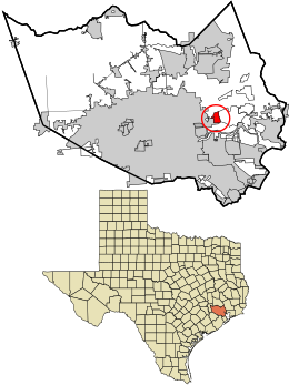 Location in Harris County and the state of Texas | |
| Coordinates: 29°47′5″N 95°10′23″W / 29.78472°N 95.17306°WCoordinates: 29°47′5″N 95°10′23″W / 29.78472°N 95.17306°W | |
| Country | United States |
| State | Texas |
| County | Harris |
| Area | |
| • Total | 3.3 sq mi (8.6 km2) |
| • Land | 3.3 sq mi (8.6 km2) |
| • Water | 0.0 sq mi (0.0 km2) |
| Elevation | 26 ft (8 m) |
| Population (2010) | |
| • Total | 22,942 |
| • Density | 6,900/sq mi (2,700/km2) |
| Time zone | UTC-6 (Central (CST)) |
| • Summer (DST) | UTC-5 (CDT) |
| ZIP code | 77015 |
| Area code(s) | 713 |
| FIPS code | 48-15628[1] |
| GNIS feature ID | 1373144[2] |

Cloverleaf is a census-designated place (CDP) in east central Harris County, Texas, United States.[3] The population was 22,942 at the 2010 census.[4]
History[]
Cloverleaf originated as a stop on the Beaumont, Sour Lake, and Western Railway. A 1936 county highway map indicates an unnamed development that became Cloverleaf. The Handbook of Texas states that a post office may have existed for a short period of time around 1950. In 1990, Cloverleaf had 18,230 residents and 18 churches.[3]
Geography[]

Cloverleaf is located at 29°47′5″N 95°10′23″W / 29.78472°N 95.17306°W (29.784676, -95.172959).[5] The community is located between the city of Jacinto City and the Channelview CDP along Interstate 10.[3]
According to the United States Census Bureau, the CDP has a total area of 3.3 square miles (8.6 km2), all of it land.
Demographics[]
| Historical population | |||
|---|---|---|---|
| Census | Pop. | %± | |
| 1980 | 17,317 | — | |
| 1990 | 18,230 | 5.3% | |
| 2000 | 23,508 | 29.0% | |
| 2010 | 22,942 | −2.4% | |
| source:[4][6] | |||
At the 2000 census there were 23,508 people, 7,287 households, and 5,800 families in the CDP. The population density was 6,589.2 people per square mile (2,542.4/km2). There were 7,865 housing units at an average density of 2,204.5/sq mi (850.6/km2). The racial makup of the CDP was 58.77% White, 16.11% African American, 0.59% Native American, 1.51% Asian, 0.05% Pacific Islander, 20.27% from other races, and 2.71% from two or more races. Hispanic or Latino of any race were 44.34%.[1]
Of the 7,287 households 46.7% had children under the age of 18 living with them, 57.9% were married couples living together, 14.9% had a female householder with no husband present, and 20.4% were non-families. 16.1% of households were one person and 3.9% were one person aged 65 or older. The average household size was 3.23 and the average family size was 3.61.
The age distribution was 33.7% under the age of 18, 11.6% from 18 to 24, 30.7% from 25 to 44, 18.2% from 45 to 64, and 5.8% 65 or older. The median age was 28 years. For every 100 females, there were 101.8 males. For every 100 females age 18 and over, there were 98.4 males.
The median household income was $37,449 and the median family income was $40,231. Males had a median income of $30,958 versus $25,044 for females. The per capita income for the CDP was $16,245. About 15.6% of families and 20.3% of the population were below the poverty line, including 26.8% of those under age 18 and 4.9% of those age 65 or over.
Government and infrastructure[]
The Harris Health System (formerly Harris County Hospital District) designated the Settegast Health Center in southeast Houston for the ZIP code 77015. The designated public hospital is Lyndon B. Johnson General Hospital in northeast Houston.[7]
Education[]
Cloverleaf is zoned to schools in the Galena Park Independent School District.[8]
Elementary schools in the Cloverleaf CDP include Cloverleaf Elementary School,[9] Green Valley Elementary School,[10] Havard Elementary School,[11] Sam Houston Elementary School,[12] and North Shore Elementary School.[13] All residents are zoned to Cobb 6th Grade School, which is located outside the CDP.[14] Most residents are zoned to North Shore Middle School, in the CDP,[15] for grades 7 through 8; some residents are zoned to Cunningham Middle School, outside the CDP, instead.[16] All residents are zoned to North Shore Senior High School for grades 9 through 12.[17]
In 1990, Cloverleaf had two elementary schools, one junior high school, and one high school.[3]
Residents of Galena Park ISD (and therefore Cloverleaf CDP) are zoned to San Jacinto College.[18]
See also[]
References[]
- ^ Jump up to: a b "U.S. Census website". United States Census Bureau. Retrieved 2008-01-31.
- ^ "US Board on Geographic Names". United States Geological Survey. 2007-10-25. Retrieved 2008-01-31.
- ^ Jump up to: a b c d Cloverleaf, Texas from the Handbook of Texas Online
- ^ Jump up to: a b "Profile of General Population and Housing Characteristics: 2010 Demographic Profile Data (DP-1): Cloverleaf CDP, Texas". United States Census Bureau. Retrieved June 27, 2012.
- ^ "US Gazetteer files: 2010, 2000, and 1990". United States Census Bureau. 2011-02-12. Retrieved 2011-04-23.
- ^ "CENSUS OF POPULATION AND HOUSING (1790-2000)". U.S. Census Bureau. Retrieved 2010-07-17.
- ^ "Clinic/Emergency/Registration Center Directory By ZIP Code". Harris County Hospital District. 2001-11-19. Retrieved 2021-04-08. - See ZIP code 77015. See this map for relevant ZIP code.
- ^ "2010 CENSUS - CENSUS BLOCK MAP: Cloverleaf CDP, TX" (PDF). U.S. Census Bureau. Retrieved 2019-05-23. - Census 2000 Map: index, pages 1 and 2. 1990 Census Maps (index for Harris County): Pages 139 and 140.
- ^ "Cloverleaf.pdf Archived 2009-02-27 at the Wayback Machine." Galena Park Independent School District. Retrieved on December 20, 2008.
- ^ "GreenValley.pdf Archived 2009-02-27 at the Wayback Machine." Galena Park Independent School District. Retrieved on December 20, 2008.
- ^ "Havard.pdf Archived 2009-02-27 at the Wayback Machine." Galena Park Independent School District. Retrieved on December 20, 2008.
- ^ "SamHouston.pdf Archived 2009-02-27 at the Wayback Machine." Galena Park Independent School District. Retrieved on December 20, 2008.
- ^ "NorthShoreElem.pdf Archived 2009-02-27 at the Wayback Machine." Galena Park Independent School District. Retrieved on December 20, 2008.
- ^ "Cobb.pdf Archived 2009-02-27 at the Wayback Machine." Galena Park Independent School District. Retrieved on December 20, 2008.
- ^ "NorthShoreMiddle.pdf Archived 2009-02-27 at the Wayback Machine." Galena Park Independent School District. Retrieved on December 20, 2008.
- ^ "Cunningham.pdf Archived 2009-02-27 at the Wayback Machine." Galena Park Independent School District. Retrieved on December 20, 2008.
- ^ "NorthShoreHighandSenior.pdf Archived 2009-02-27 at the Wayback Machine." Galena Park Independent School District. Retrieved on December 20, 2008.
- ^ Texas Education Code, Sec. 130.197. SAN JACINTO COLLEGE DISTRICT SERVICE AREA..
External links[]
- Cloverleaf, Texas from the Handbook of Texas Online

| show Municipalities and communities of Harris County, Texas, United States |
|---|


- Census-designated places in Harris County, Texas
- Census-designated places in Texas
- Greater Houston