Galena Park, Texas
Galena Park, Texas | |
|---|---|
City | |
 Galena Park sign | |
 Location in Harris County and the state of Texas | |
| Coordinates: 29°44′20″N 95°14′14″W / 29.73889°N 95.23722°WCoordinates: 29°44′20″N 95°14′14″W / 29.73889°N 95.23722°W | |
| Country | United States |
| State | Texas |
| County | Harris |
| Area | |
| • Total | 4.92 sq mi (12.74 km2) |
| • Land | 4.80 sq mi (12.44 km2) |
| • Water | 0.12 sq mi (0.30 km2) |
| Elevation | 28 ft (8.5 m) |
| Population | |
| • Total | 10,887 |
| • Estimate (2019)[4] | 10,757 |
| • Density | 2,239.18/sq mi (864.58/km2) |
| Time zone | UTC-6 (CST) |
| • Summer (DST) | UTC-5 (CDT) |
| ZIP code | 77547 |
| Area codes | 713, 281, 832, 346 |
| FIPS code | 48-27996[2] |
| GNIS feature ID | 1377177[3] |
| Website | www |

Galena Park is a city in Harris County, Texas, United States, within the Houston–Sugar Land–Baytown metropolitan area. The population was 10,887 at the 2010 census.[1]
History[]
Issac Batterson and his family settled in the area in 1833; it was a part of the Ezekiel Thomas Survey.[6] The area of Galena Park began as the settlement of Clinton in 1835.[7] The center of what would become Galena Park was a 1,000-acre (400 ha) tract that Batterson purchased from the estate of Ezekiel Thomas.[6] The settlement originally served as a farming and ranching community, but in the 1880s transformed into a railroad center along the new Port of Houston. With the coming of the petrochemical industry in the early 1900s, Clinton again transformed into a refinery center.[7]
Clinton attempted to establish a post office in 1935, but the request was denied as another Clinton, Texas, had established the name. The settlement's name was changed to Galena Park after the Galena Signal Oil Company of Texas, which built the first refinery there. Galena Park's original name survives today as the name of a major street in the city, Clinton Drive.[7] Because of the 1935 incorporation, Houston did not incorporate Galena Park's territory into its city limits, while Houston annexed surrounding areas that were unincorporated.[8] By the late 1930s Houston was growing as a port, so Galena Park expanded. Since the 1940s area residents considered the city to be a part of Greater Houston.[7]
The economy of Galena Park began to suffer in the early 1980s, when cranes used to haul ship cargo were reduced; prior to the early 1980s a team of workers, known on the docks as longshoremen, took up to one week to load cargo off of a ship. Many lived in the Galena Park area and contributed to its local economy. The use of cranes, however, led to ships unloading all cargo in less than one day.[9] The 1980s also hit Galena Park's economy with layoffs from the steel mills as the U.S. steel contracted due to overseas competition.[citation needed] The economy further decreased after the September 11, 2001 attacks, when seaport administrators tightened security rules that governed whether sailors could leave ships docked at port.[9]
Geography[]

Galena Park is located at 29°44′20″N 95°14′14″W / 29.73889°N 95.23722°W (29.738928, -95.237211).[10]
According to the United States Census Bureau, the city has a total area of 5.0 square miles (13 km2), all of it land.
The city is east of the 610 Loop, north of the Houston Ship Channel,[11] and adjacent to the City of Jacinto City,[12] as well as the Clinton Park neighborhood of Houston.[13] Clinton Drive is the main arterial road for Galena Park and traffic to and from the ship channel and the Port of Houston uses this road. The area around Galena Park includes freeways, freight railway, and heavy industry.[14]
The border between Galena Park, previously an all-white city and Clinton Park, an African-American neighborhood, is barricaded as of 2008. Rafael Longoria and Susan Rogers of the Rice Design Alliance said in 2008 that the barricade "provides a stark example of how the prevailing segregationist sentiments of the era is still in evidence."[13]
Demographics[]
| Historical population | |||
|---|---|---|---|
| Census | Pop. | %± | |
| 1940 | 1,562 | — | |
| 1950 | 7,186 | 360.1% | |
| 1960 | 10,852 | 51.0% | |
| 1970 | 10,479 | −3.4% | |
| 1980 | 9,879 | −5.7% | |
| 1990 | 10,033 | 1.6% | |
| 2000 | 10,592 | 5.6% | |
| 2010 | 10,887 | 2.8% | |
| 2019 (est.) | 10,757 | [4] | −1.2% |
| U.S. Decennial Census[15] | |||
As of the census[2] of 2010, there were 10,887 people and 3,021 households residing in the city. The population density was 2,183.3 people per square mile (843.0/km2). There were 3,273 housing units at an average density of 654.6/sq mi (253.7/km2). The racial makeup of the city was 11.4% White, Not Hispanic, 6.6% African American, Not Hispanic, 0.13% Native American or Native Alaskan, Not Hispanic, 0.09% Asian or Pacific Islander, Not Hispanic, 0.16% from other races, not Hispanic, and 0.25% from two or more races. People of Hispanic, Latino or Spanish Origin of any race were 81.4% of the population, a 21% increase in Hispanic, Latino or Spanish Origin population over the 2000 census.
Remaining demographics were not yet available from the 2010 census (expected release Summer-Fall of 2011). As of the 2000 census there were 3,054 households, out of which 46.9% had children under the age of 18 living with them, 61.9% were married couples living together, 13.3% had a female householder with no husband present, and 19.4% were non-families. 17.0% of all households were made up of individuals, and 8.8% had someone living alone who was 65 years of age or older. The average household size was 3.47 and the average family size was 3.92.
In the city, the population was spread out, with 33.8% under the age of 18, 11.4% from 18 to 24, 28.6% from 25 to 44, 16.2% from 45 to 64, and 9.9% who were 65 years of age or older. The median age was 28 years. For every 100 females, there were 99.1 males. For every 100 females age 18 and over, there were 98.5 males.
The median income for a household in the city was $31,660, and the median income for a family was $34,702. Males had a median income of $29,814 versus $21,172 for females. The per capita income for the city was $12,207. About 21.5% of families and 25.4% of the population were below the poverty line, including 34.2% of those under age 18 and 10.6% of those age 65 or over.
Government and infrastructure[]

As of 2014, Esmeralda Moya is the Mayor of the City of Galena Park. Mayor Esmeralda Moya also serves as the chief executive officer of the city. As the city's Chief Administrator and Official Representative. The City of Galena Park made history on June 21, 2014, by electing Mayor Esmeralda Moya as the first female Hispanic to hold this elected position.
The City of Galena Park operates with a Mayor-Council type of government. The City council has four positions, with each having a responsibility for a particular Municipal Department. Commissioner Zenaida Granados, position one (1), heads the Water and Sewer Services. Commissioner Rodney Chersky, position two (2), heads Police and Fire Services. Commissioner Veronica Garcia, position three (3), heads Parks and Recreation. Commissioner Beverly Mullen, position four (4), heads Streets and Bridge services.
The Galena Park Fire Department and the Galena Park Police Department serve the citizens of the city.
County, federal, and state representation[]
Galena Park is located within Harris County Precinct 2; as of 2011 Jack Morman headed Precinct 2.[16]
Galena Park is located in District 143 of the Texas House of Representatives[17] As of 2011 Ana Hernandez Luna, formerly Ana E. Hernandez, represented the district.[18] Galena Park is within District 6 [19] of the Texas Senate; as of 2011 Mario Gallegos, Jr. was the representative.[20]
Galena Park was within Texas's 29th congressional district; as of 2019 Sylvia Garcia represented the district.[21] The United States Postal Service operates the Galena Park Post Office at 1805 Clinton Drive.[22]
The designated public health center of the Harris Health System (formerly Harris County Health System) is the Strawberry Health Clinic in Pasadena. The nearest public hospital is Ben Taub General Hospital in the Texas Medical Center, Houston.[23]
Education[]
Primary and secondary schools[]
Public schools[]

Students in Galena Park attend schools in Galena Park Independent School District.[24]
Four separate elementary schools, Galena Park Elementary School in Galena Park, MacArthur Elementary School in Galena Park, Jacinto City Elementary School in Jacinto City, and Pyburn Elementary School in Houston, serve students from the city of Galena Park[25] Almost all Galena Park students are zoned to Galena Park Middle School (6-8) in Galena Park. A few in northeast Galena Park are zoned to Woodland Acres Middle School in Houston.[26] All Galena Park residents are zoned to Galena Park High School (9-12) in Galena Park.[27]
In addition GPISD operates the William F. "Bill" Becker Early Childhood Development Center, a preschool program for low income families, in Galena Park.[28]
In the pre-1970 era of racial segregation in schools, the local high school for Black children was Fidelity Manor High School.
Private schools[]
Our Lady of Fatima School, a PK 3 to Grade 8 Roman Catholic school, is in Galena Park.[29] The school is fully accredited by TEA and TCEA. It has served the community for over sixty years and is open enrollment to all faiths and denomination.
Colleges and universities[]
The Galena Park ISD area (and therefore Galena Park) is zoned to the San Jacinto College system.[30]
Public libraries[]
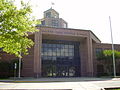
The Harris County Public Library (HCPL) system operates the Galena Park Branch at 1500 Keene Street in Galena Park. The 5,800-square-foot (540 m2) branch, a partnership between HCPL and Galena Park, was built in March 1996 opened in December of that year.[31]
Gallery of schools[]
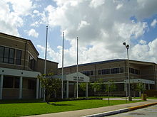
Galena Park Middle School
Galena Park Elementary School

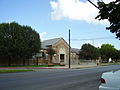
MacArthur Elementary School

Becker Early Childhood Center


Notable people[]
- Michael Glyn Brown, former hand surgeon[32]
- Howard Twilley, professional football player
Gallery[]
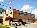
Galena Park Fire Station #1

Galena Park Police Department


See also[]
References[]
- ^ Jump up to: a b "Profile of General Population and Housing Characteristics: 2010 Demographic Profile Data (DP-1): Galena Park city, Texas". United States Census Bureau. Retrieved June 15, 2012.
- ^ Jump up to: a b "U.S. Census website". United States Census Bureau. Retrieved 2008-01-31.
- ^ "US Board on Geographic Names". United States Geological Survey. 2007-10-25. Retrieved 2008-01-31.
- ^ Jump up to: a b "Population and Housing Unit Estimates". United States Census Bureau. May 24, 2020. Retrieved May 27, 2020.
- ^ "2019 U.S. Gazetteer Files". United States Census Bureau. Retrieved August 7, 2020.
- ^ Jump up to: a b "The History" (Archive). City of Galena Park. Retrieved on August 11, 2014.
- ^ Jump up to: a b c d "Galena Park, Texas." Handbook of Texas. Retrieved on November 4, 2009.
- ^ Lee, Renée C. "Annexed Kingwood split on effects." Houston Chronicle. Sunday October 8, 2006. A21. Retrieved on July 6, 2011. "Some of the area communities that incorporated as cities and escaped annexation by Houston:" Print version exclusively has the information cited; the information is not included in the online edition.
- ^ Jump up to: a b Harkinson, Josh. "All Aboard." Houston Press. March 18, 2004. 1.
- ^ "US Gazetteer files: 2010, 2000, and 1990". United States Census Bureau. 2011-02-12. Retrieved 2011-04-23.
- ^ Lobet, Ingrid. "Cancer risk from diesel in Galena Park." Houston Chronicle. July 4, 2014. Updated July 8, 2014. Retrieved on August 10, 2014.
- ^ Krajicek, David. "Suzanne Basso and the Murder of Louis 'Buddy' Musso Archived 2014-02-25 at the Wayback Machine." Suzanne Basso and the Murder of Louis 'Buddy' Musso. Crime Library. Retrieved on March 3, 2014.
- ^ Jump up to: a b Longoria, Rafael and Susan Rogers. "The Rurban Horseshoe." (Archive) Cite 73. The Rice Design Alliance, (Northern Hemisphere) Winter 2008. Pages 18-19. Retrieved on February 24, 2010.
- ^ Feibel, Carrie. "Pollution From Ship Channel and Port Traffic Affects Galena Park." KUHF. July 8, 2014. Retrieved on August 10, 2014.
- ^ "Census of Population and Housing". Census.gov. Retrieved June 4, 2015.
- ^ [1]." Harris County. Accessed May 10, 2011.
- ^ "[2]" Texas Legislature District 143 Map Accessed May 10, 2011.
- ^ "[3]." Texas House of Representatives. Accessed May 10, 2011.
- ^ "[4]." Texas Senate, District 6 Map Accessed May 10, 2011.
- ^ ""Archived copy". Archived from the original on 2011-07-22. Retrieved 2011-07-20.CS1 maint: archived copy as title (link)". . Accessed May 10, 2011.
- ^ "Congressional District 29 Archived 2008-10-09 at the Wayback Machine." National Atlas of the United States. Retrieved on December 13, 2008.
- ^ "Post Office Location - GALENA PARK." United States Postal Service. Retrieved on December 13, 2008.
- ^ "Clinic/Emergency/Registration Center Directory By ZIP Code". Harris County Hospital District. 2001-11-19. Archived from the original on 2001-11-19. Retrieved 2021-04-08. - See ZIP code 77547. See this map for relevant ZIP codes.
- ^ "Zoning Map". City of Galena Park. Retrieved 2021-03-02. - Compare zoning Map to school zone maps.
- ^ "Elementary Schools - South Archived 2017-09-22 at the Wayback Machine," Galena Park Independent School District. Retrieved on November 29, 2008.
- ^ "Woodland Acres Middle School Archived 2017-09-22 at the Wayback Machine." Galena Park Independent School District. Retrieved on November 29, 2008.
- ^ "Galena Park High School Archived 2017-09-22 at the Wayback Machine." Galena Park Independent School District. Retrieved on November 29, 2008.
- ^ "Early Head Start Archived 2012-03-14 at the Wayback Machine." Galena Park Independent School District. Retrieved on November 11, 2011.
- ^ http://www.archgh.org/SchoolPages/schoolpages-new/ourladyoffatima-galenapark.htm
- ^ Texas Education Code, Sec. 130.197. SAN JACINTO COLLEGE DISTRICT SERVICE AREA..
- ^ "Galena Park Branch Library Archived 2008-05-17 at the Wayback Machine." Harris County Public Library. Retrieved on November 29, 2008.
- ^ Ackerman, Todd. "Troubles belie Houston hand doc's family-man image." Houston Chronicle. Monday September 6, 2010. 1. Retrieved on November 20, 2011.
External links[]
| Wikimedia Commons has media related to Galena Park, Texas. |
- City of Galena Park official website
- Galena Park, Texas from the Handbook of Texas Online
| show Municipalities and communities of Harris County, Texas, United States |
|---|


| show Authority control |
|---|
- Cities in Texas
- Cities in Harris County, Texas
- Greater Houston