Galveston County, Texas
This article needs additional citations for verification. (May 2010) |
Galveston County | |
|---|---|
U.S. county | |
 Galveston County Courts Building | |
 Seal | |
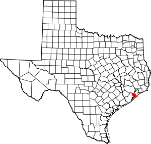 Location within the U.S. state of Texas | |
 Texas's location within the U.S. | |
| Coordinates: 29°23′N 94°52′W / 29.38°N 94.86°W | |
| Country | |
| State | |
| Founded | 1838 |
| Named for | City of Galveston |
| Seat | Galveston |
| Largest city | League City |
| Area | |
| • Total | 874 sq mi (2,260 km2) |
| • Land | 378 sq mi (980 km2) |
| • Water | 495 sq mi (1,280 km2) 57%% |
| Population | |
| • Estimate (2019) | 342,139 |
| • Density | 886/sq mi (342/km2) |
| Time zone | UTC−6 (Central) |
| • Summer (DST) | UTC−5 (CDT) |
| Congressional district | 14th |
| Website | www |

Galveston County (/ˈɡælvɪstən/ GAL-vis-tən) is a county in the U.S. state of Texas, located along the Gulf Coast adjacent to Galveston Bay. As of the 2010 U.S. Decennial Census, the population was 291,309.[1] The county was founded in 1838. The county seat is the City of Galveston, founded the following year of 1839, located on Galveston Island. The most populous municipality in the county is League City, a suburb of Houston at the northern end of the county, which surpassed Galveston in population during the early 2000s.[2]
Galveston County is part of the ten-county Houston–The Woodlands–Sugar Land (Greater Houston) metropolitan statistical area.
History[]
Sixteenth-century Spanish explorers knew Galveston Island as the Isla de Malhado, the "Isle of Misfortune", or Isla de Culebras, the "Isle of Snakes".[3] In 1519, the expedition led by Alonso Álvarez de Pineda actually sailed past Galveston Island while he was charting the route from the Florida peninsula to the Pánuco River. The information gathered from the expedition enabled the Spanish government to establish control over the entire Gulf Coast, including Galveston Island. In 1783, José Antonio de Evia, a Spanish navigator, surveyed the area and named the bay Galveston to honor Bernardo de Gálvez, who supported the United States in the Revolutionary War.[4]
Galveston County was formally established under the Republic of Texas on May 15, 1838.[5] The county was formed from territory taken from Harrisburg, Liberty, and Brazoria Counties, with governmental organization taking place in 1839.[6] The island and city of Galveston was by far the most important population center. The city of Galveston was the republic's largest city and its center of commerce and culture. Port Bolivar on the Bolivar Peninsula was a port of secondary importance. Other development in the area was initially mostly ranching interests and small farming communities. Texas soon joined the United States, and Galveston's importance continued to grow as it came to dominate the worldwide cotton trade. As railroads between Galveston, Harrisburg, Houston, and other towns were built during the 19th century, small communities grew up along the rail lines. Nevertheless, Galveston continued to remain a prominent destination for the shipping and trade industries. A bridge was completed in 1859, when the Galveston, Houston, and Henderson Railroad built a wooden trestle that was used by all other railway lines to the island until 1875, when the Gulf, Colorado and Santa Fe Railway built its own bridge. At the end of the 19th century, a group of investors established Texas City directly across the West Bay from Galveston with the hope of making it a competing port city. The port began operations just before the start of the 20th century.


The 1900 Galveston Hurricane devastated the county, killing an estimated 6000 people on the island alone and numerous others in the rest of the county. The Port of Galveston was closed for a time during reconstruction, but recovery was swift and profound. By 1910, the county's citizens had developed the commission form of government, constructed the seawall, and raised the merit of the whole city.
Investors had worried that the Texas coast was a dangerous place to establish major commercial operations because of the threat of hurricanes, and the 1900 disaster seemed to prove that. Though Galveston rebuilt its port and other major operations quickly, major investment moved inland, largely to Houston. Soon, Houston and Texas City had outpaced Galveston as major ports.
The oil boom in Texas began in 1901, and soon pipelines and refineries were built in Texas City. Industrial growth blossomed, especially during World War II. Galveston's manufacturing sector, however, was more stagnant during the 20th century.
Galveston, traditionally an attractive tourist destination even before the storm, transformed itself into a major, nationally known destination. It was around this time that entrepreneur, power broker and racketeer, Sam Maceo rose to power and transformed the island in what was known as the Free State of Galveston. [7] During this time period, the city was home to many casinos, whorehouses and speakeasies, in addition to becoming a center of culture, economy and nightlife, all due to the free availability of gambling and alcohol. [7] The city's entertainment business spread throughout the county with major casino districts in Kemah and Dickinson enabled by a lax attitude among law enforcement in the county (Houstonians often humorously referred to the Galveston County line as the "Maceo-Dickinson line"). The county prospered as oil fueled Texas City's industrial growth, and wealthy tourists flocked to Galveston and the other entertainment districts. [7]
The gambling empire was destroyed in the 1950s as state law enforcement dismantled its establishments. Galveston's economy crashed as did the economies of some other county municipalities that were dependent on tourism. Texas City's economy weathered the storm because of its strong industry.
The establishment on NASA's Johnson Space Center in 1963 soon created new growth opportunities for the county municipalities near Clear Lake and Harris County. The Clear Lake area communities in Harris and Galveston Counties soon became more tied toward each other, while the island of Galveston languished for many years as businesses increasingly left for the mainland.
Tourism has gradually resurged, both on the island and on the mainland, and today has become a major industry in the county. Aerospace and related service industries continue to be important in the Clear Lake area of the county. Texas City has become an important petrochemical center.
Geography[]
According to the U.S. Census Bureau, the county has a total area of 874 square miles (2,260 km2), of which 378 square miles (980 km2) is land and 495 square miles (1,280 km2) (57%) is covered by water.[8]
Galveston County is located on the plains of the Texas Gulf Coast in the southeastern part of the state. The county is bounded on the northeast by Galveston Bay and on the northwest by Clear Creek and Clear Lake. Much of the county covers Galveston Bay, and is bounded to the south by the Galveston Seawall and beaches on the Gulf of Mexico.
Adjacent counties[]
- Harris County (north)
- Chambers County (northeast)
- Brazoria County (west)
Demographics[]
| Historical population | |||
|---|---|---|---|
| Census | Pop. | %± | |
| 1850 | 4,529 | — | |
| 1860 | 8,229 | 81.7% | |
| 1870 | 15,290 | 85.8% | |
| 1880 | 24,121 | 57.8% | |
| 1890 | 31,476 | 30.5% | |
| 1900 | 44,116 | 40.2% | |
| 1910 | 44,479 | 0.8% | |
| 1920 | 53,150 | 19.5% | |
| 1930 | 64,401 | 21.2% | |
| 1940 | 81,173 | 26.0% | |
| 1950 | 113,066 | 39.3% | |
| 1960 | 140,364 | 24.1% | |
| 1970 | 169,812 | 21.0% | |
| 1980 | 195,940 | 15.4% | |
| 1990 | 217,399 | 11.0% | |
| 2000 | 250,158 | 15.1% | |
| 2010 | 291,309 | 16.5% | |
| 2019 (est.) | 342,139 | [9] | 17.4% |
| U.S. Decennial Census[10] 1850–2010[11] 2010–2019[1] | |||
As of the census[12] of 2000, 250,158 people, 94,782 households, and 66,157 families resided in the county. The population density was 628 people per square mile (242/km2). The 111,733 housing units averaged 280 per square mile (108/km2). The racial makeup of the county was 72.69% White, 15.44% Black or African American, 0.47% Native American, 2.10% Asian, 0.04% Pacific Islander, 7.18% from other races, and 2.08% from two or more races. About 18% of the population was Hispanic or Latino of any race.
Of the 94,782 households, 33.80% had children under the age of 18 living with them, 52.40% were married couples living together, 13.10% had a female householder with no husband present, and 30.20% were not families. Around 25.1% of all households were made up of individuals, and 8.1% had someone living alone who was 65 years of age or older. The average household size was 2.60 and the average family size was 3.12.
In the county, the population was distributed as 26.70% under the age of 18, 8.70% from 18 to 24, 30.20% from 25 to 44, 23.30% from 45 to 64, and 11.10% who were 65 years of age or older. The median age was 36 years. For every 100 females, there were 95.90 males. For every 100 females age 18 and over, there were 93.10 males.
The median income for a household in the county was $42,419, and for a family was $51,435. Males had a median income of $41,406 versus $28,703 for females. The per capita income for the county was $21,568. About 10.10% of families and 13.20% of the population were below the poverty line, including 17.60% of those under age 18 and 10.20% of those age 65 or over.
Politics[]
United States Congress[]
| U.S. Senators | Name | Party | First Elected | Level | |
|---|---|---|---|---|---|
| Senate Class 2 | John Cornyn | Republican | 2002 | Senior Senator | |
| Senate Class 1 | Ted Cruz | Republican | 2012 | Junior Senator | |
| U.S. Representatives | Name | Party | First Elected | ||
| District 14 | Randy Weber | Republican | 2012 | ||
Texas Legislature[]
Texas Senate[]
| District | Name | Party | First Elected | ||
|---|---|---|---|---|---|
| 11 | Larry Taylor | Republican | 1999 | ||
Texas House of Representatives[]
| District | Name | Party | First Elected | Area(s) of Galveston County Represented | |
|---|---|---|---|---|---|
| 23 | Mayes Middleton | Republican | 2014 | Galveston, Jamaica Beach, Texas City, Port Bolivar, Crystal Beach, Gilchrist & High Island | |
| 24 | Greg Bonnen | Republican | 2012 | Hitchcock, La Marque, Santa Fe, Dickinson, League City, Friendswood (Galveston County part), Algoa, Kemah, Clear Lake Shores | |


Education[]
Eight independent school districts (ISDs) serve Galveston County communities:
- Clear Creek ISD
- Dickinson ISD
- Friendswood ISD
- Galveston ISD
- High Island ISD
- Hitchcock ISD
- Santa Fe ISD
- Texas City ISD
A ninth school district, La Marque Independent School District, was subsumed into Texas City ISD in 2016 after the Texas Education Agency revoked its accreditation due to poor academic and financial performance.[14]
Higher education[]
The city of Galveston is home to Texas A&M University at Galveston, an extension of the main A&M campus in College Station, and the University of Texas Medical Branch at Galveston.
The Texas Legislature specified that the following community colleges also serve the area: College of the Mainland for Texas City (including former La Marque), Hitchcock, Santa Fe, Friendswood, and Dickinson school districts as well as the Galveston County portion of Clear Creek ISD (in other words mainland Galveston County); and Galveston College for Galveston ISD and High Island ISD (the islands).[15]
Public libraries[]
The Galveston County Library System operates libraries in most of the larger towns and cities. The Rosenberg Library in Galveston has the distinction of being the oldest public library in Texas, and serves as the headquarters for the Galveston County Library System. Its librarian also functions as the Galveston County librarian. Also, seven other libraries are in Galveston County, including the Genevieve Miller Library in Hitchcock, the La Marque Public Library, the Helen Hall Public Library in League City, the Moore Memorial Public Library in Texas City, the Mares Memorial Library in Dickinson, the Friendswood Public Library, and the Mae Bruce Library in Santa Fe.
Political organization[]
The head of a Texas county, as set up in the Texas Constitution, is the county judge, who sits as the chair of the county's commissioners' court.[16] The county is split into four geographical divisions called precincts. Each precinct elects a commissioner to sit as a representative of their precinct on the commissioners court and also for the oversight of county functions in their area.
Other elected positions in Galveston County include a county clerk, a district attorney, a , a county clerk, a sheriff, nine constables, a tax assessor-collector, a county treasurer, and every judge in the county except , who are appointed by the officials of their respective cities.[17]
Hospital services[]
Galveston County is served by a major medical complex in Galveston and a private for-profit hospital in Texas City.
The University of Texas Medical Branch in Galveston is a 1,200-bed, major medical complex of seven hospitals. The main general-care hospital is John Sealy Hospital, with other on-campus hospitals specializing in women, children, burn victims, geriatrics, and psychiatrics. Currently, UTMB is certified as a level I trauma center and serves as the lead trauma facility for the nine-county region in southeast Texas, including the Greater Houston area.[18]
The Mainland Medical Center, a 233-bed, private, for-profit hospital, operates in Texas City.[19]
Transportation[]
Major highways[]
 Interstate 45
 State Highway 3
 State Highway 6
 State Highway 87
 State Highway 146
Airports[]
This section needs additional citations for verification. (December 2010) |
Scholes International Airport at Galveston (IATA: GLS, ICAO: KGLS), the county's sole publicly owned airport, is a two-runway airport located on Galveston Island in Galveston. The airport is primarily used for general aviation, offshore energy transportation, and some limited military operations.
Privately owned airports for private use include Creasy Airport and Kami-Kazi Airport, both inn unincorporated areas.
The closest airport with regularly scheduled commercial service is William P. Hobby Airport, located in Houston.[citation needed] The Houston Airport System stated that Galveston County is also within the primary service area of George Bush Intercontinental Airport, an international airport near Houston in Harris County.[20]
Private heliports for private use include:
- University of Texas Medical Branch in Galveston has two heliports: one for Ewing Hall and one for its emergency room.
- is in an unincorporated area, adjacent to Hitchcock.
Rail[]
All rail traffic is currently industry-related. Regularly scheduled passenger rail service in Galveston County ceased on April 11, 1967.[21]
Mass transit[]
The City of Galveston is served by Island Transit, a public transportation agency.
Crime[]
This section needs expansion. You can help by . (May 2013) |
In the unincorporated areas of the county, in 2002, 1,267 criminal offenses were recorded. In 2003, 1,136 criminal offenses were reported in unincorporated areas, including 507 thefts, 153 motor-vehicle thefts, 313 burglaries, two murders, and one rape. In 2004, 836 offenses were reported, including 369 thefts, 84 motor vehicle thefts, 236 burglaries, two murders, and 26 rapes. In 2004, considering all of the reported offenses, arrests occurred in 85 of those cases.[22]
Between 2003 and 2004, a decline was noted in overall reported offenses by 300, or a 26.4% decrease. The crime with the largest percentage decrease from 2003 to 2004 was motor-vehicle thefts. County sheriff Gean Leonard said, "I'd have to say the combination of public education and more public consciousness about where they park and how they leave their cars, especially not leaving keys in cars, has certainly helped."[22]
Corrections[]
The Galveston County Jail is located at 5700 Avenue H in Galveston.[23]
The Texas Department of Criminal Justice and University of Texas Medical Branch manage health care facilities for prisoners in Galveston, Galveston County. The facilities include the co-gender Galveston Hospital for prisoners in Galveston[24] and the Young Medical Facility Complex for females in Texas City.[25] Hospital Galveston began contracting for medical treatment of prisoners in 1983.[26] Young opened in 1996 as the Texas City Regional Medical Unit.[27]
Communities[]
Galveston County has several unincorporated areas; most of them are on the Bolivar Peninsula. Others are outside of Hitchcock and Santa Fe along Texas State Highway 6, and the three communities in the "Bayshore" area: Bacliff, San Leon, and Bayview.[22]
Cities[]
- Bayou Vista
- Clear Lake Shores
- Dickinson
- Friendswood (small part in Harris County)
- Galveston (county seat)
- Hitchcock
- Jamaica Beach
- Kemah
- La Marque
- League City (small part in Harris County)
- Santa Fe
- Texas City
Villages[]
Census-designated places[]
- Bacliff
- Bolivar Peninsula
- San Leon
Unincorporated communities[]
Alta Loma, previously unincorporated,[28] became a part of Santa Fe in 1978.[29]
Notable people[]
- John Baptista Ashe, former U.S. Representative for Tennessee[30]
- Dez Bryant, American football wide receiver and return specialist for the Dallas Cowboys, was born in Galveston County.[31]
- Red Bryant, American football defensive end for the Seattle Seahawks of the National Football League, was born in Galveston County.[32]
- YBN Almighty Jay, rapper in the YBN collective, was born in Galveston County.
- Larry Taylor - Republican member of the Texas Senate from District 11 (2013-Present) and Texas House of Representatives from District 24 (2003-2013)
See also[]
- List of museums in the Texas Gulf Coast
- National Register of Historic Places listings in Galveston County, Texas
- Recorded Texas Historic Landmarks in Galveston County
References[]
- ^ Jump up to: a b "State & County QuickFacts". United States Census Bureau. Archived from the original on July 17, 2011. Retrieved December 16, 2013.
- ^ Schladen, Marty (2006-07-23). "Forces drive people off island". Galveston County Daily News. Archived from the original on 2007-12-31. Retrieved 2014-01-14.CS1 maint: bot: original URL status unknown (link) ()
- ^ Diana J. Kleiner. "Galveston County". Texas State Historical Association. Retrieved 2018-03-16.
- ^ "Galveston". Galveston County Historical Museum. Retrieved 2018-03-17.
- ^ Office of the Auditor of Galveston County, Texas. "Galveston County 2007 Comprehensive Financial Report" (PDF). Galveston County, Texas. Retrieved 2010-11-12.
- ^ Galveston County, Texas from the Handbook of Texas Online
- ^ Jump up to: a b c "Sam Maceo is the kindly king of the Texas gambling realm".
- ^ "2010 Census Gazetteer Files". United States Census Bureau. August 22, 2012. Retrieved April 27, 2015.
- ^ "Population and Housing Unit Estimates". United States Census Bureau. May 24, 2020. Retrieved May 27, 2020.
- ^ "U.S. Decennial Census". United States Census Bureau. Retrieved April 27, 2015.
- ^ "Texas Almanac: Population History of Counties from 1850–2010" (PDF). Texas Almanac. Retrieved April 27, 2015.
- ^ "U.S. Census website". United States Census Bureau. Retrieved 2011-05-14.
- ^ Leip, David. "Dave Leip's Atlas of U.S. Presidential Elections". uselectionatlas.org. Retrieved 2018-07-23.
- ^ Zaveri, Mihir. "Texas City ISD moves toward absorbing La Marque school district" (Archive). Houston Chronicle. Wednesday, February 17, 2016. Retrieved on March 22, 2018.
- ^ Texas Education Code Sec. 130.174. COLLEGE OF THE MAINLAND DISTRICT SERVICE AREA. Sec. 130.179. GALVESTON COLLEGE DISTRICT SERVICE AREA.
- ^ Galveston County, http://www.co.galveston.tx.us/County_Judge/default.htm
- ^ "Pages - Galveston County". co.galveston.tx.us.
- ^ "Welcome - School of Health Professions - UTMB Health" (PDF). sahs.utmb.edu.
- ^ Mainland Medical Center, http://www.mainlandmedical.com/CustomPage.asp?guidCustomContentID={263215B6-AC55-4276-A52B-B8F34390E0BE} Archived 2008-06-11 at the Wayback Machine
- ^ "Master Plan Executive Summary Archived July 11, 2011, at the Wayback Machine." George Bush Intercontinental Airport Master Plan. Houston Airport System. December 2006. 2-1 (23/130). Retrieved on December 14, 2010.
- ^ "Galveston County Railroad Museum". galvestonrrmuseum.com.
- ^ Jump up to: a b c Evans, Thayer. "Crime numbers go down - Figures drop 26.4 percent in unincorporated Galveston County." Houston Chronicle. Thursday February 3, 2005. ThisWeek p. 1. "Other unincorporated areas are along Texas 6 outside Hitchcock and Santa Fe and in the Bayshore area, which includes Bacliff, Bayview and San Leon." Available at NewsBank Record Number: 3841079.
- ^ "Corrections Bureau - Jail Division." Galveston County Sheriff's Office. Accessed September 12, 2008.
- ^ "Hospital Galveston." Texas Department of Criminal Justice. Accessed September 12, 2008.
- ^ "YOUNG MEDICAL FACILITY COMPLEX (GC) Archived 2008-08-21 at the Wayback Machine." Texas Department of Criminal Justice. Accessed September 12, 2008.
- ^ Texas Department of Criminal Justice. Turner Publishing Company, 2004. 50. ISBN 1-56311-964-1, ISBN 978-1-56311-964-4.
- ^ Texas Department of Criminal Justice. Turner Publishing Company, 2004. 51. ISBN 1-56311-964-1, ISBN 978-1-56311-964-4.
- ^ "Community Plan 2010-2011." Galveston County. p. 3 (PDF 3/41). Retrieved on January 5, 2015.
- ^ "ALTA LOMA, TX." Handbook of Texas. Retrieved on January 5, 2015.
- ^ "ASHE, John Baptista, (1810 - 1857)". Biographical Directory of the United States Congress. Retrieved October 10, 2012.
- ^ "88 Dez Bryant, R". CBSSports.com. Retrieved November 21, 2012.
- ^ "Red Bryant". Pro-Football-Reference.Com. Retrieved October 3, 2012.
Further reading[]
- Petitt, Jr., B.M. and A.G. Winslow. (1957). Geology and ground-water resources of Galveston County, Texas [U.S. Geological Survey Water-Supply Paper 1416]. Washington, D.C.: U.S. Government Printing Office.
External links[]
| Wikimedia Commons has media related to Galveston County, Texas. |
- Galveston County government’s website
- Galveston County Economic Development
- Historic materials of Galveston County, hosted by the Portal to Texas History
- Galveston Island State Park
- Galveston County, Texas from the Handbook of Texas Online
- Galveston County District Court
- . The American Cyclopædia. 1879.
| show Places adjacent to Galveston County, Texas |
|---|
| show Municipalities and communities of Galveston County, Texas, United States |
|---|


| show Authority control |
|---|
- Texas counties
- Galveston County, Texas
- 1838 establishments in the Republic of Texas
- Populated places established in 1838
- Greater Houston