Combrand
Combrand | |
|---|---|
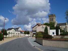 The church and surrounding buildings in Combrand | |
show Location of Combrand | |
 Combrand | |
| Coordinates: 46°51′54″N 0°41′18″W / 46.865°N 0.6883°WCoordinates: 46°51′54″N 0°41′18″W / 46.865°N 0.6883°W | |
| Country | France |
| Region | Nouvelle-Aquitaine |
| Department | Deux-Sèvres |
| Arrondissement | Bressuire |
| Canton | Cerizay |
| Government | |
| • Mayor (2020–2026) | Anne-Marie Reveau[1] |
| Area 1 | 24.62 km2 (9.51 sq mi) |
| Population (Jan. 2018)[2] | 1,159 |
| • Density | 47/km2 (120/sq mi) |
| Time zone | UTC+01:00 (CET) |
| • Summer (DST) | UTC+02:00 (CEST) |
| INSEE/Postal code | 79096 /79140 |
| Elevation | 140–222 m (459–728 ft) (avg. 224 m or 735 ft) |
| 1 French Land Register data, which excludes lakes, ponds, glaciers > 1 km2 (0.386 sq mi or 247 acres) and river estuaries. | |


Combrand is a commune in the Deux-Sèvres department in the Nouvelle-Aquitaine region in western France.
See also[]
References[]
- ^ "Répertoire national des élus: les maires". data.gouv.fr, Plateforme ouverte des données publiques françaises (in French). 2 December 2020.
- ^ "Populations légales 2018". INSEE. 28 December 2020.
| Wikimedia Commons has media related to Combrand. |
| show Authority control |
|---|
This Deux-Sèvres geographical article is a stub. You can help Wikipedia by . |
Categories:
- Communes of Deux-Sèvres
- Deux-Sèvres geography stubs