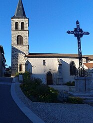
Connangles
Connangles | |
|---|---|
Commune | |
 | |
show Location of Connangles | |
 Connangles | |
| Coordinates: 45°17′59″N 3°38′53″E / 45.2997°N 3.6481°ECoordinates: 45°17′59″N 3°38′53″E / 45.2997°N 3.6481°E | |
| Country | France |
| Region | Auvergne-Rhône-Alpes |
| Department | Haute-Loire |
| Arrondissement | Brioude |
| Canton | Plateau du Haut-Velay granitique |
| Government | |
| • Mayor (2020–2026) | Maryse Pourrat[1] |
| Area 1 | 21.89 km2 (8.45 sq mi) |
| Population (Jan. 2018)[2] | 142 |
| • Density | 6.5/km2 (17/sq mi) |
| Time zone | UTC+01:00 (CET) |
| • Summer (DST) | UTC+02:00 (CEST) |
| INSEE/Postal code | 43076 /43160 |
| Elevation | 873–1,145 m (2,864–3,757 ft) (avg. 950 m or 3,120 ft) |
| 1 French Land Register data, which excludes lakes, ponds, glaciers > 1 km2 (0.386 sq mi or 247 acres) and river estuaries. | |


Connangles is a commune in the Haute-Loire department in south-central France.
Geography[]
The Senouire forms most of the commune's northeastern border, then flows southwest through its southeastern part.
Population[]
|
|
See also[]
References[]
- ^ "Répertoire national des élus: les maires". data.gouv.fr, Plateforme ouverte des données publiques françaises (in French). 2 December 2020.
- ^ "Populations légales 2018". INSEE. 28 December 2020.
| Wikimedia Commons has media related to Connangles. |
This Haute-Loire geographical article is a stub. You can help Wikipedia by . |
Categories:
- Communes of Haute-Loire
- Haute-Loire geography stubs