Lapte
Lapte | |
|---|---|
Commune | |
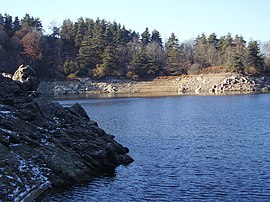 Lac de Lavalette | |
show Location of Lapte | |
 Lapte | |
| Coordinates: 45°11′11″N 4°13′04″E / 45.1864°N 4.2178°ECoordinates: 45°11′11″N 4°13′04″E / 45.1864°N 4.2178°E | |
| Country | France |
| Region | Auvergne-Rhône-Alpes |
| Department | Haute-Loire |
| Arrondissement | Yssingeaux |
| Canton | Yssingeaux |
| Government | |
| • Mayor (2014–2020) | André Defour |
| Area 1 | 30.75 km2 (11.87 sq mi) |
| Population (Jan. 2018)[1] | 1,721 |
| • Density | 56/km2 (140/sq mi) |
| Time zone | UTC+01:00 (CET) |
| • Summer (DST) | UTC+02:00 (CEST) |
| INSEE/Postal code | 43114 /43200 |
| Elevation | 600–914 m (1,969–2,999 ft) (avg. 843 m or 2,766 ft) |
| 1 French Land Register data, which excludes lakes, ponds, glaciers > 1 km2 (0.386 sq mi or 247 acres) and river estuaries. | |


Lapte is a commune in the Haute-Loire department in south-central France, located 23 kilometres southwest of Firminy. Lapte is surrounded by the communes Grazac, Chenereilles and Raucoules.
Geography[]
The municipality of Lapte covers 30.8 square kilometres. It is located at 860 metres above the Lignon du Velay river, where it converges with the . The river Lignon du Velay also flows through the commune.
Population[]
|
|
See also[]
References[]
- ^ "Populations légales 2018". INSEE. 28 December 2020.
| Wikimedia Commons has media related to Lapte. |
This Haute-Loire geographical article is a stub. You can help Wikipedia by . |
Categories:
- Communes of Haute-Loire
- Haute-Loire geography stubs