Conneaut, Ohio
Conneaut, Ohio | |
|---|---|
City | |
 Aerial view of the port at Conneaut | |
 Seal | |
| Motto(s): "Life's Just Better Here!" | |
 Location of Conneaut, Ohio | |
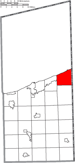 Location of Conneaut in Ashtabula County | |
| Coordinates: 41°56′50″N 80°33′20″W / 41.94722°N 80.55556°WCoordinates: 41°56′50″N 80°33′20″W / 41.94722°N 80.55556°W | |
| Country | United States |
| State | Ohio |
| County | Ashtabula |
| Settled | 1799 |
| Incorporated | 1834 (village) 1902 (city) |
| Area | |
| • Total | 26.50 sq mi (68.64 km2) |
| • Land | 26.44 sq mi (68.47 km2) |
| • Water | 0.07 sq mi (0.17 km2) |
| Elevation | 646 ft (197 m) |
| Population | |
| • Total | 12,841 |
| • Estimate (2021[2]) | 12,613 |
| • Density | 473.97/sq mi (183.00/km2) |
| Time zone | UTC-5 (Eastern (EST)) |
| • Summer (DST) | UTC-4 (EDT) |
| ZIP code | 44030 |
| Area code(s) | 440 Exchanges: 593.599 |
| FIPS code | 39-18350 |
| GNIS feature ID | 1077521[4] |
| Website | www.conneautohio.gov |

Conneaut (/ˈkɒniɔːt/[5] KON-ee-awt) is a city in Ashtabula County, Ohio, United States, along Lake Erie at the mouth of Conneaut Creek 66 miles (106 km) northeast of Cleveland. The population was 12,841 at the 2010 Census. Conneaut is located at the far northeastern corner of the state.
History[]

Conneaut is located on an old Native American trail, later used by early westbound pioneers. The word conneaut comes from the Seneca language, and has a disputed meaning.[6] A Mississauga village was located at or near Conneaut, c. 1747.[7] Conneaut was originally named Salem, and the parts surrounding it were named "Lakeville" from 1944 to 1964, though these were eventually combined into what is now known as "Conneaut". People still refer to parts of Conneaut as Lakeville or Amboy.[8]
Conneaut was described in 1833 as having a printing office, one meeting house, two taverns, and several stores and shops.[9]
On March 27, 1953 a three-train collision near Conneaut resulted in the deaths of 21 persons.[10]
Geography[]
Conneaut is located at 41°57′N 80°34′W / 41.950°N 80.567°W (41.9433, -80.5695).[11] According to the United States Census Bureau, the city has a total area of 26.43 square miles (68.45 km2), of which 26.36 square miles (68.27 km2) is land and 0.07 square miles (0.18 km2) is water.[12] Conneaut is situated along Lake Erie at the mouth of Conneaut Creek.
Conneaut is located in the northeasternmost corner of Ohio, bordering the state of Pennsylvania to the east and has 27 square miles (70 km2) within its corporate city limits, making it the 15th-largest city in Ohio by total land area.
Conneaut is a mixture of urban areas and rural farmland. The city has over seven miles (11 km) of shoreline along Lake Erie, with beaches, boating facilities and a healthy summer tourist trade.
Demographics[]
| Historical population | |||
|---|---|---|---|
| Census | Pop. | %± | |
| 1840 | 2,642 | — | |
| 1850 | 818 | −69.0% | |
| 1860 | 1,952 | 138.6% | |
| 1870 | 1,163 | −40.4% | |
| 1880 | 1,256 | 8.0% | |
| 1890 | 3,241 | 158.0% | |
| 1900 | 7,133 | 120.1% | |
| 1910 | 8,319 | 16.6% | |
| 1920 | 9,343 | 12.3% | |
| 1930 | 9,691 | 3.7% | |
| 1940 | 9,355 | −3.5% | |
| 1950 | 10,230 | 9.4% | |
| 1960 | 10,567 | 3.3% | |
| 1970 | 14,552 | 37.7% | |
| 1980 | 13,839 | −4.9% | |
| 1990 | 13,241 | −4.3% | |
| 2000 | 12,485 | −5.7% | |
| 2010 | 12,841 | 2.9% | |
| 2019 (est.) | 12,530 | [13] | −2.4% |
| U.S. Decennial Census[14] 2018 Estimate[15] | |||
2010 census[]
As of the census[3] of 2010, there were 12,841 people, 4,740 households, and 3,034 families living in the city. The population density was 487.1 inhabitants per square mile (188.1/km2). There were 5,702 housing units at an average density of 216.3 per square mile (83.5/km2). The racial makeup of the city was 89.8% White, 7.5% African American, 0.2% Native American, 0.4% Asian, 0.4% from other races, and 1.8% from two or more races. Hispanic or Latino of any race were 1.8% of the population.
There were 4,740 households, of which 29.2% had children under the age of 18 living with them, 44.2% were married couples living together, 14.2% had a female householder with no husband present, 5.7% had a male householder with no wife present, and 36.0% were non-families. 30.3% of all households were made up of individuals, and 14% had someone living alone who was 65 years of age or older. The average household size was 2.37 and the average family size was 2.90.
The median age in the city was 39.6 years. 20.2% of residents were under the age of 18; 9.2% were between the ages of 18 and 24; 28.2% were from 25 to 44; 26.5% were from 45 to 64; and 15.7% were 65 years of age or older. The gender makeup of the city was 54.4% male and 45.6% female.
2000 census[]
As of the census of 2000, there were 12,485 people, 5,038 households, and 3,410 families living in the city. The population density was 473.4 people per square mile (182.8/km2). There were 5,710 housing units at an average density of 216.5 per square mile (83.6/km2). The racial makeup of the city was 96.33% White, 1.12% African American, 0.18% Native American, 0.47% Asian, 0.05% Pacific Islander, 0.23% from other races, and 1.61% from two or more races. Hispanic or Latino of any race were 1.06% of the population. 19.7% were of German, 16.0% Italian, 13.7% English, 12.0% Irish, 6.2% American and 6.2% Finnish ancestry according to Census 2000. There were 5,038 households, out of which 30.4% had children under the age of 18 living with them, 52.3% were married couples living together, 11.4% had a female householder with no husband present, and 32.3% were non-families. 27.9% of all households were made up of individuals, and 13.5% had someone living alone who was 65 years of age or older. The average household size was 2.45 and the average family size was 2.98.
In the city the population was spread out, with 25.2% under the age of 18, 7.7% from 18 to 24, 27.5% from 25 to 44, 22.4% from 45 to 64, and 17.2% who were 65 years of age or older. The median age was 38 years. For every 100 females, there were 94.2 males. For every 100 females age 18 and over, there were 89.4 males.
The median income for a household in the city was $31,717, and the median income for a family was $37,955. Males had a median income of $31,964 versus $21,198 for females. The per capita income for the city was $14,703. About 10.7% of families and 13.0% of the population were below the poverty line, including 20.3% of those under age 18 and 9.1% of those age 65 or over.
Economy[]
Major industries within the city include CSP of Ohio (formerly Venture Industries), General Aluminum (automotive parts), and CW Ohio (windows and pillars). The city's historic business district and its harbor business district are not as thriving as in the past. A few of the main businesses that anchor the downtown are Gerdes Pharmacy and Orlando Brothers grocery store. From 1944 until 2000, the Astatic Corporation was a major manufacturer of microphones. Astatic merged CAD (Conneaut Audio Devices) in 2000 which continues to produce microphones.[16][circular reference] Conneaut is also home to the Lake Erie Correctional Institution, which has a total staff of 295 employees as of February 2020.[17] The port of Conneaut, Ohio is the loading point for train cars bearing iron ore for Pittsburgh area steel mills, including the Edgar Thomson Works.
Government[]
The city has been operated under a council-manager government since 1992.[citation needed]
Transportation[]
Transportation services Conneaut via Interstate 90, which bisects the city, along with an international shipping port and three railroads. U.S Route 20 also bisects Conneaut. Ohio State Route 7 has its northern terminus on Conneaut where it intersects with State Route 531.
Notable people[]
- Laura Boulton, eminent ethnologist, anthropologist and film-maker
- Mary L. Doe, first president of Michigan State Equal Suffrage Association
- Mildred Gillars, American radio personality (Axis Sally) during World War II, best known for her propaganda broadcasts for Nazi Germany
- Osee M. Hall, U.S. House Representative from Minnesota
- Joseph Russell Jones, appointed by Ulysses S. Grant as Minister Resident to Belgium
- Larry Kelley, football player for Yale University, second winner of Heisman Trophy
- Jean Lovell, All-American Girls Professional Baseball League player
- John P. McGoorty, Illinois judge and staterepresentative
- Mike Palagyi, MLB pitcher for Washington Senators
- John R. Pillion, Republican member of U.S. House of Representatives from New York
- George Morton Randall, United States Army general
- Mason A. Thayer, Republican member of Wisconsin State Assembly
- Doug Tompkins, co-founder of North Face and Esprit
Gallery[]
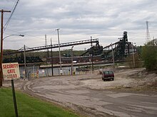
Industry related to the shipping of ores

Conneaut lighthouse

A modern-day playground.


References[]
- ^ "2019 U.S. Gazetteer Files". United States Census Bureau. Retrieved July 27, 2020.
- ^ "Explore Census Data". data.census.gov. Retrieved 2021-07-20.
- ^ Jump up to: a b "U.S. Census website". United States Census Bureau. Retrieved 2013-01-06.
- ^ Jump up to: a b "US Board on Geographic Names". United States Geological Survey. 2007-10-25. Retrieved 2008-01-31.
- ^ "A Pronunciation Guide to places in Ohio -- E.W.Scripps School of". scrippsjschool.org. Archived from the original on 25 July 2017. Retrieved 15 April 2018.
- ^ Overman, William Daniel (1958). Ohio Town Names. Akron, OH: Atlantic Press. p. 33.
- ^ Tanner, Helen Hornbeck; Adele Hast; Jacqueline Peterson; Robert J. Surtees; Miklos Pinther (1987). Atlas of Great Lakes Indian History. University of Oklahoma Press. p. 75. ISBN 0-8061-2056-8.
- ^ "What's With the Name!". Ohio Amish Country Marketing LLC. Retrieved 30 March 2016.
- ^ Kilbourn, John (1833). The Ohio Gazetteer, or, a Topographical Dictionary. Scott and Wright. pp. 160. Retrieved 12 December 2013.
- ^ Borsvold, David (2003). Railroading in Conneaut, Ohio. Arcadia Publishing. p. 39. ISBN 9780738523460. Retrieved 1 December 2013.
- ^ "US Gazetteer files: 2010, 2000, and 1990". United States Census Bureau. 2011-02-12. Retrieved 2011-04-23.
- ^ "US Gazetteer files 2010". United States Census Bureau. Archived from the original on 2012-01-24. Retrieved 2013-01-06.
- ^ "Population and Housing Unit Estimates". Retrieved May 21, 2020.
- ^ United States Census Bureau. "Census of Population and Housing". Retrieved November 21, 2013.
- ^ "Population Estimates". United States Census Bureau. Retrieved January 23, 2020.
- ^ Astatic Corporation
- ^ "Lake Erie Correctional (Alpha Version: 9.3.2.1024)". drc.ohio.gov. Retrieved 2020-02-09.
Further reading[]
- Ashtabula County Genealogical Society. 1985. Ashtabula County history, then and now : a history of the people of the county. Dallas: Taylor Publishing.
- Biographical history of northeastern Ohio : embracing the counties of Ashtabula, Geauga and Lake. 1893. Chicago: Lewis Publishing.
- Borsvald, David. 2003. Railroading in Conneaut, Ohio. Images of Rail. Chicago: Arcadia Publishing. (ISBN 978-0738523460)
- Clark, Rev. Rufus. 1880. Early History of South Ridge. Published in the Conneaut Reporter starting c. 22 January 1880; Reprint, 1985, Ashtabula County Genealogical Society.
- Large, Moina M. 1924. History of Ashtabula County, Ohio. 2 vols. Indianapolis, IN: Historical Publishing Co.
- Owens, David B. 2010. Conneaut. Images of America. Charleston, SC: Arcadia Publishing. (ISBN 978-0738577319)
- Williams, William W. 1878. History of Ashtabula County, Ohio, with illustration and biographical sketches of its pioneers and most prominent men. Philadelphia: J.B. Lippincott. (Reprint, 1974, Ashtabula Genealogical Society; 1993, Higginson Book Company)
External links[]
| Wikimedia Commons has media related to Conneaut, Ohio. |
- City of Conneaut
- . New International Encyclopedia. 1905.
- . Collier's New Encyclopedia. 1921.
| show Municipalities and communities of Ashtabula County, Ohio, United States |
|---|


| show Authority control |
|---|
- Cities in Ashtabula County, Ohio
- Inland port cities and towns in Ohio
- Ohio populated places on Lake Erie
- 1799 establishments in the Northwest Territory
- Cities in Ohio