Connecticut Route 15
 | ||||
|---|---|---|---|---|
 | ||||
| Route information | ||||
| Maintained by CTDOT | ||||
| Length | 83.53 mi[1] (134.43 km) | |||
| Existed | 1932[2] (relocated 1948)–present | |||
| Restrictions | No commercial vehicles, trailers, towed vehicles, buses, or hearses on Merritt and Wilbur Cross Parkways[3] | |||
| Major junctions | ||||
| South end | ||||
| North end | ||||
| Location | ||||
| Counties | Fairfield, New Haven, Hartford | |||
| Highway system | ||||
| ||||
Route 15 is a state highway in the U.S. state of Connecticut that runs 83.53 miles (134.43 km) from a connection with New York's Hutchinson River Parkway in Greenwich, Connecticut to its northern terminus intersecting with Interstate 84 (I-84) in East Hartford, Connecticut. Route 15 consists of four distinct sections: the Merritt Parkway, the Wilbur Cross Parkway, the Berlin Turnpike, and part of the Wilbur Cross Highway. The unified designation was applied to these separate highways in 1948 to provide a continuous through route from New York to Massachusetts.
Route description[]
Merritt Parkway[]
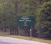
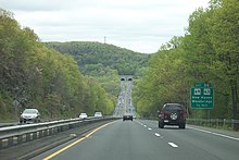
Route 15 begins at the New York border, where the Hutchinson River Parkway continues southwest towards New York City, at the New York State Route 120A interchange in the village of Rye Brook, in the town of Rye, New York. The highway comes into the state of Connecticut, continuing as the Merritt Parkway, a four lane limited-access parkway with low bridges, sharp curves, and a tree-filled median, that passes through the affluent urbanized areas of southern Fairfield County. Commercial vehicles are prohibited on this section of Route 15. The parkway heads into the town of Greenwich, where it passes a service plaza in both directions and curves north-northwest, before heading northeast and meeting interchanges at Round Hill Road, providing access to Downtown Greenwich, and at Lake Avenue. From there, Route 15 turns northeast, and reverse turns through its interchange with North Street, which provides another outlet into Downtown Greenwich. Past this interchange, the parkway enters the city of Stamford, where it crosses over the Mianus River within the Mianus River State Park, before reaching an interchange with Route 104 in the residential areas of North Stamford, providing access to Downtown Stamford and the University of Connecticut Stamford Campus. Route 15 continues to an interchange with Route 137 before the route leaves Stamford.[4]
The parkway comes into the town of New Canaan, where it crosses the Noroton River within its interchange with Route 106, adjacent to the Talmadge Hill station on the New Canaan Branch of the Metro-North Railroad's New Haven Line, located to the southeast of the interchange. Afterwards, Route 15 passes under the New Canaan Branch and curves around to meet an interchange for Route 124 before reaching the New Canaan Service Plaza. After crossing the Fivemile River, the parkway enters the city of Norwalk and immediately comes to an interchange with Route 123, which provides access to the Norwalk Community College. Just past its crossing of the Silvermine River, Route 15 meets the U.S. Route 7 (US 7) freeway at an incomplete interchange before it crosses over the Danbury Branch of the New Haven Line just south of the Merritt 7 station, and the Norwalk River and comes to a cloverleaf interchange with Main Avenue which provides the missing movements between the parkway and US 7. From there, Route 15 continues northeast through residential areas in the neighborhood of Cranbury before it leaves Norwalk, after crossing over Route 53 without an interchange.[4]

The parkway enters the town of Westport, where it crosses over the Saugatuck River, and comes to right-in/right-out interchanges with Route 33, just east of the town line. Route 15 turns to the northeast again, upon reaching its interchange with Route 57, that has a park and ride lot serving the town of Westport in its northwest corner. Immediately after this interchange, the parkway crosses over Route 136 with no access and enters its longest stretch without exits, where it passes more wooded residential areas and comes into the town of Fairfield, where it meets its next interchange, five and a half miles later, at Route 58, which also has a park and ride lot, located in its southeastern corner. Route 58 provides access to both Fairfield Center and the campus of Fairfield University. Route 15 crosses the Mill River, passes service plazas in both directions, and then meets Route 59 at a pair of right-in/right-out interchanges. Route 59 provides access to the headquarters of General Electric. The parkway turns east-northeast and enters the town of Trumbull at its interchange with Park Avenue, which provides access to the campus of Sacred Heart University just to the southwest of the road, as well as the campus of the University of Bridgeport in the adjacent city of Bridgeport. Route 15 then reaches a single-point urban interchange with Route 111, adjacent to the Westfield Trumbull shopping mall, in its southwestern corner. The parkway meets the Route 25 freeway at an incomplete turbine interchange, which provides access to the Beardsley Zoo in Bridgeport, and the route crosses the Pequonnock River within the interchange. Past Route 25, Route 15 reaches a southbound exit and northbound entrance for Route 127 and then a full interchange for Route 108, in tandem with stack interchange with the Route 8 freeway.[4]
Route 15 comes into the town of Stratford through more wooded suburban areas, and reaches an interchange with Route 110 at the northeastern edge of town. Past this interchange, the parkway runs due east to cross the Igor Sikorsky Memorial Bridge over the Housatonic River where it leaves both Stratford and Fairfield County. Route 15 enters both Milford and New Haven County, coming to a modified trumpet interchange with the Milford Parkway which provides access to both the I-95 freeway and US 1, north of Downtown Milford. At this point, the Merritt Parkway ends and Route 15 turns northeast again through the wooded residential areas of southwestern New Haven County.[4]
Wilbur Cross Parkway[]
The next component of Route 15, the Wilbur Cross Parkway, begins at the Milford Parkway junction. The Wilbur Cross Parkway follows the same general configuration and landscape as the Merritt Parkway, continues with the Merritt Parkway's exit numbers, and excludes commercial vehicles from its use, too. A few miles after the Milford Parkway, Route 15 comes into the town of Orange, where it passes a bi-directional service plaza, and meets Route 121 at a pair of right-in/right-out ramps, which provides access to the Orange campus of the University of New Haven. Now running north-northeast, Route 15 continues to a cloverleaf interchange with Route 34 which provides access eastbound to the Yale Bowl, in the city of New Haven. The parkway crosses the Wepawaug River, where it turns northeast and enters the town of Woodbridge, passing under Route 114 without access. Route 15 again crosses a boundary and comes into New Haven, where it meets an interchange with Route 69/Route 63 that provides access to the campus of Southern Connecticut State University, in the neighborhood of Amity, crossing the West River within the interchange.[4]
From here, the parkway briefly crosses back through the southeastern corner of Woodbridge, before coming back into New Haven, and entering Heroes Tunnel which passes under West Rock Ridge. Immediately after exiting the tunnel, Route 15 comes into the town of Hamden, where it heads into a mix of residential and commercial areas around its interchange with Route 10, that also provides access to the Paier College of Art. The parkway then enters the town of North Haven, where it crosses the Mill River and passes under the Route 40 freeway as the only freeway crosspath[check spelling] in the state without an interchange, over East Rock. A short distance later, the parkway meets an interchange with Route 22 and continues northeast to the last pair of service plazas on the route. Past the plazas, Route 15 turns north-northeast along the western edge of the Quinnipiac River State Park, where the route enters the town of Wallingford. In Wallingford, the parkway has exits to Quinnipiac Street providing access to Gaylord Specialty Healthcare and the Wallingford station on Amtrak and ConnDOT's Hartford Line, as well as Route 150 that provides access to the Masonicare Health Center. Route 15 crosses the Quinnipiac River and turns northeast, where it comes to an interchange for US 5, where it also crosses the Hartford Line.[4]
Route 15 continues northeast into the city of Meriden and passes entrances to the ConnDOT maintenance facilities. The parkway continues a short distance before reaching an interchange complex on the east side of town. First, Route 15 crosses over the I-91 freeway, where it turns north to reach a southbound exit and northbound entrance, before meeting East Main Street, which provides access to the Wesleyan University campus, where the Interstate Highway begins to run inside the median. The parkway widens to six lanes through here, then reaches the next exits for northbound I-91 with a northbound exit and southbound entrance, as well as a northbound exit and southbound entrance to and from the westbound direction of the I-691 freeway, where there is also access from westbound I-691 to the northbound Wilbur Cross Parkway. Past I-691, Route 15 narrows back to four lanes, and turns north-northwest before heading north-northeast again, where the Wilbur Cross Parkway ends and northbound US 5 merges with northbound Route 15 to head toward the suburban areas of Greater Hartford.[4]
Berlin Turnpike[]

Route 15 continues onto a four-lane divided surface highway concurrent with US 5, known as the Berlin Turnpike, running between Silver Lake to the west and Lamentation Mountain to the east. Here, it passes along a commercial strip before passing areas of residence. The highway enters the town of Berlin and Hartford County, and briefly forms the western edge of Lamentation Mountain State Park, before heading back into commercial areas. An old alignment of the Berlin Turnpike, splits to the west, while US 5/Route 15 reverse curve to their interchange with the Route 9 freeway and Route 372, in which all access besides the ramps from US 5/Route 15 to southbound Route 9 and from southbound Route 9 to US 5/Route 15 is made via Route 372. North of Route 9, the old alignment of the Berlin Turnpike rejoins the new road briefly, before splitting again, this time to the east. The highway crosses the Mattabesset River before intersecting the western terminus of Route 160. US 5/Route 15 passes rows of shopping centers, as it comes into the town of Newington, intersecting the southern terminus of Route 173, which heads north towards the town of West Hartford. The highway continues to its junction with the southern terminus of Route 176, which heads north towards the center of Newington. A park and ride lot is located in the northeastern corner of this intersection, with Griswoldville Avenue. From here, US 5/Route 15 passes the ConnDOT headquarters on the east, prior to reaching the intersections with Route 287. The highway leaves Newington at its interchange with Route 175, which heads west towards the center of town and east towards the town of Wethersfield.[4]
After the Route 175 interchange, US 5/Route 15 enters Wethersfield and passes more commercial areas before reaching the partial interchange with Route 314. The Berlin Turnpike splits and continues north-northeast along Route 314, narrowing to a two-lane undivided road, until it reaches the Hartford city line, continuing into that city as Maple Avenue. US 5/Route 15 exits onto a four-lane freeway that heads northeast towards I-91 as a limited-access outlet into Hartford.[4]
Wilbur Cross Highway[]
Past Route 314, US 5/Route 15 continue onto the Wilbur Cross Highway, a four-lane freeway with a jersey barrier in the middle. The highway passes through wooded urbanized areas, to the southeast of the Connecticut Department of Labor headquarters, before it comes to an interchange with the northern terminus of Route 99, in which the overpass that carries the two routes over that route and the Providence and Worcester Railroad's Connecticut Valley Railroad line is called the . Next, US 5/Route 15 comes into Hartford, turns north-northeast at an interchange with I-91, where there are ramps from northbound and southbound US 5/Route 15 to southbound I-91, and from northbound I-91 to northbound I-91 to southbound US 5/Route 15. The next interchange at Brainard Road/Airport Road with access to Hartford-Brainard Airport, has no southbound exit. The highway continues through industrial areas and comes exits from the southbound Wilbur Cross Highway to Southbound I-91, as well as an exit from the northbound Wilbur Cross Highway and northbound I-91 that also provides access to westbound I-84.[4]

From here, US 5/Route 15 cross over the Connecticut River on the Charter Oak Bridge, where the routes enter the town of East Hartford. On the other side of the bridge, there is an interchange serving Route 2, where northbound US 5 splits and exits Route 15 onto Main Street, which runs north through the center of East Hartford. Route 15 reverse curves to a northbound exit and southbound entrance with Silver Lane, before the highway reaches its northern terminus and merges onto eastbound I-84 and US 6. A dedicated connection also exists between Route 15 and I-84/US 6's high-occupancy vehicle lanes. The Wilbur Cross Highway continues northeast along I-84 towards Interstate 90/Massachusetts Turnpike in Sturbridge, Massachusetts.[4][5][3]
History[]
The Route 15 designation was created as part of the 1932 state highway renumbering and originally ran from New Haven through Middletown, East Hartford and Stafford Springs to the Massachusetts state line in Union.[2] The original route used the pre-expressway alignment of modern Route 17 to Glastonbury, Main Street to East Hartford center, U.S. Route 5 to the junction with Route 30, then modern Route 30 to Stafford, then modern Route 190 to Union, and modern Route 171 to the Massachusetts state line.[6]
In 1943, a newly constructed two-lane highway (now the Wilbur Cross Highway) between Tolland and Union was opened to traffic. Route 15 was relocated on this new highway and the former Route 15 between Route 74 and Route 190 (then part of Route 20) was redesignated as Route 30. By 1948, the rest of the old two-lane Wilbur Cross Highway to East Hartford had also opened, connecting to the Charter Oak Bridge and the Hartford Bypass. In 1948, the State Highway Department decided to relocate Route 15 to a series of roadways, namely the Merritt Parkway, Wilbur Cross Parkway, Berlin Turnpike, Hartford Bypass, Charter Oak Bridge, and the new Wilbur Cross Highway, creating a modern, high-speed throughway from the New York state line to the Massachusetts state line. The Route 15 designation was applied to the previously unnumbered parkways from Greenwich to Meriden, then overlaid with U.S. Route 5 through East Hartford, then designated on the southern half of the Wilbur Cross Highway to Tolland, connecting with the portion previously designated as Route 15 five years before. The former Route 15 between South Windsor and Tolland was reassigned as an extension of Route 30, and the former Route 15 between New Haven and Glastonbury became redesignated as Route 17.[6][7]
In 1948, a portion of the Wilbur Cross Parkway between Route 34 and Whitney Avenue had still been under construction. Route 15 was temporarily routed along Route 34, Sherman Avenue (former Routes 5 and 10), Henry Street/Munson Street/Hillside Place/Edwards Street (former Route 5), and Whitney Avenue (former Route 10A). By 1949, the Wilbur Cross Parkway was completed and the temporary Route 15 designation was removed from the surface streets. Further improvements in the Wilbur Cross Highway took place over the next several years and the road became a four-lane divided highway by 1954. In 1968, most of the Wilbur Cross Highway was designated as I-86 and further upgrades to the road were implemented. Route 15 and I-86 overlapped from the current 15/84 junction in East Hartford to the Massachusetts state line. In 1984, the overlap was removed, truncating Route 15 to its current northern end, while at the same time I-86 was redesignated as I-84.[7]
Exit list[]
| County | Location | mi[1] | km | Exit | Destinations | Notes |
|---|---|---|---|---|---|---|
| Fairfield | Greenwich | 0.00 | 0.00 | – | Continuation into New York; exit numbers continue south along Hutchinson Parkway | |
| 0.05 | 0.080 | 27 future 19B | Access to NY 120A south via Hutchinson Parkway exit 19A | |||
| 3.39 | 5.46 | 28 | Round Hill Road | To Greenwich Business District | ||
| 4.16 | 6.69 | 29 | Lake Avenue | |||
| Butternut Hollow Road | At-grade intersection; intersection closed 1955[8] | |||||
| 5.71 | 9.19 | 31 | North Street | To Greenwich Business District | ||
| Stamford | 8.89 | 14.31 | 33 | Den Road | Right-in/right-out interchange | |
| 9.22 | 14.84 | 34 | To Downtown Stamford and University of Connecticut Stamford Campus | |||
| 10.40 | 16.74 | 35 | ||||
| New Canaan | 13.15 | 21.16 | 36 | |||
| 13.89– 14.10 | 22.35– 22.69 | 37 | ||||
| Norwalk | 16.01 | 25.77 | 38 | To Norwalk Community College | ||
| 16.87– 17.31 | 27.15– 27.86 | 39 | Northbound exit and southbound entrance; signed as exits 39A (south) and 39B (north); redesign in proposal stage[9] | |||
| 17.53– 17.63 | 28.21– 28.37 | 40 | Signed as exits 40A (south) and 40B (north); no northbound signage for US 7 | |||
| Westport | 20.73 | 33.36 | 41 | |||
| 21.59 | 34.75 | 42 | ||||
| Fairfield | 26.95 | 43.37 | 44 | To Fairfield Business District and Fairfield University | ||
| 28.58 | 46.00 | 46 | To General Electric Headquarters | |||
| Trumbull | 29.31 | 47.17 | 47 | Park Avenue | To University of Bridgeport and Sacred Heart University | |
| 30.37 | 48.88 | 48 | Single-point urban interchange | |||
| 31.64 | 50.92 | 49S | No southbound exit; exit 7A on (Route 25) northbound | |||
| 32.69 | 52.61 | 49N | Signed as exit 49 southbound; exit 8A and B on (Route 25) southbound | |||
| 32.99 | 53.09 | 50 | Southbound exit and northbound entrance | |||
| 33.51 | 53.93 | 51 | Northbound exit and southbound entrance | |||
| 33.77– 34.57 | 54.35– 55.64 | 52 | No northbound exit to Route 8 southbound; signed as exit 9 northbound and 10 southbound on Route 8 | |||
| Stratford | 36.54 | 58.81 | 53 | |||
| Housatonic River | 37.53 | 60.40 | Igor I. Sikorsky Memorial Bridge | |||
| New Haven | Milford | 37.67 | 60.62 | 54 | Access via Milford Parkway | |
| Transition between Merritt and Wilbur Cross Parkways | ||||||
| 38.14– 38.66 | 61.38– 62.22 | 55A | Wheelers Farms Road | Signed as exit 55 southbound | ||
| 55B | Wolf Harbor Road | Northbound exit only | ||||
| Orange | 41.32 | 66.50 | 56 | |||
| 42.69– 43.00 | 68.70– 69.20 | 57-58 | Cloverleaf interchange; signed as exits 57 (east) and 58 (west) | |||
| New Haven | 46.57– 46.70 | 74.95– 75.16 | 59 | |||
| Woodbridge | 47.20– 47.43 | 75.96– 76.33 | Heroes Tunnel (formerly West Rock Tunnel) | |||
| Hamden | 50.00 | 80.47 | 60 | No northbound signage for New Haven | ||
| 51.72 | 83.24 | 61 | Whitney Avenue – Hamden, New Haven | Signed for Hamden exit 61 northbound and 62 southbound, New Haven exit 61 southbound | ||
| 51.82– 52.15 | 83.40– 83.93 | 62 | Dixwell Avenue | Northbound exit and entrance | ||
| North Haven | 53.45 | 86.02 | 63 | |||
| Wallingford | 58.17 | 93.62 | 64 | Wallingford | Access via South Turnpike Road / Quinnipiac Street | |
| 58.55 | 94.23 | 65 | ||||
| 61.12– 61.26 | 98.36– 98.59 | 66 | ||||
| Meriden | 63.02 | 101.42 | – | ConnDOT Maintenance Facility | Also serves Miller Avenue | |
| 64.05 | 103.08 | 67S | Southbound exit and northbound entrance; exit 17 on (I-91) north; commercial vehicles must exit here | |||
| 64.33 | 103.53 | 67W | East Main Street | Signed as exit 67 northbound | ||
| 64.63 | 104.01 | 68N-E | Northbound exit and southbound entrance, signed as exits 68N (I-91) north and 68E (Route 66) east | |||
| 64.95 | 104.53 | 68W | No southbound exit; exits 9-10 on I-691 | |||
| 66.89 | 107.65 | Transition between Wilbur Cross Parkway and Berlin Turnpike | ||||
| – | Southern terminus of US 5 concurrency; southbound exit and northbound entrance | |||||
| Hartford | Berlin | 71.38 | 114.87 | Interchange; exits 21-22 on Route 9 | ||
| 71.63 | 115.28 | Interchange; southbound access via Worthington Ridge Road (SR 572) | ||||
| 72.76 | 117.10 | Western terminus of Route 160 | ||||
| Newington | 74.26 | 119.51 | Southern terminus of Route 173 | |||
| 74.88 | 120.51 | Southern terminus of Route 176 | ||||
| 76.27 | 122.74 | Western terminus of Route 287 concurrency | ||||
| 76.34 | 122.86 | Eastern terminus of Route 287 concurrency | ||||
| Wethersfield | 76.87 | 123.71 | Interchange | |||
| 77.89 | 125.35 | Northbound exit and southbound entrance | ||||
| Route transition between Berlin Turnpike and Wilbur Cross Highway | ||||||
| 79.65 | 128.18 | 85 | ||||
| Hartford | 80.05– 80.22 | 128.83– 129.10 | 86 | Exits 28-29 on I-91 | ||
| 80.50 | 129.55 | 87 | I-91 not signed northbound; exit 27 on I-91 | |||
| 81.31 | 130.86 | 89 | Northbound exit and southbound entrance; exit 28 on I-91 | |||
| Connecticut River | 81.90 | 131.81 | Charter Oak Bridge | |||
| East Hartford | 81.95 | 131.89 | 90 | Northern terminus of US 5 concurrency; no southbound signage for Route 2 | ||
| 82.74 | 133.16 | 91 | Silver Lane (SR 502) | Northbound exit and southbound entrance | ||
| 83.53 | 134.43 | – | Exit 57 on I-84 west; Wilbur Cross Highway continues east | |||
1.000 mi = 1.609 km; 1.000 km = 0.621 mi
| ||||||
References[]
- ^ Jump up to: a b State of Connecticut Department of Transportation (2012). "2012 Traffic Volumes, State Maintained Highway Network" (PDF). Retrieved January 27, 2020.
- ^ Jump up to: a b "Road Conditions in Connecticut". The Hartford Daily Courant. May 27, 1932. p. 14. Retrieved December 24, 2019 – via Newspapers.com.

- ^ Jump up to: a b Connecticut Department of Motor Vehicles: Registering a Pick-up Truck with Passenger Plates (archived from original article)
- ^ Jump up to: a b c d e f g h i j k Google (April 19, 2020). "overview of Connecticut Route 15" (Map). Google Maps. Google. Retrieved April 19, 2020.
- ^ "Connecticut State Highway Log (2006)" (PDF). Archived from the original (PDF) on September 27, 2011. Retrieved May 8, 2008.
- ^ Jump up to: a b kurumi.com - Route 15
- ^ Jump up to: a b Larry Larned, "Route 15: The Road to Hartford", (Arcadia Publishing, 2002)
- ^ "Crossover to be Closed". The Daily Item. Port Chester, New York. November 16, 1955. p. 6. Retrieved May 9, 2021 – via Newspapers.com.
- ^ "Route 7/15 Norwalk Project". Archived from the original on March 28, 2019. Retrieved May 22, 2019.
External links[]
| Wikimedia Commons has media related to Connecticut Route 15. |
Route map:

| ( • help)
|
| Authority control |
|
|---|
- State highways in Connecticut
- Transportation in Fairfield County, Connecticut
- Transportation in New Haven County, Connecticut
- Transportation in Hartford County, Connecticut
- U.S. Route 5