Massachusetts Turnpike
  | ||||
|---|---|---|---|---|
| Interstate 90 | ||||
Massachusetts Turnpike highlighted in green | ||||
| Route information | ||||
| Length | 138.1 mi[1] (222.3 km) | |||
| Existed | 1957–present | |||
| Restrictions | No hazardous goods and cargo tankers east of exit 131[2] | |||
| Major junctions | ||||
| West end |
| |||
| East end | ||||
| Location | ||||
| Counties | Berkshire, Hampden, Worcester, Middlesex, Suffolk, Norfolk | |||
| Highway system | ||||
| ||||

The Massachusetts Turnpike (colloquially "Mass Pike" or "the Pike"[3]) is a toll highway in the U.S. state of Massachusetts that is maintained by the Massachusetts Department of Transportation (MassDOT). The turnpike begins at the New York state line in West Stockbridge, linking with the Berkshire Connector portion of the New York State Thruway. Spanning 138 miles (222 km) along an east–west axis, it is entirely concurrent with the portion of Interstate 90 (I-90) that lies within the state. The turnpike is the longest Interstate Highway in Massachusetts, while I-90 in full (which begins nationally in Seattle, Washington) is the longest Interstate Highway in the United States.
The turnpike opened in 1957, and it was designated as part of the Interstate Highway System in 1959. The original western terminus of the turnpike was located at Route 102 in West Stockbridge before I-90 had been completed in New York state. The turnpike intersects with several Interstate Highways as it traverses the state, including I-91 in West Springfield; I-291 in Chicopee; I-84 in Sturbridge; the junction of I-290 and I-395 in Auburn; and I-495 in Hopkinton. The eastern terminus of the turnpike was originally at I-95 in Weston, it has been extended several times: to Allston in 1964, to the Central Artery (designated as I-93, US 1, and Route 3) in Downtown Boston in 1965, and to East Boston in 2003 as part of the "Big Dig" megaproject. There are two auxiliary Interstate Highways in Massachusetts for I-90, those being I-190 and I-290.
The turnpike was maintained by the Massachusetts Turnpike Authority until the department was replaced by the Highway Division of MassDOT in 2009. The implementation and removal of tolls in some stretches of the turnpike have been controversial; travel between most, but not all, exits requires payment. The Fast Lane electronic toll collection system was introduced alongside cash payment in 1998; it was later folded into the E-ZPass branding in 2012. The original toll booths were demolished and replaced by toll gantries with the transition to open road tolling in 2016, which replaced cash payment with "pay-by-plate" billing.
Route description[]
The Massachusetts Turnpike is informally divided into two sections by MassDOT: the original 123-mile (198 km) "Western Turnpike" extending from the New York state border through the interchange with I-95 and Route 128 at exit 123 in Weston, and the 15-mile (24 km) "Boston Extension" that continues beyond exit 123 through Boston.[4] It is a four-lane highway from the New York state border through its interchange with I-84 at exit 78 in Sturbridge; it expands to six lanes beyond this interchange, and briefly travels with eight lanes from exit 127 in Newton through exit 133 by the Prudential Center in Boston.[4] The .75-mile (1.21 km) underwater section of the Ted Williams Tunnel, which carries the turnpike under Boston Harbor to its eastern terminus at Route 1A by Logan International Airport, reduces to four lanes.[5] The turnpike is the longest Interstate Highway in Massachusetts,[6] while I-90 in full (which begins nationally in Seattle, Washington) is the longest Interstate Highway in the United States.[7]
Western Turnpike[]


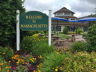
In the west, the turnpike begins in Berkshire County at the Massachusetts state line in West Stockbridge, where I-90 (routed through the Berkshire Connector portion of the New York State Thruway) enters from Canaan, New York.[8] Most toll plazas were located on the entrance/exit ramps before entering the turnpike itself. An exception was the mainline West Stockbridge toll plaza, designed for toll collection from inbound traffic from New York; it existed shortly after exit 3, an eastbound-only entrance and westbound-only exit in Massachusetts.[9] The turnpike crosses the Williams River later in West Stockbridge, and passes over the Housatonic River in Lee.[10] The 30-mile (48 km) gap between exit 10 to US 20 in Lee and exit 41 to US 202 and Route 10 in Westfield (the first in Hampden County) is the longest gap between exits on the turnpike,[11] and the seventh-longest gap between exits in the entire Interstate Highway System.[12] The highest elevation on the turnpike exists in The Berkshires, reaching 1,724 feet (525 m) above sea level in Becket; this point is also the highest elevation on I-90 east of South Dakota.[13] Beyond the peak elevation and between the exits, an eastbound runaway truck ramp exists in Russell.[14]
The turnpike has an interchange with I-91 and US 5 at exit 45 in West Springfield;[9] it passes over the Connecticut River before reaching Route 33 at exit 49 and I-291 at exit 51, both in Chicopee. The turnpike passes through Ludlow at exit 54 before crossing the Quaboag River to exit 63 in Palmer.[9][10] The turnpike first exits into Worcester County in Sturbridge, where exit 78 is the eastern terminus of I-84.[15] In Auburn, exit 90 deposits traffic into the route transition of I-395 traveling southbound and I-290 traveling eastbound.[15] The Blackstone River flows underneath the turnpike in Millbury,[10] where it has an interchange with Route 146 and a second direct connection to US 20 at exit 94.[9] Entering Middlesex County in Hopkinton, it intersects with I-495 at exit 106.[9] The turnpike crosses the Sudbury River between exit 111 at Route 9 and exit 117 at Route 30, all located within Framingham.[10][9] The last connection with another Interstate Highway on the Western Turnpike is located in Weston, at the I-95 and Route 128 concurrency.[9] This multi-piece interchange is collectively referred to as the "Weston tolls".[16] Before being renumbered exit 123 in both directions, exit 14 was an eastbound exit and westbound entrance, and exit 15 was a westbound exit and eastbound entrance; prior to demolition, a mainline toll plaza existed for through traffic.[9] Following the removal of the toll plazas, exit 15 was reconfigured into exit 15A (now exit 123A) for I-95 and Route 128, and exit 15B (now exit 123B) towards Route 30.[17] At this junction, the turnpike crosses over the Charles River.[10]
Boston Extension[]

The first exit of the Boston Extension, exit 125 is an eastbound entrance and westbound exit at Route 16 in Newton.[18] The turnpike enters Suffolk County in Boston before reaching the "Allston–Brighton tolls", depositing traffic towards the Boston neighborhoods of Allston and Brighton, and the nearby city of Cambridge.[4] Before being renumbered exit 131 in both directions, exit 18 was a left-hand eastbound exit and westbound entrance, and exit 20 was a westbound exit and eastbound entrance; a mainline toll plaza was previously placed in between them for through traffic, and was classified as "exit 19".[18] Compensating for the sparsity of eastbound entrances and westbound exits in Back Bay and Downtown Boston, a westbound U-turn ramp heading eastbound was opened in Allston in 2007;[19] while unsigned with an exit number, it was recognized as exit 20A for administrative purposes.[4] The turnpike crosses over the Muddy River past the Allston–Brighton tolls.[10]
Exit 133 and the now-closed Clarendon Street on-ramp are located within the Prudential Tunnel, which takes the turnpike underneath the Prudential Center;[20] the former is an eastbound exit towards the Prudential Center and Copley Square, while the latter is a westbound-only entrance from Clarendon Street.[18] Beyond the Prudential Tunnel, exit 134 is labeled as a singular exit traveling westbound, but splits into three ramps for eastbound travel; exit 134A is a left-hand exit towards South Station, while exits 134B and 134C are directed towards I-93 northbound and southbound, respectively.[18] The turnpike travels under the Fort Point Channel before reaching South Boston at exit 135,[18] after which it enters the Ted Williams Tunnel to pass beneath Boston Harbor.[21] Exit 137 to Logan International Airport is the sole exit within the Ted Williams Tunnel, before the turnpike exits the tunnel and merges into Route 1A northbound toward Revere.[18]
Service plazas[]
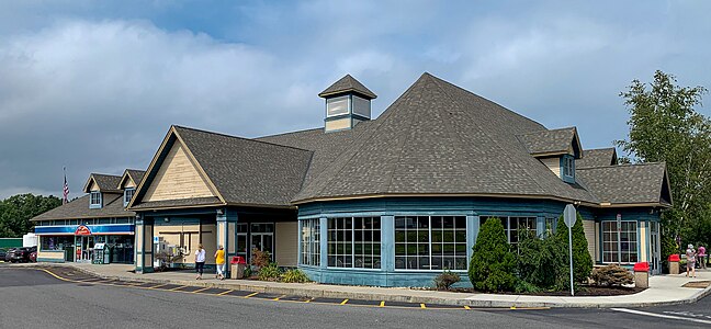
Ludlow Service Plaza westbound
Lee Service Plaza eastbound


| Location | Direction | mi (km) | Services[22] |
|---|---|---|---|
| Lee | Eastbound | 8.5 miles (13.7 km) |
|
| Westbound |
| ||
| Blandford | Eastbound | 29 miles (47 km) |
|
| Westbound |
| ||
| Ludlow | Eastbound | 55.6 miles (89.5 km) |
|
| Westbound |
| ||
| Charlton | Eastbound | 80.2 miles (129.1 km) |
|
| Westbound | 84.8 miles (136.5 km) |
| |
| Westborough | Westbound | 104.6 miles (168.3 km) |
|
| Framingham | Westbound | 114.4 miles (184.1 km) |
|
| Natick | Eastbound | 117.6 miles (189.3 km) |
|
Tolls[]
As of 2009, toll revenue generated from the Massachusetts Turnpike is to be spent in the section in which it was collected, either the Western Turnpike or the Boston Extension (alternatively named the "Metropolitan Highway System" for administrative purposes).[23] Tolls from exit 3 (former exit 1) in West Stockbridge through exit 51 (former exit 6) in Chicopee were removed by then-Governor Bill Weld in 1996, following complaints that the tolls collected in Western Massachusetts were financing the Big Dig in Boston;[24] they were ultimately reinstated in October 2013.[25]
At the recommendation of former Secretary of Administration and Finance Eric Kriss, who recommended that tolls be eliminated along the entire turnpike with the exception of the tunnels leading to Logan International Airport,[26] the Massachusetts Turnpike Authority voted to remove all tolls west of Route 128 in Weston in October 2006.[27] Members of the Massachusetts Legislature Transportation Committee cited the potential need to amend state law and the uncertainty of how the turnpike would be maintained as setbacks to the toll removal, which ultimately never came to fruition.[28]
The issue of the removal of the tolls is highly charged politically. Several members of the state Democratic Party declared this as a political maneuver to bolster the gubernatorial campaign of Lieutenant Governor Kerry Healey, a Republican, who was behind in the polls at the time of the announcement. Also, because the MTA Board is composed of Romney appointees, Kriss's former association with the Romney administration and the ongoing election at the time, the issue was clouded by accusations of partiality and political agendas from both sides of the aisle.
In the November 9, 2006, edition of The Boston Globe, Romney announced his intention to try to remove the tolls before Governor-elect Deval Patrick, a Democrat, was inaugurated in January 2007, but this did not occur. As of November 2008, Patrick's plan was to remove all tolls west of Interstate 95, except at the West Stockbridge and Sturbridge tolls,[29] but this also did not occur before the end of his term in January 2015. State law requires tolls to be removed west of Route 128 when its debt is paid and the road is in "good condition", but MassDOT plans to continue tolls after the bonds are paid off in January 2017, because the road will still need $135 million per year for repairs and maintenance.[30][needs update]
At a January 22, 2009, board meeting, the Turnpike decided to stop charging a one-time $25.95 fee for the acquisition of a Fast Lane toll transponder, replacing it with a 50-cent monthly recurring service fee.[31] The implementation of the 50-cent monthly fee was canceled after long delays at toll plazas on Easter Sunday.[32][33]
Toll plazas[]


The turnpike traditionally utilized the ticket system for toll collection; a driver would obtain a ticket from an on-ramp, which they would surrender to an off-ramp and pay a toll based on traveled distance.[34] While most toll plazas were located on the entrance/exit ramps by the turnpike, exceptions included the mainline toll plazas in West Stockbridge, Weston, and Allston–Brighton.[4] Electronic toll collection was introduced as an alternative to cash payment with Fast Lane transponders in 1998; when installed in the inner windshield of a vehicle, the equipment would be recognized automatically in special lanes at toll plazas, and would withdraw the toll amount from the motorist's account.[35] It was first sponsored by BankBoston, and later FleetBoston Financial, before sponsorship was assumed by Citizens Bank in 2003.[36] Motorists were previously charged $27.50 for the hardware itself,[36] although this fee has since been removed.[37] Citing federal highway regulations that prohibit sponsorship of toll plaza signage, the contract with Citizens Bank was not renewed upon expiration; the Fast Lane name was replaced with the E-ZPass branding, with which Fast Lane was interoperable, in 2012.[38]
Open road tolling[]

In 2014, Raytheon won a $130 million contract to convert the Massachusetts Turnpike to all-electronic open road tolling.[39] The stated goal of the change was to "make vehicle travel safer and more efficient".[40] Additional changes included the elimination of toll booth operators, as well as the demolition of existing toll plazas and reconfiguration of surrounding roadways.[30][41][42] Overhead gantries between most exits read E-ZPass transponders. Drivers without a transponder use pay-by-plate, having their license plate photographed and an invoice sent to the registered owner. This method of payment adds a $0.60 surcharge per invoice, with payment made online, or in cash at a local retail location.[43][44] Installation of gantries began in January 2016, and open road tolling began on October 28, 2016.[41] The inner segments of the toll booths were demolished 30 days after this date, which allowed traffic speeds to be raised. Complete demolition of toll booths and reconstruction was completed by the end of 2017.[41][45]
As there are no gantries between exits 45 and 54 (former exits 4 and 7), or between exits 90 and 96 (former exits 10 and 11), the Massachusetts Turnpike is essentially free between those pairs of exits. Otherwise the transition to open road tolling is revenue neutral, meaning the tolls between any other pair of exits only saw small adjustments. Tolls are slightly higher for out-of-state residents without an E-ZPassMA transponder, and no-transponder tolls are higher.[46]
When all-electronic tolling went live on the Mass Pike, the Tobin Bridge, Callahan Tunnel, Sumner Tunnel, and Ted Williams Tunnel joined the system and were converted to charging a single toll in both directions, rather than a double toll in one direction. The Tobin Bridge was converted to all-electronic tolling for southbound only in July 2014.[41]
In addition to license plate information, the gantries also collect vehicle speed data, which a MassDOT spokesperson said "will not be using the AET system to issue speeding violations".[47] Toll data is not a public record that must be disclosed by Freedom of Information Act requests, and MassDOT "All data collected will remain secure and kept confidential."[41] Toll data can be obtained by subpoena, and law enforcement will be able to specify license-plate numbers that will generate an immediate e-mail if detected by the system.[48]
History[]
Background and construction[]
As Boston's place as a center of commerce and manufacturing began to grow in the late eighteenth and early nineteenth centuries, the need to move goods to the city's ports from growing mills and factories in communities such as Worcester, Lowell and Providence, Rhode Island, to warehouses in the city required investments in new methods of transportation. The growth of shipbuilding in the city also required the importation of raw materials from the interior regions. Additionally the newly expanded marketplaces within the city, such as Faneuil Hall, needed ways to bring their products to market. In response to these needs, the city and Commonwealth began a process of expanding transportation access to the city. New infrastructure such as bridges, wharves and ferries were established, often by early public-private corporations chartered by the Commonwealth.[49][50]
The rudimentary system of roads that existed in the region at the time was woefully insufficient for the needs of the merchants, being in need of major overhauls and upgrades that were beyond the financial means of the Commonwealth and municipal governments of the time. The poor quality of the early roadways in the state, as well as others in the young nation, would often make the transportation of goods inland from the ports via road economically impractical.[49]
While the military necessity of transporting men and supplies during the revolution helped improve some of the early highways in the states, many of these were not maintained or upgraded after the war's end. Many roadways lacked bridges and adequate facilities to feed and house travelers on trips that would often take anywhere from a few days to a week to complete. Many communities were also hesitant or unable to provide sufficient capital required to establish or maintain amenities for those who passed through their towns.[51]
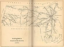
On March 16, 1805, the Massachusetts legislature chartered a system of private roads, or turnpikes, designed to help facilitate travel and commerce into general laws of the Commonwealth. These turnpikes, named after the system of tollgates used to collect fares from travelers, were based upon a franchises-like system of private operators who would build, maintain and operate the roads using the toll revenue. The turnpikes often operated at a loss and many folded shortly after their opening.[52]
One such turnpike was designed to run from Roxbury to Worcester and was chartered as the Worcester Turnpike Corporation on March 7, 1806. The Worcester Turnpike was designed to be the primary roadway on the western approach to Boston and utilized a part of the old Connecticut Path along Tremont and Huntington streets, into Brookline and continued west to Worcester along roughly the same route as the modern Route 9. However, the costs of maintaining the road began to spiral as needed bridges in Shrewsbury began to deteriorate, and mandates in its charter to run and maintain older and unaffiliated roadways along the route made it difficult for the Corporation to maintain profitability. Like many of its contemporary turnpikes, the Worcester Turnpike eventually succumbed to failure in 1841, had its charter dissolved by the Commonwealth, and the roadway was portioned and control transferred to local municipalities.[53]
One of the primary contributors to the demise of the Worcester Turnpike was the ascendancy of the railroad during the 1830s.[54] Chartered in 1831 by the General Court, the Boston and Worcester Railroad began construction of its line in 1832, and the mainline was completed in July 1835.[55] The newly completed railroad initially utilized the right of way along another failed turnpike, the Central Turnpike, which ran from Boston to Worcester though Brookline, Wellesley, Natick, Framingham and other communities along what is now the Framingham/Worcester MBTA commuter rail line.[56] The railway originally ran through the tidal flats of the Back Bay and its impact on the city was only felt along the southern sections of the city. While originally designed as a long haul railway, the proprietors of the B&W, and other railways, eventually found that there was a willing market for commuter services along the routes and by 1845 had established a series of commuter rail facilities along its route.[57] Through a series of mergers during the next several decades, the Boston and Worcester Railroad eventually evolved into the Boston and Albany Railroad in 1870, connecting the capitols of Massachusetts and New York state.[55]
As the city slowly began filling in the Back Bay tidal estuary to establish the South End and Back Bay sections of the city, the rail line went from being a lone causeway in the middle of said tidal estuary to a major transportation cut through the heart of the western sections of the city. Besides being a physical separator, the railroad was a societal and economic barrier as well; while the South End reclamation project was a municipal project that lacked any form of solid planning, the Back Bay reclamation project was a state-run program that established specific ideas of who would reside within the district. The proximity of the railway also led to an unforeseen effect, suburban flight. With the new rail lines in close proximity to the entire city, many wealthier citizens began migrating to the cities and towns west of Boston. This migration put financial burdens for municipal services such as water and sewer, fire and police on these communities, and helped lead to drives for them to be annexed by Boston, further expanding the city limits.[58] Despite these issues, by the end of the nineteenth century the western railroad and its contemporaries were helping drive the city's economy by assisting local industries to bring products to Boston's port, helping it become the second busiest port on the eastern seaboard.[59]
To help accommodate the growth in rail traffic, the Boston and Albany constructed two large rail yards, one in the Allston section of city and another adjacent to the Lennox Hotel on Huntington St, adjacent to the Back Bay. While the Boston and Albany and its contemporary railroads were constructing new yards, other factors that would foreshadow the decline of the city's fortunes were manifesting themselves through the late nineteenth century and into the early twentieth; traffic to the Port of Boston declined, necessitating the Federal government to dredge the main shipping channels and construct new piers to handle larger vessels; AT&T moved its operations and headquarters from Boston to New York in 1910. The problematic relationship between the city and the business sector under the successive mayoral administrations of James Michael Curley drove a wedge between these businesses and the municipal government, souring employers on Boston. Adding to these problems, a series of economic recessionary periods culminating with the Great Depression coupled with a heavy tax burden sent the city's finances into a tailspin. Despite minor uplifts from the mobilization of the two World Wars, by the end of the World War II the city was in dire straits.[60] Much of the state's infrastructure west of Boston was in a serious state of decay, with the major east-west Routes 2 and 9 in need of significant upgrades. At the same time, rail traffic in the region was becoming financially untenable to utilize for material transportation for newly emerging technology companies of the era due to the railroads’ outmoded pricing structures and limited geographical reach.[61]

In the period following World War II, Boston had fallen into a deep period of stagnant growth. Its former maritime industries had closed as traffic in the harbor declined, the textile mills that had provided a large portion of the city's wealth had migrated out of the region seeking new locations that would allow them to maximize revenues, and property development had ground to a halt with virtually no new construction of any impact occurring since the beginning of the Great Depression.[62] Boston retail stalwarts such as Filenes and Jordan Marsh had decided to focus their energies and growth into the suburbs; Boston's citizens had begun to flee to the same suburban pastures as property taxes in the city skyrocketed. As U.S. News and World Report stated, Boston was "dying on the vine".[63]
After the end of the war, Massachusetts entered into a period of new highway projects planning that sought to help end the economic malaise the state was suffering from. It was in 1947 that Republican Governor Robert Bradford realized that the Commonwealth needed to implement a standard framework to properly guide the planning and construction of these new roadways. He commissioned a study to produce a new Highway Master Plan for the eastern region, and by 1948 it had been completed. Seeking the political benefits that a major public works project would bring, Bradford sent his plan to the Democratic-controlled Massachusetts legislature for approval; however the Democrats sat on the project until their candidate, newly elected Democratic Governor Paul A. Dever, took office in January 1949.[61]
It was instead Dever who initiated the program to implement the Highway Master Plan for the city shortly after taking office in 1949. Enjoying a Democratic majority within the State House coupled with a Democratic governor for the first time in the Commonwealth's history, he pushed through a series of highway bills with associated gas tax increases totaling over US$400 million (US$3.97 billion in 2014, adjusted for inflation) between 1949 and 1952.[64] To oversee this undertaking, Dever brought in the former Commissioner of the Massachusetts Department of Public Works, William F. Callahan, to once again head the agency he had helmed from 1934 to 1939. Known for his strong personality and drive to get projects completed,[64] Callahan immediately set out to construct three of the proposed highways, not including what would become the eventual "outermost" beltway around Boston, planned from 1947: the "original outer" circumferential highway which became Route 128, the Southeast Expressway, and the Central Artery through the heart of the Boston's downtown. These three projects, totaling more than US$92 million (US$913 million in 2014, adjusted for inflation) were seen as being essential to the growth of the city in the future. However, the construction of these roads took such a large portion of funds that the Commonwealth was unable to provide funds for the Western Expressway project. However, before Callahan could oversee the completion of the southern leg of Route 128, he was appointed by Dever to run the newly formed Massachusetts Turnpike Authority.[65][66]
Because of the financial strain created by the bond issues used to construct these other highways, the Commonwealth was unable to afford the costs of floating more bonds to fund the expenditures required to construct the Western Expressway along the Western Approach corridor of Boston. Callahan suggested creating a strong, independent, and semi-public transportation authority that could fund the new expressway by floating its own bond issues and financing them through tolls along the highway while having its own powers of eminent domain to secure the land needed to build it. Utilizing the political goodwill he accrued during his tenure as public works commissioner, primarily through extensive patronage hires,[64] Callahan was able to push his idea for the new authority through the Statehouse with ease.[67] The authority was formed in early 1952, and by 1955 it had issued the required bonds needed to construct a 123 mi (198 km) highway from the New York-Massachusetts border to the recently completed Route 128 in Weston. Despite being completed in 1957, many within the Commonwealth quickly realized that the local routes used to get into Boston were still insufficient for the automotive traffic burdens placed upon them.[68] In the late 1950s' eminent domain for the Mass Turnpike devastated the historic African-American community named "The Village". Compensation was offered for the homes below market value. Homeowners and renters confronted racial discrimination when trying to purchase or rent homes in Newton. Real estate agents would not work with them. They had to rely on word of mouth to find a new home. It is estimated that 50% left Newton as a result of the construction of the Mass Turnpike.[69]
Expansion into Boston[]
While the highway construction boom proved to be fortunate for the suburban communities these new roadways passed through, the economy of Boston was still in a fragile state.[70] Realizing that Boston still needed to be connected to the Turnpike to help reverse its flagging economy and reputation as a municipal has-been, Callahan was tasked in 1955 by the Legislature to create an extension into the city designed to facilitate a turnaround of the city's fortunes. This new highway would connect the Massachusetts Turnpike to the heart of the city with a 12.3-mile extension of the Interstate. It was his plan to bring the tolled Turnpike from its terminus at Route 128 in West Newton into the city along the path of the Boston and Albany Railroad and connect it to the Southeast Expressway. This plan was in line with the 1948 Master Highway Plan for the city, which had always called for a Western Expressway to be built into the city. However, with the passage of the Interstate Highway Act in 1956, the Federal Government provided sufficient funds to the states to construct new highways with a ninety percent subsidy—rendering the need for a toll road into the city obsolete.[71]
Complicating the matter, Callahan's planned extension route was not universally accepted by others within the state, such as newly elected Governor John A. Volpe and Newton Mayor Donald Gibbs, who sought to construct a freeway that would follow a different route between the Borders of Newton, Waltham and Watertown along the Charles River and U.S. Route 20 and be constructed using the funds now being provided by the Federal Highway Administration.[72] Additionally, residents of the city of Newton, who would see significant demolition of neighborhoods within the city along with large portions of its central business district to make way for the Turnpike Extension, were adamantly against the proposed Boston and Albany routing of the road.[73] Newton, through the terms of two mayors, set about fighting the Turnpike proposal through a series of increasingly futile legislative maneuvers in the General Court. Realizing that the needs and wants of the smaller city could not overcome the influence of Callahan within the state capitol, the smaller city would instead redirect its efforts to blocking the highway at the Federal level through the Interstate Commerce Commission and Federal courts.[74] Affected property owners within Boston who were also looking at the possibility of losing their homes and business followed Newton's lead by filing a series of state and federal lawsuits that they hoped would derail the proposed extension.[75]
Prudential Company[]
Adding to Callahan's numerous problems with those in opposition to the new roadway, the Prudential Life Insurance Company announced that it was in the process of acquiring the 32-acre Boston and Albany Tremont St. rail yard for the purpose of constructing a brand new building and associated complex to house its Northeastern American operations at about the same time as the Commonwealth's plan to bypass the Turnpike Authority was being announced. This proposed development stood square in the middle of the Boston leg of Callahan's planned Turnpike extension, and could possibly kill his proposed extension.[76][71] While many opponents within and outside the city looked upon the Prudential announcement as the possible final nail-in-the-coffin for Callahan's proposed toll road, Boston Redevelopment Authority head Edward J. Logue saw Callahan's Prudential problem as a way to overcome issues the BRA was having in obtaining approval for the Prudential project from the city.[76][77]
Logue was in many ways the equal to Callahan; a driven man who sought the power to get things done as the head of a semi-independent authority whose structure had been modeled on Callahan's Turnpike Authority.[76][78] Logue, who was responsible for many urban renewal projects in Boston at the time, including the construction of Storrow Drive and the West End redevelopment project, realized the Prudential project was essential to Boston's redevelopment efforts. The main issue holding up the project was a lack of consensus over tax breaks Prudential was demanding in order to move forward with the project.[79] Additionally, several legal decisions were handed down by the Massachusetts Supreme Judicial Court questioning the constitutionality of the land takings required to build the complex.[76][80]
Adding to the problems associated with the Prudential project, during 1960 and 1961 there was a series of allegations made against Callahan claiming he had been engaging in illegal activities related to his second tenure as Public Works Commissioner. These allegations included charges of financial kickbacks, bid rigging, and other questionable practices. This led to a corruption trial which threw a pall on his reputation that did not help with his drive to construct the Turnpike extension. On top of the legal allegations, a group of three professors from MIT and Harvard made public allegations that the Turnpike Authority had been using inflated numbers to push through its bond issues, thus artificially inflating their values. This led to failed series of bond issues that critics hoped would prevent the Turnpike Authority from raising the needed funds for construction.[81]
It was in the midst of these many legal problems that in April 1960 Prudential announced that continuation of their building project was contingent on direct highway access via a toll road along the Boston & Albany Rail Road right of way.[76][81] Additionally, Prudential would lease air rights to the parcels from the Turnpike Authority and purchase a large portion of bonds issued by the Authority. Despite this agreement, Governor Volpe was still trying to nix the Turnpike's plans along the Boston and Albany right of way, filing the city of Newton's request with the ICC to stop the construction of the roadway. It was only after a series of meetings between Volpe, Callahan and Prudential executives that the Governor was finally persuaded to withdraw the ICC filing and reluctantly support the toll road.[82] With the new deal in place, a not-guilty finding in the criminal case, and public relations push-back to the allegations of market tampering by the Turnpike Authority, the bond measures were once again seen as a sound investment and investors quickly picked up the $175 million (US$1.4 billion in 2014, adjusted for inflation) bond issuance.[81][80] With the Turnpike-Prudential agreement in place, Logue was able to petition the General Court to once again authorize a land taking deal and tax-deferment bill, which was passed rather quickly and signed by then-Governor Foster Furcolo. While this new bill was again deemed unconstitutional by the SJC, in its decision the Court provided a framework for the legislature to construct a bill that would pass constitutional muster. The bill also gave Logue's BRA considerable powers over the redevelopment project, allowing him to rapidly move forward with permit approvals and tax issues.[76][81] The Turnpike-Prudential deal linked with the Logue and the BRA's new powers to move the project forward quickly quieted much of the remaining opposition to the new roadway, and cemented the idea of air right development as an integral part of the Turnpike moving forward.[83] By 1965 the Massachusetts Turnpike had been connected to the Central Artery, and the Prudential Center was on its way to completion; however, Callahan did not live to see this. On April 24, 1964, he died of a massive heart attack at his home.[84]
The year 1968 saw the beginning of the first major expansion of the Turnpike after the completion of the Boston extension in 1965. While the original design of the roadway called for an eight-lane expressway along the majority of the route, it was only constructed as a four-lane roadway along most of its length until it reached the junction of Route 9 in Framingham where the roadway expanded to six lanes. Starting in 1968 the highway from the Interstate 84 interchange in Sturbridge to Route 9 was widened from its original four lanes to six; that widening project was completed around 1971. However, the mainline right-of-way was constructed to allow future expansion of the roadway, with most bridges over the highway built with the eight-lane roadway in mind, so few bridges had to be rebuilt when it was widened in the late 1960s.
Big Dig[]
When designing the Central Artery/Tunnel project in the 1970s and 1980s, the horror stories regarding urban renewal projects such as the construction of the old viaduct in the 1950s weighed heavy on the minds of Frederick Salvucci and his team. It was realized early on that the Commonwealth could not just lay waste to parts of the city and pave them over; the state would have to ensure that construction would balance the needs of the highways against the livability of the city and neighborhoods the project would pass through. Mitigation efforts would be of utmost importance in moving ahead with the project.[85][86]
Governor Francis Sargent had shut down any ideas of further freeway construction within the MA Route 128 beltway in 1970, thereby cancelling both the I-695 "inner belt" and the Southwest Corridor freeway projects, placing more emphasis on the already-completed Boston extension of I-90, the extension of I-93 into Boston, and the work to eventually depress Boston's Central Artery below ground level as the only unbuilt freeway-related construction projects "inside" of Route 128 that would be allowed to go forward.[87]
The notions of using existing rights of way or areas where neighborhood displacement would be minimized were applied to the second extension of the Turnpike as part of the CA/T project. Salvucci deliberately planned to bring the East Boston Extension through areas with little or no occupancy or those properties already owned by the Commonwealth. As a result, East Boston saw almost no takings of buildings or homes through eminent domain or the destruction of neighborhoods because construction was relegated to the then-unoccupied areas of the South Boston Seaport and Logan Airport. Like the first Turnpike extension, the connection of the Turnpike to East Boston was also designed to provide an economic stimulus to the city, this one to revitalize the desolate Seaport district.[86]

The Massachusetts Turnpike Authority managed the Central Artery/Tunnel Project (the "Big Dig"), which rerouted the elevated Central Artery into the O'Neill Tunnel through downtown Boston, and extended the turnpike beyond its terminus at the Central Artery into the Ted Williams Tunnel and connected it to Route 1A beyond Logan International Airport. Construction began in 1991, and the final extension of the turnpike was opened in 2003.
It was for the financial needs of the project that the "Metropolitan Highway System" was created with the turnpike east of Route 128; the Ted Williams, Sumner, and Callahan tunnels under Boston Harbor; and I-93 from Southampton Street through the O'Neill Tunnel and the Zakim Bridge to the foot of the Tobin Bridge.[88] Finances for the Western Turnpike and the Boston Extension continue to be handled separately with this reorganization.
Ceiling collapse[]

In response to a fatality caused by the collapse of the ceiling of the eastbound I-90 connector tunnel approaching the Ted Williams Tunnel on July 10, 2006, and in response to Turnpike Authority Chairman Matthew J. Amorello's refusal (at the time) to resign, Romney took legal steps to have Amorello forcibly removed as head of the Massachusetts Turnpike Authority.[89] This effort culminated in Amorello's resignation on August 15, 2006. The next day, John Cogliano was sworn in as the new Chairman of the Turnpike Authority by Romney.[90] On November 27, 2006, departing Attorney General Tom Reilly (Democrat) announced the state will launch a civil suit over the collapse of the ceiling in the Ted Williams Tunnel. The Commonwealth will be seeking over $150 million from project manager Bechtel/Parsons Brinckerhoff, builder Modern Continental Construction Co. and the manufacturer of the epoxy used to hold the ceiling bolts.[91][92][93][94]
Infill exits[]
With the exception of exits opened during construction of the Boston Extension, two infill exits were opened between existing interchanges on the Western Turnpike. Exit 106 (former exit 11A) in Hopkinton connects the turnpike with I-495 and enables transit between northern New England and Cape Cod; it was opened in 1969.[95] Exit 94 (former exit 10A) in Millbury connects the turnpike to Route 146 and US 20 via the Route 20 Connector, which in turn facilitates movement between Worcester and Providence, Rhode Island; construction began in 1996 and was opened in 1998 before being completed in 1999.[96]
Air rights[]

Much of the air space ("air rights") over the Boston Extension has been leased to third parties for commercial development. This concept was originally designed to "knit together communities" that were divided by the new highway,[97] since the turnpike had been described as "wider and more divisive to the city" than the original Central Artery.[98] More recently, the income received from the leased air rights have been used for paying off the Big Dig.[98] There are 23 parcels of air space over the highway, the majority of which have not been developed.[99] Among other objectives, guidelines established by the "Civic Vision for Turnpike Air Rights in Boston" in 2000 recommend that the proposed use of the parcels "[foster] increased use and capacity of public transportation" and "[reinforce] the vitality and quality of life in adjacent neighborhoods".[100]
The Star Market (briefly renamed Shaw's Supermarket) in Newton is the earliest example of commercial construction over the turnpike. In the 1960s, the Massachusetts Turnpike Authority intended to route the highway through the parking lot of the supermarket's previous location in the city; this alignment that was ultimately approved by the Massachusetts Supreme Judicial Court, under the condition that a replacement Star Market was allowed to be built over the turnpike.[101] Other projects developed through air rights include the Newton Plaza Hotel in Newton,[102][103] the Copley Place shopping mall in Boston,[103][104] and the Prudential Center in Boston.[103][105] Proposals for future air rights projects include the mixed-use Fenway Center,[106] and an extension of the Boston University campus near Boston University Bridge.[107]
After four decades of no new developments, in August 2020, construction began on Parcel 12, and construction was expected to begin within the month at Fenway Center pending a final agreement with MassDOT,[108] leading to planned closure of one lane in each direction for a year.[109] Parcel 12[110] is between Newbury Street, Boylston Street, and the west side of Massachusetts Avenue, and is expected to feature a 13-story hotel, a 20-story office tower (including the headquarters of CarGurus), a reconstructed bus shelter, a public park, street-level retail, and a new entrance to the Hynes Convention Center station of the MBTA Green Line subway.[108] The developer of Parcel 13, on the east side of Massachusetts Avenue along Boylston Street, submitted updated plans in February 2020, with 17 stories of condos, hotel, parking, and public space.[111] An approved plan for Parcel 15 (known as 1000 Boylston Street) was cancelled by the developer in August, 2019,[112] with the dissolution resulting in a lawsuit.[113]
Future[]
Proposed exits[]
The construction of an exit between exit 10 (former exit 2) in Lee and exit 41 (former exit 3) in Westfield, separated by a 30-mile (48 km) gap, has been controversial since the 1960s.[114] The state conducted a study to determine the feasibility of such a project in 2018;[114] land occupied by a service plaza and a maintenance facility (both in Blandford) and Algerie Road in Otis have been suggested as locations for a potential exit.[115] As of November 2020, the proposal for a new interchange between exits 2 and 3 is officially dead with a 79-no vote compared to a 63-yes vote.
Allston interchange[]
The "I-90 Allston Multimodal Project" is a plan to replace a deteriorating viaduct in Allston by straightening the turnpike through the land of the former Beacon Park Yard, which is owned by Harvard University, along with improvements to the MBTA's Framingham/Worcester Line.[116][117] The preliminary design plan calls for the turnpike to be realigned at-grade and off of the existing viaduct, and for the adjacent Soldiers Field Road to be partially realigned onto a new viaduct above the turnpike and off of the existing at-grade roadbed. The design is of a considerably smaller footprint than the existing configuration; this would facilitate the construction of the proposed West Station and the expansion of Harvard University on land where the existing viaduct is located.[118] The design phase was expected to be completed in 2019, and with a planned ground breaking in 2020.[119] A 2019 timeline of the project proposed by MassDOT has the design phase now running through 2020–2021, with a proposed start in 2022 with construction lasting 8–10 years.[120]
I-495 interchange[]
The "I-495/I-90 Interchange Improvements Project" is intended to realign exit 107 (former exit 11A) in Hopkinton, where the existing interchange (designed for the now-demolished toll plazas) is notoriously congested and accident-prone during rush hour and holiday travel times.[121] As of 2018, MassDOT is examining three design proposals, which have raised the suggestions of separate northbound/southbound I-495 exits and the extension of acceleration lanes through exit 111 (former exit 11A) in Framingham. The project initially was estimated to cost between $296–413 million, and the design phase expected to be 25-percent complete by 2020.[122]} In July 2019, MassDOT announced that the state would be moving ahead with preferred design for overhaul of I-495-Mass Pike interchange consisting of a series of "flyover ramps" that would eliminate the interweaving of traffic that causes bottlenecks and crashes at the interchange. The state expects that the construction would begin in 2022 and run through 2026 at an estimated cost of approximately $296.4 million.[123]
Government oversight[]
Since 2001, the Turnpike Authority had come under fire from state politicians in a fight for control of the quasi-state agency. Beginning in 2001, former Massachusetts acting Governor Jane Swift (Republican) attempted to fire Christy Mihos, a former Turnpike board member and Jordan Levy, the Vice Chairman of the board.
Mihos and Levy had cast votes on the board to postpone a toll hike. Swift objected, saying such a delay was "fiscally irresponsible" and saying the two men "interfered with the effective daily management of the Authority."[124] Mihos and Levy refused to step down and sued Swift to retain their positions. The Massachusetts Supreme Judicial Court (SJC) ruled that the Turnpike was "not part of the machinery of the government" and therefore not subject to Swift's decisions.[125]
Governor Mitt Romney, elected in 2002 during a fiscal crisis, ran on a political platform of streamlining state government and eliminating waste. Part of this was the elimination of the Turnpike Authority. Romney wanted to fold the Turnpike into MassHighway, the state highway department, operated under the Executive Office of Transportation. A first step to this was to replace the Chairman of the Board, Matthew J. Amorello with someone loyal to the Governor. The Governor has the power to appoint members to the board, but the Massachusetts Supreme Judicial Court (SJC) advised in an advisory opinion that "nothing in G. L. c. 81A explicitly provides for the removal and reassignment of the chairperson to the position of "member."[126][127]
Romney put pressure on Amorello to step down. Amorello announced he would do so in 2007, after Romney would have left office. Romney continued to press the legislature to give him the power to remove members from the board, specifically the chairman, pointing to a series of financial and construction mishaps over the last several years. However, the legislature instead sought to keep Amorello on board by extending the terms of various board members to prevent Romney from removing Amorello.[128]
Under a plan to save state funds, the Massachusetts Registry of Motor Vehicles (RMV) announced plans to close eleven of its branches in leased locations and move the operations into facilities owned by MassHighway and the Massachusetts Turnpike Authority located in toll plazas, visitor centers, and offices. RMV branch closings were planned for Framingham, Lowell, North Attleboro, Cambridgeside Galleria Mall in Cambridge, New Bedford, Eastfield Mall in Springfield, Southbridge, Falmouth, Eastham, Beverly, and Boston.[129] Also, a portion of the newly increased sales tax in the state averted a planned toll increase. The MTA will receive approximately $100 million from the state general fund over the next few years, alleviating the need for the toll hike.[130]
Under legislation signed into law by Gov. Deval Patrick on June 26, 2009, the turnpike was folded into a new super-agency that controls all surface transportation in the state. The new agency, the Massachusetts Department of Transportation (MassDOT), operates all highways formerly under MassHighway and the Turnpike Authority as well as eight urban roadways formerly owned and maintained by the state Department of Conservation and Recreation (DCR).[131] In addition, MassDOT oversees the RMV, the Massachusetts Bay Transportation Authority (MBTA), regional transit authorities, and the state aeronautics commission.[132] The new Transportation Department began operations on November 1, 2009.[133][failed verification]
The Turnpike Authority also owned the Callahan Tunnel and the Sumner Tunnel, the other two road connections between downtown Boston and East Boston under Boston Harbor.[134] Upon completion of the Central Artery/Tunnel Project, all tunnels constructed as part of the Big Dig, including the O'Neill Tunnel segment of I-93, were transferred to its control.[135] The Authority received no state or federal government funding. Its revenues came from tolls, leases on air rights and service areas, and advertising. Its assets were all transferred to the new MassDOT agency as part of the restructuring of agencies.[136]
Highway shield[]

The original logo depicted Paul Revere on horseback with the words "Massachusetts Turnpike Authority" in a circle around him. One incarnation of the pilgrim hat shield had a Native American arrow sticking through the pilgrim hat. It was replaced with a plain hat and the words "Mass Pike" in 1989. It has been reported variously that the sign was changed due to confusion among motorists who sometimes mistakenly turned in the direction the arrow pointed (right) when attempting to enter the turnpike,[137] or that it was the result of a letter campaign describing the signs as offensive to Native Americans.[138]
According to MTA board member Mary Z. Connaughton's blog entry for the Boston Herald, all of the pilgrim-hat signage unique to the Turnpike will be eliminated.[139] However, in a personal correspondence with AARoads.com's road blog, a MassDOT official said that usage of the hat would actually increase. When guide signs on I-95 and I-495 are replaced, the "Mass Pike" signage will be replaced with pilgrim hat shields.[140]
Exit list[]
While Massachusetts has used sequential exit numbers since 1964,[141] the 2009 edition of the Manual on Uniform Traffic Control Devices required that all U.S. states submit plans to transition to milepost-based exit numbering by 2012.[142] All exits on the turnpike were expected to be renumbered following this convention with two sign replacement projects scheduled for completion by 2018; the contractors were ultimately instructed to install the new signs with the existing numbers, albeit with wider exit tabs that would accommodate larger two- and three-digit exit numbers should the conversion take place in the future.[143] In November 2019, MassDOT announced that statewide milepost-based exit renumbering would begin in Western Massachusetts in summer 2020.[144] The work began along I-90 during the week of December 13, 2020, starting from Weston (I-95) and working westward before renumbering the exits inside the 95 and towards the airport.[145] The work was expected to take about four weeks.[146]
This section contains a table that is missing mileposts for one or more junctions. |
| County | Location[147] | mi[147] | km | Old exit | New exit[148] | Destinations[148] | Notes |
|---|---|---|---|---|---|---|---|
| Berkshire | West Stockbridge | 0.000 | 0.000 | — | – | Continuation into New York | |
| 2.736 | 4.403 | 1 | 3 | Westbound exit and eastbound entrance | |||
| Lee | 8.5 | 13.7 | Lee Service Plaza | ||||
| 10.01 | 16.11 | Electronic toll gantry[41] | |||||
| 10.592 | 17.046 | 2 | 10 | To Route 102 and US 7 | |||
| Hampden | Blandford | 26.25 | 42.25 | Electronic toll gantry[41] | |||
| 29.0 | 46.7 | Blandford Service Plaza | |||||
| Westfield | 40.434 | 65.072 | 3 | 41 | |||
| 40.86 | 65.76 | Electronic toll gantry[41] | |||||
| West Springfield | 45.740 | 73.611 | 4 | 45 | Exit 11 on I-91 | ||
| Chicopee | 49.041 | 78.924 | 5 | 49 | |||
| 51.154 | 82.324 | 6 | 51 | Exit 7 on I-291 | |||
| Ludlow | 54.780 | 88.160 | 7 | 54 | |||
| 55.6 | 89.5 | Ludlow Service Plaza | |||||
| 57.68 | 92.83 | Electronic toll gantry[41] | |||||
| Palmer | 62.641 | 100.811 | 8 | 63 | |||
| Worcester | Warren | 69.78 | 112.30 | Electronic toll gantry[41] | |||
| Sturbridge | 78.300 | 126.012 | 9 | 78 | Eastern terminus of I-84 | ||
| Charlton | 80.2 | 129.1 | Charlton Service Plaza | ||||
| 83.10 | 133.74 | Electronic toll gantry[41] | |||||
| Auburn | 90.049 | 144.920 | 10 | 90 | Exit 12 on I-290 | ||
| Millbury | 93.642 | 150.702 | 10A | 94 | Exit 18 on Route 146 | ||
| 96.343 | 155.049 | 11 | 96 | To Route 30 and Route 140 | |||
| Westborough | 104.6 | 168.3 | Westborough Service Plaza (westbound only) | ||||
| Middlesex | Hopkinton | 104.86 | 168.76 | Electronic toll gantry[41] | |||
| 106.236 | 170.970 | 11A | 106 | Exit 58 on I-495 | |||
| Worcester | Southborough | 109.07 | 175.53 | Electronic toll gantry[41] | |||
| Middlesex | Framingham | 111.181 | 178.928 | 12 | 111 | ||
| 113.92 | 183.34 | Electronic toll gantry[41] | |||||
| 114.4 | 184.1 | Framingham Service Plaza (westbound only) | |||||
| 116.600 | 187.650 | 13 | 117 | ||||
| Natick | 117.6 | 189.3 | Natick Service Plaza / Fast Lane Service Center (eastbound only) | ||||
| Weston | 120.21 | 193.46 | Electronic toll gantry[41] | ||||
| 122.600 | 197.306 | 14 | 123 | Eastbound exit and westbound entrance; exit 39B on I-95 | |||
| 123.458 | 198.686 | 15A | 123A | Westbound exit and eastbound entrance; exit 39B on I-95 | |||
| 15B | 123B | Westbound exit; shared ramp with exit 15A until 2017 | |||||
| Newton | 125.207 | 201.501 | 16 | 125 | Westbound exit and eastbound entrance | ||
| 126.18 | 203.07 | Electronic toll gantry[41] | |||||
| 127.553 | 205.277 | 17 | 127 | Washington Street / Galen Street / Centre Street / Park Street / St. James Street – Newton, Watertown | |||
| Suffolk | Boston | 130.04 | 209.28 | Electronic toll gantry[41] | |||
| 130.991 | 210.810 | 18 | 131 | Cambridge Street / Storrow Drive – Brighton, Cambridge | Lefthand eastbound exit and westbound entrance | ||
| 20 | 131 | Cambridge Street / Storrow Drive – Brighton, Cambridge | Westbound exit and eastbound entrance | ||||
| — | U-turn to Boston | Westbound U-turn only | |||||
| 131.15 | 211.07 | Electronic toll gantry[41] | |||||
| 132.863 | 213.822 | — | — | Westbound entrance only | |||
| 132.889 | 213.864 | West end of Prudential Tunnel | |||||
| 133.344 | 214.596 | 22 | 133 | Dartmouth Street – Prudential Center, Copley Square | Eastbound exit and westbound entrance. Access to Route 9 West. | ||
| 133.586 | 214.986 | — | — | Clarendon Street | Former westbound entrance only; permanently closed on September 3, 2019[149] | ||
| 133.576 | 214.970 | East end of Prudential Tunnel | |||||
| 133.876 | 215.453 | — | — | Arlington Street | Westbound entrance only | ||
| 134.315 | 216.159 | 24A | 134A | South Station | Eastbound exit only; access via Atlantic Avenue | ||
| 24B | 134B | Eastbound exit only; exit 16B on I-93 | |||||
| 24C | 134C | Eastbound exit and westbound entrance; exit 16 on I-93 | |||||
| 24 | 134 | Westbound exit and entrance only | |||||
| 134.275 | 216.095 | Fort Point Tunnel under Fort Point Channel | |||||
| 134.773 | 216.896 | 25 | 135 | South Boston | Access via Congress Street | ||
| Ted Williams Tunnel under Boston Harbor | |||||||
| Electronic toll gantry[41] | |||||||
| 137.239 | 220.865 | 26 | 137 | Eastbound exit only | |||
| 138.15 | 222.33 | — | — | National eastern terminus of I-90 | |||
1.000 mi = 1.609 km; 1.000 km = 0.621 mi
| |||||||
References[]
- ^ "State Numbered Routes with Milepoints in District 4" (PDF). Commonwealth of Massachusetts. Archived from the original (PDF) on July 19, 2011. Retrieved June 21, 2017.
- ^ "Hazardous material route designation". Mass.gov. Retrieved January 15, 2018.
- ^ "Open Road Toll Structure Now On Mass Pike In Weston". WBZ-TV. January 4, 2016. Retrieved June 19, 2017.
- ^ Jump up to: a b c d e Cambridge Systematics, Inc. (January 28, 2010). "Massachusetts Turnpike: Metropolitan Highway System" (PDF). Massachusetts Department of Transportation. Archived from the original (PDF) on October 20, 2015. Retrieved June 19, 2017.
- ^ "Massachusetts SuperGraphic". U-Haul. Retrieved June 19, 2017.
- ^ Adderly, Kevin (January 15, 2014). "Table 3: Interstate Routes in Each of the 50 States, District of Columbia, and Puerto Rico". Route Log and Finder List. Federal Highway Administration. Retrieved May 20, 2014.
- ^ "Eisenhower Interstate Highway System, Previous Facts of the Day - 50th Anniversary - Interstate System". Highway History. Federal Highway Administration. February 27, 2019. Retrieved August 20, 2021.
- ^ O'Brien, Tim (March 25, 2010). "Thruway connector's name spurs question". Times Union. Hearst Corporation. Retrieved June 19, 2017.
- ^ Jump up to: a b c d e f g h "I-90: Massachusetts Turnpike" (PDF). Central Transportation Planning Staff. Retrieved June 19, 2017.
- ^ Jump up to: a b c d e f "Travel Activities". Massachusetts Department of Transportation. Archived from the original on June 14, 2017. Retrieved June 19, 2017.
- ^ Sacharczyk, Tamara (May 17, 2016). "Hilltown residents pushing for new Mass Pike exit". WWLP. Retrieved June 21, 2017.
- ^ Carey, Anne (August 13, 2011). "Top 16 longest gaps between Interstate exits". USA Today. Retrieved June 21, 2017.
- ^ Vanhoenacker, Mark (August 18, 2014). "What Does This Beloved Road Sign on the Massachusetts Turnpike Actually Mean?". Slate. Retrieved June 19, 2017.
- ^ "Runaway Truck Ramp". Flickr. September 9, 2017. Retrieved July 20, 2018.
- ^ Jump up to: a b "Official Massachusetts Transportation Map". Massachusetts Department of Transportation. Archived from the original on June 24, 2018. Retrieved June 21, 2017.
- ^ "2015 Triennial Inspection: Metropolitan Highway System" (PDF). TranSystems. Retrieved June 22, 2017.
- ^ "Weston: Newly Constructed Ramp Opens Friday, June 23". Massachusetts Department of Transportation. June 22, 2017. Retrieved June 27, 2017.
- ^ Jump up to: a b c d e f "I-90: Mass Turnpike (Route 16, Newton, to Route 1A, East Boston)" (PDF). Central Transportation Planning Staff. Retrieved June 22, 2017.
- ^ Estes, Andrea (September 10, 2007). "Pike U-turn ramp opening delayed". The Boston Globe. Retrieved June 22, 2017.
- ^ Sweet, Laurel (March 26, 2017). "Man killed as car goes airborne in Pru tunnel". Boston Herald. Retrieved June 22, 2017.
- ^ "Tunnels & Bridges". Massachusetts Department of Transportation. Archived from the original on June 22, 2017. Retrieved June 22, 2017.
- ^ "Travel Service Plazas & Tourist Information Center". Massachusetts Department of Transportation. Archived from the original on June 28, 2017. Retrieved June 20, 2017.
- ^ Mullan, Jeffrey (December 13, 2010). "Transportation Budget in Plain Language Explanation of MassDOT Funding Sources". Massachusetts Department of Transportation. Archived from the original on March 3, 2016. Retrieved June 21, 2017.
- ^ Fanto, Clarence (July 30, 2013). "Update: Westernmost Pike tolls will return, but how much will they be?". The Berkshire Eagle. Retrieved June 21, 2017.
- ^ "Western Mass. tolls set to be restored". The Boston Globe. October 13, 2013. Archived from the original on October 14, 2013. Retrieved June 21, 2017.
- ^ Kriss, Eric (October 18, 2006). "Turnpike Task Force Final Report" (PDF). Turnpike Task Force. Archived from the original (PDF) on July 17, 2011. Retrieved June 21, 2017.
- ^ Misrha, Raja; Daniel, Mac (October 29, 2006). "Pike board acts to end tolls west of Route 128". The Boston Globe. Retrieved June 21, 2017.
- ^ Daniel, Mac (October 10, 2006). "Ending Pike tolls is called illegal". The Boston Globe. Retrieved June 21, 2017.
- ^ Press, Glen Johnson/Associated. "Patrick planning to dismantle Mass. Turnpike". MetroWest Daily News, Framingham, MA.
- ^ Jump up to: a b Thompson, Elaine (January 23, 2016). "All-Electronic Tolling Begins Installation on Mass. Pike". Telegram & Gazette. Worcester, MA. Retrieved September 5, 2016.
- ^ Martin Finucane (January 21, 2009). "Fast Lane transponders will be free, but users will see a new fee". The Boston Globe. Archived from the original on January 24, 2009. Retrieved April 3, 2010.
- ^ Noah Bierman (April 22, 2009). "After Easter snafus, Pike puts toll taker layoffs on hold". The Boston Globe. Archived from the original on April 25, 2009. Retrieved April 3, 2010.
- ^ "Fast Lane Transponders Are Now Fee Free". WBZ-TV. Archived from the original on April 28, 2009. Retrieved August 6, 2009.
- ^ Burke, Isaac (July 1, 2016). "Mass Pike prepares to phase out toll booths". Daily Hampshire Gazette. Retrieved June 22, 2017.
- ^ Chesto, Jon (May 10, 2012). "Massachusetts pulls out of the Fast Lane in favor of E-ZPass". Wicked Local. Archived from the original on June 11, 2017. Retrieved June 22, 2017.
- ^ Jump up to: a b Flint, Anthony (October 24, 2003). "Turnpike users may get a free toll device". The Boston Globe. Retrieved June 22, 2017.
- ^ "Mass. Pike Electronic Tolling: What You Should Know". CBS Boston. October 27, 2016. Retrieved June 22, 2017.
- ^ O'Connell, Scott (June 16, 2012). "Mass Pike says goodbye to 'Fast Lane'". The MetroWest Daily News. GateHouse Media. Retrieved June 22, 2017.
- ^ Baker, Cynthia (August 13, 2014). "Raytheon Awarded $130 Million to Convert Massachusetts to Electronic Highway Tolling System" (Press release). Raytheon. Retrieved September 5, 2016.
- ^ Dummies, Gintautas (June 7, 2016). "New Mass. Pike Electronic Tolling: Will There Be Any Cost Savings from Eliminating Toll Plazas?". MassLive. Retrieved August 9, 2016.
- ^ Jump up to: a b c d e f g h i j k l m n o p q r s "All Electronic Tolling". Massachusetts Department of Transportation. Archived from the original on October 28, 2016. Retrieved June 6, 2017.
- ^ Dummies, Gintautas (July 27, 2016). "New Mass. Pike Toll Rate Structure Expected to Be Released in August". MassLive. Retrieved August 9, 2016.
- ^ Highway Division (2016). "Pay By Plate MA". Massachusetts Department of Transportation. Archived from the original on September 7, 2016. Retrieved September 5, 2016.
- ^ McKay, David (July 19, 2016). "'Open Road Tolling Coming Soon: Time to Get an E-ZPass". Chicopee, MA: WWLP-TV. Retrieved August 9, 2016.
- ^ Highway Division (August 22, 2016). "All Electronic Tolling: Toll Plaza Demolition and Roadway Reconstruction" (PDF). Massachusetts Department of Transportation. Archived from the original (PDF) on August 24, 2016. Retrieved September 5, 2016.
- ^ Rocheleau, Matt (August 22, 2016). "How Much Will Your New Mass. Pike Toll Be?". The Boston Globe. Retrieved September 5, 2016.
- ^ Bombard, Noah R. (July 19, 2016). "Yes, Those New Electronic Toll Gantries on the Mass. Pike Are Clocking Your Speed". MassLive. Retrieved August 9, 2016.
- ^ Matt Rocheleau (August 22, 2016). "New Mass. Gantries Can Send Authorities Alerts". The Boston Globe. Retrieved September 5, 2016.
- ^ Jump up to: a b Wood, Frederick J. & Karr, Ronald D. (1997) [1919]. The Turnpikes of New England. Peperell, Massachusetts: Branch Line Press. p. 3. ISBN 0942147057.
- ^ Kennedy, Lawrence (1994). Planning the City Upon a Hill: Boston Since 1630 (3rd ed.). Boston: University of Massachusetts Press. pp. 46–50. ISBN 0870239236.
- ^ Wood & Karr (1997), pp. 5–6.
- ^ Wood & Karr (1997), pp. 8–10.
- ^ Wood & Karr (1997), pp. 138–147.
- ^ Wood & Karr (1997), pp. 146–147.
- ^ Jump up to: a b "Boston and Albany Collection". Baker Library Special Collections, Harvard Business School – via Harvard University Library.
- ^ "Boston and Albany Railroad Station". Historic Framingham. January 5, 2010. Retrieved September 10, 2014.
- ^ Kennedy (1994), p. 46.
- ^ Kennedy (1994), pp. 68–71.
- ^ Kennedy (1994), pp. 110–11.
- ^ Kennedy (1994), pp. 130–154.
- ^ Jump up to: a b Tsipis, Yanni (2002). Building the Mass Pike. Mount Pleasant, South Carolina: Arcadia Publishing. pp. 7–8. ISBN 0738509728.
- ^ Tsipis (2002), pp. 9–10.
- ^ Berkman, Toby (1998). Six Lanes, Five Miles, a Decade of Construction. The Concord Review. p. 200.
- ^ Jump up to: a b c "Baystate Notes Spending Record". The New York Times. November 5, 1958.[page needed]
- ^ Tsipis, Yanni (2003). Building 128. Mount Pleasant, South Carolina: Arcadia Publishing. pp. 8–9. ISBN 0738511633.
- ^ Tsipis (2002), pp. 27–28.
- ^ Berkman (1998), pp. 180–181
- ^ Tsipis (2002), pp. 27–29.
- ^ Lovett, Laura. "African-American community of Newton has long legacy". Newton TAB.
- ^ Kennedy (1994), p. 168.
- ^ Jump up to: a b Tsipis (2002), pp. 47–48.
- ^ Britten[full citation needed]
- ^ Berkman (1998), pp. 170–173
- ^ Berkman (1998), pp. 177–181
- ^ Fenton[full citation needed]
- ^ Jump up to: a b c d e f Aloisi, James (October 3, 2013). "Collins and Logue: a formidable team". CommonWealth Magazine. Retrieved September 11, 2014.
- ^ Kennedy (1994), pp. 172–173.
- ^ Aloisi, James (October 26, 2013). "The New Boston was a mix of good and bad". CommonWealth Magazine. Retrieved September 11, 2014.
- ^ Kennedy (1994), p. 172.
- ^ Jump up to: a b Berkman (1998), pp. 188
- ^ Jump up to: a b c d Lewis, Anthony (June 20, 1961). "Massachusetts Turnpike Chief Criticized in Rising Scandals". The New York Times. p. 1.
- ^ Tsipis (2002), p. 48.
- ^ Berkman (1998), pp. 188–189
- ^ Funeral[full citation needed]
- ^ DOT[full citation needed]
- ^ Jump up to: a b Altshuler, p. 95–96.[full citation needed]
- ^ "Great Projects: The Building of America . Interviews | PBS". www.pbs.org.
- ^ "MGL Chapter 81A, Section 3". Archived from the original on July 26, 2010. Retrieved February 21, 2009.
- ^ Lehigh, Scot (July 14, 2006). "Amorello, now adrift". The Boston Globe. Archived from the original on September 7, 2008. Retrieved August 20, 2008.
- ^ "Cogliano Sworn In as New Turnpike Chief". WCVB-TV. August 16, 2006. Archived from the original on September 30, 2007. Retrieved October 27, 2009.
- ^ Herbst, Svea (November 28, 2006). "Mass. to sue Big Dig firms over tunnel accident". Reuters.
- ^ Murphy, Sean P.; Andrea Estes (July 11, 2007). "Wide risk, wide blame". The Boston Globe. Retrieved October 9, 2009.
- ^ Saltzman, Jonathan (November 15, 2008). "Companies to settle for $26m in tunnel collapse". The Boston Globe. Retrieved October 9, 2009.
- ^ Finucane, Martin (March 27, 2009). "AG settles with final two firms in fatal collapse of Big Dig tunnel". The Boston Globe. Retrieved October 9, 2009.
- ^ "Historic Overview". Boston Roads. Retrieved April 18, 2019.
- ^ "Worcester's Link to the MassPike: An Update on the Route 146 Connector" (PDF). Worcester Regional Research Bureau. May 15, 2003. Retrieved April 18, 2019.
- ^ "Why Develop Air Rights" (PDF). The Boston Informer. Retrieved June 21, 2017.
- ^ Jump up to: a b "Mass Pike Air Rights". The Boston Globe. Retrieved June 21, 2017.
- ^ ARCH 7130 Research Studio (March 14, 2013). "Air Rights by Northeastern School of Architecture". Issuu. Retrieved June 21, 2017.
- ^ "Civic Vision for Turnpike Air Rights in Boston". Boston Redevelopment Authority. March 3, 2003. Archived from the original on February 3, 2004. Retrieved June 21, 2017.
- ^ Herwick III, Edgar (May 24, 2017). "How Did That Star Market End Up Over The Massachusetts Turnpike?". WGBH. Retrieved June 21, 2017.
- ^ "Sheraton over Mass Pike becomes a Crowne Plaza". The Boston Globe. June 26, 2009. Retrieved June 21, 2017.
- ^ Jump up to: a b c DePaola, Frank (March 15, 2013). "Tunnel Inspection and Testing Protocol For Roadways Covered by Air Rights Developments" (PDF). Massachusetts Department of Transportation. Archived from the original (PDF) on July 21, 2017. Retrieved June 21, 2017.
- ^ Palmer, Thomas (March 19, 2006). "Building on the Pike". The Boston Globe. Retrieved June 21, 2017.
- ^ Treffeisen, Beth (October 28, 2016). "Project Over Turnpike Moves Closer to Reality". Beth Treffeisen Photography. Retrieved June 21, 2017.
- ^ Acitelli, Tom (October 24, 2016). "Fenway Center could finally get going next year". Curbed. Retrieved June 21, 2017.
- ^ "BU says campus future is up in the air". The Daily Free Press. Boston University. May 6, 2008. Retrieved June 21, 2017.
- ^ Jump up to: a b "It's been 40 years since someone has built over the Mass. Pike. Until now - The Boston Globe". BostonGlobe.com.
- ^ "Get Ready For A Year Of Traffic Restrictions On The Pike Through Back Bay". www.wbur.org.
- ^ "Parcel 12 | Boston Planning & Development Agency".
- ^ Acitelli, Tom (February 10, 2020). "Massachusetts Turnpike project at Boylston Street and Mass. Ave. comes back to life". Curbed Boston.
- ^ Acitelli, Tom (August 19, 2019). "Back Bay's 1000 Boylston Street a no-go over the Massachusetts Turnpike". Curbed Boston.
- ^ "A desperate plea to save a development project: 'Who is ever going to trust me again?' - The Boston Globe". BostonGlobe.com.
- ^ Jump up to: a b Kinney, Jim (May 9, 2018). "Exit 2.5 next right: Where could a new Massachusetts Turnpike exit go between Westfield and Lee?". MassLive. Retrieved July 20, 2018.
- ^ Kinney, Jim (September 11, 2018). "MassDOT narrows possible sites for new Massachusetts Turnpike exit". MassLive. Retrieved September 19, 2018.
- ^ "Allston Multimodal Project". Massachusetts Department of Transportation. Retrieved January 10, 2020.
- ^ Sperance, Cameron (October 12, 2017). "Harvard's Boston Real Estate Move Has Made It 'An Allston University With A Cambridge Campus'". Bisnow Media. Retrieved June 28, 2018.
- ^ Vaccaro, Adam (January 10, 2019). "Mass. Pike in Allston, Soldiers Field Road are set for a major overhaul". The Boston Globe. Retrieved January 20, 2019.
- ^ "I-90 Allston Interchange Improvement Project Update". Massachusetts Department of Transportation. November 14, 2017. Retrieved June 28, 2018.
- ^ "About the Allston Multimodal Project". Massachusetts Department of Transportation. Retrieved January 10, 2020.
- ^ "Project background: I-495/I-90 interchange improvements". Massachusetts Department of Transportation. Retrieved April 19, 2019.
- ^ Phelps, Jonathan (October 10, 2018). "Three designs for turnpike/495 interchange rise to the top". Telegram & Gazette. Worcester, MA. Retrieved April 19, 2019.
- ^ Malachowski, Jeff (July 26, 2019). "State officials unveil preferred design for overhaul of I-495-Mass Pike interchange". Telegram & Gazette. Worcester, MA. Retrieved January 10, 2020.
- ^ "Jordan Levy & another vs. the Acting Governor & another". November 19, 2001. Retrieved July 13, 2007.
- ^ "Jordan Levy & another vs. the Acting Governor & another SJC-08730". May 7, 2002. Retrieved July 2, 2007.
- ^ "Answer of the justices to the governor". June 29, 2005. Retrieved July 2, 2007.
- ^ "REQUEST FOR ADVISORY OPINION, A-108 SJC-09461". June 29, 2005. Retrieved July 2, 2007.
- ^ Murphy, Sean P. (June 2, 2006). "Budget amendment in Senate would let Amorello keep job". The Boston Globe.
- ^ Riley, David Riley (July 3, 2009). "Registry to close Framingham branch, 10 other locations". The MetroWest Daily News. Retrieved August 1, 2009.
- ^ "Masspike toll hike scrapped". WWLP. Associated Press. June 29, 2009. Archived from the original on September 27, 2011. Retrieved August 1, 2009.
- ^ "Chapter 25 of the Acts of 2009". The 186th General Court of The Commonwealth of Massachusetts. Retrieved November 5, 2009.
- ^ "Governor Patrick signs bill to dramatically reform transportation system". Commonwealth of Massachusetts. June 26, 2009. Archived from the original on June 30, 2009. Retrieved August 1, 2009.
- ^ "About Us". Commonwealth of Massachusetts. Retrieved November 3, 2009.
- ^ Office of Transportation Planning (January 12, 2007). Jurisdiction of Roads in District 4 (PDF) (Map). 1:95,040. Boston: Massachusetts Executive Office of Transportation. Archived from the original (PDF) on June 15, 2007.
- ^ "The Big Dig". Archived from the original on December 13, 2009. Retrieved October 4, 2014.
- ^ Schworm, Peter (October 16, 2009). "End of the road for Mass. Pike". The Boston Globe. Retrieved November 3, 2009.
- ^ Montgomery, M. R. (February 28, 1991). "Redrawing the Native American Image". The Boston Globe. p. 69. Retrieved April 3, 2010.
Too many tourists, non-English readers and reflexive drivers were always turning right, following the politically incorrect arrow to nowhere.
- ^ Bazinet, Kenneth R. (November 22, 1989). "Mass. Turnpike to Change Logo: Teacher, Class Get Arrow Out of Pilgrim's Hat". Schenectady Gazette. p. A8. Retrieved December 25, 2019 – via Google News.
- ^ Connaughton, Mary Z. (July 21, 2009). "Hats off, Governor". Boston Herald. Archived from the original on September 18, 2012. Retrieved August 1, 2009.
- ^ "Mass Turnpike Authority to be absorbed by new Mass Surface Trans Authority". Retrieved October 4, 2014.
- ^ Clauss, Kyle Scott (April 8, 2016). "Many Massachusetts Highway Exit Numbers Could Soon Change". Boston Magazine. Retrieved June 28, 2018.
- ^ Thompson, Elaine (March 19, 2016). "Watchdog Report: No signs yet from state on exit-conversion launch". Telegram & Gazette. Worcester, MA. Retrieved June 28, 2018.
- ^ Malme, Robert H. "Misc. Massachusetts Highway Photos: MassDOT Exit Renumbering Project 2016". Massachusetts Highways for the 21st Century. Archived from the original on March 5, 2016. Retrieved July 13, 2018.[self-published source]
- ^ "Milepost-based Exit Renumbering" (PDF). Massachusetts Department of Transportation. December 5, 2019. Retrieved December 5, 2019.
- ^ Levin, Jake (December 13, 2020). "MassDOT Exit Renumbering Project Begins Sunday". NBC Boston. Retrieved August 20, 2021.
- ^ "INTERACTIVE MAP: Mass Pike exit renumbering". WWLP. December 22, 2020. Retrieved August 20, 2021.
- ^ Jump up to: a b MassDOT Planning Division. "Massachusetts Route Log Application". Massachusetts Department of Transportation. Retrieved August 22, 2014.
- ^ Jump up to: a b Massachusetts Department of Transportation. "Exit Numbers and Names: Route I-90 (West Stockbridge to Boston)". MassDOT. Retrieved June 13, 2016.
- ^ "Crash-plagued Clarendon Street Mass Pike permanently closed". WCVB-TV. September 3, 2019. Retrieved September 3, 2019.
Further reading[]
- Ingraham, Joseph C. (May 24, 1959). "Boston to Chicago; New Section of Thruway Completes Express Route Between Cities Boston to Chicago". The New York Times.
- Tsipis, Yanni K. (2001). Boston's Central Artery. Charleston, South Carolina: Arcadia Publishing. ISBN 0738505269.
External links[]
| Wikimedia Commons has media related to Massachusetts Turnpike. |
Route map:

| ( • help)
|
- Freeways in the United States
- Interstate 90
- Interstate Highways in Massachusetts
- Toll roads in Massachusetts
- Tolled sections of Interstate Highways
- Transportation in Berkshire County, Massachusetts
- Transportation in Boston
- Transportation in Hampden County, Massachusetts
- Transportation in Middlesex County, Massachusetts
- Transportation in Suffolk County, Massachusetts
- Transportation in Worcester County, Massachusetts
- U.S. Route 20