Converse Airport
Converse Airport | |||||||||||
|---|---|---|---|---|---|---|---|---|---|---|---|
| Summary | |||||||||||
| Airport type | Public | ||||||||||
| Owner | Converse BOAC | ||||||||||
| Location | Converse, Indiana | ||||||||||
| Elevation AMSL | 840 ft / 256 m | ||||||||||
| Coordinates | 40°34′15″N 085°53′30″W / 40.57083°N 85.89167°WCoordinates: 40°34′15″N 085°53′30″W / 40.57083°N 85.89167°W | ||||||||||
| Map | |||||||||||
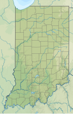 1I8 Location of airport in Indiana | |||||||||||
| Runways | |||||||||||
| |||||||||||

Converse Airport (FAA LID: 1I8) is a public airport 1 mile (1.6 km) west of Converse, in Miami County, Indiana. The airport was founded in October 1944 as one of 26 satellite airfields for Bunker Hill Naval Air Station. The town of Converse gained control of the field in November 1947 after the Navy abandoned the field when the war ended.
References[]
External links[]
Categories:
- Airports in Indiana
- Transportation buildings and structures in Miami County, Indiana