Cook's Harbour
Cook's Harbour | |
|---|---|
Town | |
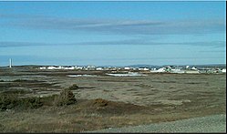 View of Cook's Harbour | |
 Cook's Harbour Location within Newfoundland | |
| Coordinates: 51°36′12″N 55°52′16″W / 51.60333°N 55.87111°WCoordinates: 51°36′12″N 55°52′16″W / 51.60333°N 55.87111°W | |
| Country | |
| Province | |
| Area | |
| • Land | 1.95 km2 (0.75 sq mi) |
| Population (2016)[1] | |
| • Total | 123 |
| • Density | 62.9/km2 (163/sq mi) |
| Time zone | UTC-3:30 (Newfoundland Time) |
| • Summer (DST) | UTC-2:30 (Newfoundland Daylight) |
| Area code(s) | 709 |
| Highways | |


Cook's Harbour is a town in the Canadian province of Newfoundland and Labrador. The town had a population of 123 in the Canada 2016 Census.[1]
History[]
Cook's Harbour was named by Captain James Cook in 1764, during his survey of Newfoundland.[2]
References[]
- ^ a b "Census Profile, 2016 Census". Statistics Canada. February 14, 2017. Retrieved February 15, 2017.
- ^ "Cook's Harbour". Land of First Contact. 2014. Archived from the original on 2014-10-15. Retrieved 2014-10-10.
| Towns |
|  |
|---|---|---|
| Unorganized subdivisions |
| |
| Designated places |
| |
| Subdivisions and statistical units |
|
|---|---|
| Communities |
|
| Cities | |
| Towns |
|
| Inuit community governments | |
| |
This Newfoundland and Labrador location article is a stub. You can help Wikipedia by . |
Categories:
- Towns in Newfoundland and Labrador
- Newfoundland and Labrador geography stubs