Corinda, Queensland
| Corinda Brisbane, Queensland | |||||||||||||||
|---|---|---|---|---|---|---|---|---|---|---|---|---|---|---|---|
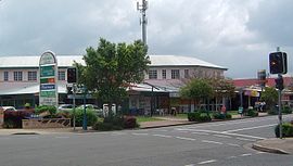 Shops along Oxley Road | |||||||||||||||
 Corinda | |||||||||||||||
| Coordinates | 27°32′33″S 152°59′02″E / 27.5425°S 152.9838°ECoordinates: 27°32′33″S 152°59′02″E / 27.5425°S 152.9838°E | ||||||||||||||
| Population | 5,064 (2016 census)[1] | ||||||||||||||
| • Density | 1,688/km2 (4,370/sq mi) | ||||||||||||||
| Established | 1862 | ||||||||||||||
| Postcode(s) | 4075 | ||||||||||||||
| Area | 3.0 km2 (1.2 sq mi) | ||||||||||||||
| Time zone | AEST (UTC+10:00) | ||||||||||||||
| Location | 13 km (8 mi) SW of Brisbane GPO | ||||||||||||||
| LGA(s) | City of Brisbane (Tennyson Ward)[2] | ||||||||||||||
| State electorate(s) | |||||||||||||||
| Federal Division(s) | Moreton | ||||||||||||||
| |||||||||||||||

Corinda is a suburb in the City of Brisbane, Queensland, Australia.[3] In the 2016 census, Corinda had a population of 5,064 people.[1]
History[]
The suburb takes its name from the Corinda railway station, which in turn was likely named after a local cattle station owned by Sir Arthur Palmer, which he named after his Corinda pastoral station near Aramac.[3]
Corinda was first settled in the 1860s as a small farming community. Among the original settlers was the Francis family who in 1862 purchased 21 acres, which extended from the Brisbane River to Francis Lookout, a local heritage listed[4] landmark on Dewar Terrace. Francis Lookout survives to this day, and includes a small burial ground opened in 1862.[5] Its ten graves include those of some of the pioneer settlers. The oldest of the graves is of Clement Francis who died in 1863. The lychgate, erected by Angela Francis, dates to 1902. Most of the original older-style Queenslander homes date back to the colonial period and were built high on the hills around the lookout.
The first rail line opened in 1874. A small commercial district on Oxley Road gradually grew around it. The Corinda School of Arts (now municipal library) is one of the earliest surviving buildings on this strip and is a small timber structure built in 1895. The commercial district rapidly developed after the 1920s. Many large bungalow styled homes were built on the floodplain toward Oxley Creek during this time.
In October 1883, 140 subdivided allotments of 'Sherwood Junction Estate' were auctioned by J. Cameron. A map advertising the auction shows the Estate was at the junction of the South Brisbane Railway Line.[6][7]
In 1879, the local government area of Yeerongpilly Division was created. In 1891, parts of Yeerongpilly Division were excised to create Sherwood Division becoming a Shire in 1903 which contained the suburb of Corinda. In 1925, the Shire of Sherwood was amalgamated into the City of Brisbane.[8]
In 1915 seeing a need for more Catholic schools, Roman Catholic Archbishop of Brisbane, James Duhig, invited a number of orders of teaching Sisters to come to Brisbane. One of those orders was the Daughters of Our Lady of the Sacred Heart who came to Brisbane and established St Joseph's Catholic Primary School, which opened on 28 January 1917 with 50 students. The school was operated by the Sisters until 1993, when a lay principal was appointed.[9][10]
In July 1920, 32 subdivided allotments of 'Corinda Park Estate' were auctioned by Cameron Bros. A map advertising the auction states the Estate was 10 minutes walk from both Corinda and Oxley Railway Stations[11][12]
Corinda State School opened on 1 June 1927.[10]
St Aidan's Anglican Girls' School opened on 5 February 1929.[10]
Montrose Home School for Crippled Children opened in January 1934. In March 1934 it was renamed Montrose Special School. It closed on 2 June 2006.[10]
Our Lady of the Sacred Heart College opened in January 1941 and closed in December 1972.[10]
Corinda State High School opened on 25 January 1960.[10]
The Corinda RSL was established in 1964 and now trades as the Sherwood Services Club.[13] With the opening of Coles Supermarkets, the commercial centre has continued to develop and extend westward.
The Corinda Library became a branch of the Brisbane City Council library in 1966 and had a major refurbishment in 2016.[14]
The suburb experienced a landslip during the 1974 Brisbane flood which affected more than 20 houses.
In the 2011 census, the population of Corinda was 4,695 people.[15]
In the 2016 census, Corinda had a population of 5,064 people.[1]
Heritage listings[]


Corinda has a number of heritage-listed sites, including:
Open space[]
Corinda has two main parks both sharing the same name but separated at either end of the suburb. One is a forest reserve along the Brisbane River which includes Carrington Rocks and Carrington Boat Club. The other is on the floodplain of Oxley Creek near the bowls club and state school. The historic Francis Lookout reserve has another small park used for the traditional local Carols by Candlelight celebrations run by various local church and school groups. The Sherwood Arboretum borders the suburb but is located in Sherwood.
Places of worship[]
- Christ Community Church West, Cliveden Avenue
- St John’s Lutheran Church, corner Oxley Rd and Clewley Street
- St Joseph's Catholic Church, corner Oxley Rd and Martindale Street
- Grace Bible Church Corinda, corner Hassall and Clara Street
Transport[]

The Corinda railway station provides residents with access to the Brisbane CBD, servicing many suburbs and providing access to many popular entertainment and educational venues along the way, including the Indooroopilly Shopping Centre and the University of Queensland. As a result of changes to transport planning in July 2011, there is also a less frequent bus service (Bus 104) to Tennyson railway station.
Education[]
Corinda State School is a government primary (Prep-6) school for boys and girls at 330 Cliveden Avenue (27°32′57″S 152°58′53″E / 27.5493°S 152.9815°E).[19][20] In 2017, the school had an enrolment of 575 students with 45 teachers (39 full-time equivalent) and 23 non-teaching staff (14 full-time equivalent).[21] It includes a special education program.[19]

St Joseph's Primary School is a Catholic primary (Prep-6) school for boys and girls at 28 Clewley Street (27°32′17″S 152°58′57″E / 27.5380°S 152.9825°E) near the Corinda Village Shopping Centre.[19][22] In 2017, the school had an enrolment of 456 students with 33 teachers (28 full-time equivalent) and 13 non-teaching staff (6 full-time equivalent).[21]
Corinda State High School is a government secondary (7–12) school for boys and girls at 46 Pratten Street (27°32′39″S 152°59′11″E / 27.5443°S 152.9864°E).[19][23] In 2017, the school had an enrolment of 1788 students with 138 teachers (132 full-time equivalent) and 55 non-teaching staff (43 full-time equivalent).[21] It includes a special education program.[19][24]
St Aidan's Anglican Girls School is a private primary and secondary (Prep-12) school for girls at 11 Ruthven Street (27°32′19″S 152°58′43″E / 27.5387°S 152.9787°E) near the railway line.[19][25] In 2017, the school had an enrolment of 711 students with 71 teachers (60 full-time equivalent) and 76 non-teaching staff (45 full-time equivalent).[21]
Amenities[]

- The Brisbane City Council operates a public library at 641 Oxley Road.[26]
- The is a 50-metre, heated, outdoor pool at 794 Oxley Road, Corinda, QLD, 4075.[27]
- The Corinda Horse and Pony Club is located at the end of Rinora St, Corinda QLD 4075.
Natural hazards[]
As the suburb is bounded by the Brisbane River and Oxley Creek, parts of the suburb are susceptible, in extreme circumstances, to flooding. Parts of the suburb are also susceptible to landslip, as demonstrated in the 1974 Corinda Landslip.
Demographics[]
In the 2011 census, the population of Corinda was 4,695, consisting of 52.3% female and 47.7% male. The median age of the Corinda population was 39 years, two years above the Australian median. 71.8% of people living in Corinda were born in Australia, similar to the national average of 69.8%. The other top responses for country of birth were England 4.9%, New Zealand 2.9%, India 1.1%, Philippines 0.8%, Germany 0.7%. 82.9% of people speak only English at home, while other languages include 0.9% Vietnamese, 0.8% Spanish, 0.8% Mandarin, 0.6% Cantonese, 0.6% Arabic.[15]
References[]
- ^ Jump up to: a b c Australian Bureau of Statistics (27 June 2017). "Corinda (SSC)". 2016 Census QuickStats. Retrieved 20 October 2018.

- ^ "Tennyson Ward". Brisbane City Council. Brisbane City Council. Archived from the original on 4 March 2017. Retrieved 19 March 2017.
- ^ Jump up to: a b "Corinda – suburb in City of Brisbane (entry 43030)". Queensland Place Names. Queensland Government. Retrieved 25 January 2020.
- ^ "Francis Lookout (entry 602441)". Queensland Heritage Register. Queensland Heritage Council. Retrieved 13 July 2015.
- ^ Francis Lookout burial ground, Corinda, Brisbane Archived 27 September 2011 at the Wayback Machine. Retrieved 13 February 2011.
- ^ "Sherwood Junction Estate, Parish of Oxley being subdivisions 1 to 48 of portions 90 & 91". 29 October 1883. hdl:10462/deriv/436439. Cite journal requires
|journal=(help) - ^ "Advertising". The Telegraph (3, 443). Queensland, Australia. 27 October 1883. p. 8. Retrieved 26 March 2019 – via National Library of Australia.
- ^ Fones, Ralph (1 January 1993). "Suburban conservatism in the Sherwood Shire 1891-1920". UQ eSpace. Archived from the original on 2 March 2020. Retrieved 2 March 2020.
- ^ "School History" (PDF). St Joseph's Catholic Primary School. Archived (PDF) from the original on 9 November 2019. Retrieved 9 November 2019.
- ^ Jump up to: a b c d e f Queensland Family History Society (2010), Queensland schools past and present (Version 1.01 ed.), Queensland Family History Society, ISBN 978-1-921171-26-0
- ^ "Corinda Park Estate". 3 July 1920. hdl:10462/deriv/427737. Cite journal requires
|journal=(help) - ^ "Advertising". The Telegraph (14, 841). Queensland, Australia. 21 June 1920. p. 12. Retrieved 26 March 2019 – via National Library of Australia.
- ^ Sherwood Club History Archived 30 March 2011 at the Wayback Machine. Services Club. Retrieved 13 February 2011.
- ^ "Public Libraries Statistical Bulletin 2016-17" (PDF). Public Libraries Connect. State Library of Queensland. November 2017. p. 11. Archived (PDF) from the original on 30 January 2018. Retrieved 30 January 2018.
- ^ Jump up to: a b Australian Bureau of Statistics (31 October 2012). "Corinda (State Suburb)". 2011 Census QuickStats. Retrieved 18 February 2020.
- ^ "Monkton (entry 601170)". Queensland Heritage Register. Queensland Heritage Council. Retrieved 6 July 2013.
- ^ "Francis Lookout (entry 602441)". Queensland Heritage Register. Queensland Heritage Council. Retrieved 6 July 2013.
- ^ "Weemalla (entry 602820)". Queensland Heritage Register. Queensland Heritage Council. Retrieved 23 December 2014.
- ^ Jump up to: a b c d e f "State and non-state school details". Queensland Government. 9 July 2018. Archived from the original on 21 November 2018. Retrieved 21 November 2018.
- ^ "Corinda State School". Archived from the original on 20 April 2013. Retrieved 21 November 2018.
- ^ Jump up to: a b c d "ACARA School Profile 2017". Archived from the original on 22 November 2018. Retrieved 22 November 2018.
- ^ "St Joseph's Primary School". Archived from the original on 11 August 2011. Retrieved 21 November 2018.
- ^ "Corinda State High School". Archived from the original on 25 January 2019. Retrieved 21 November 2018.
- ^ "Corinda SHS - Special Education Program". Archived from the original on 25 January 2019. Retrieved 21 November 2018.
- ^ "St Aidan's Anglican Girls School". Archived from the original on 20 November 2018. Retrieved 21 November 2018.
- ^ "Library opening hours and locations". Brisbane City Council. 3 January 2018. Archived from the original on 30 January 2018. Retrieved 30 January 2018.
- ^ "Pool opening hours and facilities". Brisbane City Council. 12 October 2019. Archived from the original on 11 October 2019. Retrieved 11 October 2019.
External links[]
| Wikimedia Commons has media related to Corinda, Queensland. |
- "Corinda". Queensland Places. Centre for the Government of Queensland, University of Queensland.
- "Corinda". BRISbites. Brisbane City Council. Archived from the original on 19 July 2008.
- "Corinda". Our Brisbane. Brisbane City Council. Archived from the original on 22 December 2007.
- Suburbs of the City of Brisbane
- Corinda, Queensland
- 1862 establishments in Australia