Wakerley, Queensland
| Wakerley Brisbane, Queensland | |||||||||||||||
|---|---|---|---|---|---|---|---|---|---|---|---|---|---|---|---|
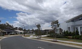 Watervale Parade, 2014 | |||||||||||||||
 Wakerley | |||||||||||||||
| Coordinates | 27°28′54″S 153°09′33″E / 27.4816°S 153.1591°ECoordinates: 27°28′54″S 153°09′33″E / 27.4816°S 153.1591°E | ||||||||||||||
| Population | 8,445 (2016 census)[1] | ||||||||||||||
| • Density | 1,723/km2 (4,460/sq mi) | ||||||||||||||
| Postcode(s) | 4154 | ||||||||||||||
| Area | 4.9 km2 (1.9 sq mi) | ||||||||||||||
| Time zone | AEST (UTC+10:00) | ||||||||||||||
| Location | 17.7 km (11 mi) E of Brisbane GPO | ||||||||||||||
| LGA(s) | City of Brisbane (Chandler Ward;[2] Doboy Ward)[3] | ||||||||||||||
| State electorate(s) | Chatsworth | ||||||||||||||
| Federal division(s) | Bonner | ||||||||||||||
| |||||||||||||||

Wakerley is a suburb in the City of Brisbane, Queensland, Australia.[4] In the 2016 census, Wakerley had a population of 8,445 people.[1]
Geography[]
Wakerley is south of the Brisbane River, 15 kilometres (9.3 mi) east of the Brisbane CBD, and close to the Southern bayside suburbs.
History[]

Wakerley was named after early settler John William Wakerley.[4]
Agnew School opened on 3 February 2003.[5]
In the 2011 census, the population of Wakerley was 7,804.[6]
In the 2016 census, Wakerley had a population of 8,445 people.[1]
Education[]
Agnew School is a private primary and secondary (3-12) school for boys and girls at 190 Ingleston Road (27°29′07″S 153°08′30″E / 27.4852°S 153.1417°E).[7][8] In 2018, the school had an enrolment of 318 students with 36 teachers (32 full-time equivalent) and 26 non-teaching staff (20 full-time equivalent).[9]
Demographics[]
In the 2011 census, the population of Wakerley was 7,804, 50.9% female and 49.1% male.[6] The median age of the Wakerley population was 33 years, 4 years below the Australian median. 68.7% of people living in Wakerley were born in Australia, compared to the national average of 69.8%; the next most common countries of birth were England 6.5%, New Zealand 6.3%, South Africa 4%, Scotland 1%, India 0.6%. 85.8% of people spoke only English at home; the next most common languages were 1.8% Afrikaans, 0.9% Greek, 0.7% Spanish, 0.6% Hindi, 0.6% Italian.[6]
References[]
- ^ a b c Australian Bureau of Statistics (27 June 2017). "Wakerley (SSC)". 2016 Census QuickStats. Retrieved 20 October 2018.

- ^ "Chandler Ward". Brisbane City Council. Brisbane City Council. Archived from the original on 4 February 2017. Retrieved 12 March 2017.
- ^ "Doboy Ward". Brisbane City Council. Brisbane City Council. Archived from the original on 14 June 2018. Retrieved 12 March 2017.
- ^ a b "Wakerley – suburb in City of Brisbane (entry 49639)". Queensland Place Names. Queensland Government. Retrieved 11 October 2020.
- ^ "Opening and closing dates of Queensland Schools". Queensland Government. Retrieved 18 April 2019.
- ^ a b c Australian Bureau of Statistics (31 October 2012). "Wakerley, Qld (State Suburb)". 2011 Census QuickStats. Retrieved 24 October 2013.
- ^ "State and non-state school details". Queensland Government. 9 July 2018. Archived from the original on 21 November 2018. Retrieved 21 November 2018.
- ^ "Agnew School". Archived from the original on 14 November 2018. Retrieved 21 November 2018.
- ^ "ACARA School Profile 2018". Australian Curriculum, Assessment and Reporting Authority. Archived from the original on 27 August 2020. Retrieved 28 January 2020.
External links[]
- "Wakerley". Queensland Places. Centre for the Government of Queensland, University of Queensland.
- ourbrisbane.com website, Wakerley section
- Suburbs of the City of Brisbane