Crépy, Aisne
show This article may be expanded with text translated from the corresponding article in French. (December 2008) Click [show] for important translation instructions. |
Crépy | |
|---|---|
Commune | |
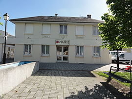 The town hall of Crépy | |
 Coat of arms | |
show Location of Crépy | |
 Crépy | |
| Coordinates: 49°36′18″N 3°30′53″E / 49.605°N 3.5147°ECoordinates: 49°36′18″N 3°30′53″E / 49.605°N 3.5147°E | |
| Country | France |
| Region | Hauts-de-France |
| Department | Aisne |
| Arrondissement | Laon |
| Canton | Laon-1 |
| Intercommunality | Pays de Laon |
| Government | |
| • Mayor (2020–2026) | Fabrice Fèron[1] |
| Area 1 | 27.7 km2 (10.7 sq mi) |
| Population (Jan. 2018)[2] | 1,830 |
| • Density | 66/km2 (170/sq mi) |
| Time zone | UTC+01:00 (CET) |
| • Summer (DST) | UTC+02:00 (CEST) |
| INSEE/Postal code | 02238 /02870 |
| Elevation | 63–183 m (207–600 ft) (avg. 79 m or 259 ft) |
| 1 French Land Register data, which excludes lakes, ponds, glaciers > 1 km2 (0.386 sq mi or 247 acres) and river estuaries. | |


Crépy, formerly known as Crépy-en-Laonnais, is a commune in the Aisne department in Hauts-de-France in northern France.
History[]
The treaty of Crépy, during the Italian War of 1542–1546 was signed there between Francis I of France and Holy Roman Emperor Charles V on 18 September 1544.[a]
Population[]
| Year | Pop. | ±% |
|---|---|---|
| 1962 | 1,567 | — |
| 1968 | 1,534 | −2.1% |
| 1975 | 1,441 | −6.1% |
| 1982 | 1,543 | +7.1% |
| 1990 | 1,574 | +2.0% |
| 1999 | 1,710 | +8.6% |
| 2008 | 1,860 | +8.8% |
| 2012 | 1,946 | +4.6% |
Geography[]
Climate[]
This area is characterized by equable climates with few extremes of temperature and ample precipitation in all months. It is located poleward of the Mediterranean climate region on the western sides of the continents, between 35° and 60° N and S latitude. The Köppen Climate Classification subtype for this climate is "Cfb". (Marine West Coast Climate).[3]
| hideClimate data for Crépy, Aisne | |||||||||||||
|---|---|---|---|---|---|---|---|---|---|---|---|---|---|
| Month | Jan | Feb | Mar | Apr | May | Jun | Jul | Aug | Sep | Oct | Nov | Dec | Year |
| Average high °C (°F) | 4 (39) |
6 (42) |
10 (50) |
14 (57) |
18 (64) |
21 (69) |
22 (71) |
21 (69) |
19 (66) |
14 (57) |
8 (46) |
6 (42) |
13 (55) |
| Average low °C (°F) | 0 (32) |
0 (32) |
1 (33) |
4 (39) |
7 (44) |
10 (50) |
12 (53) |
11 (51) |
9 (48) |
6 (42) |
3 (37) |
1 (33) |
5 (41) |
| Average precipitation mm (inches) | 46 (1.8) |
46 (1.8) |
43 (1.7) |
41 (1.6) |
46 (1.8) |
53 (2.1) |
58 (2.3) |
51 (2) |
51 (2) |
48 (1.9) |
51 (2) |
58 (2.3) |
570 (22.6) |
| Source: Weatherbase [4] | |||||||||||||
See also[]
Notes[]
- ^ At the time of the treaty Crépy was spelt Crespy so the treaty is also known as the Treaty of Crespy ("Crespy, Treaty of." The Columbia Encyclopedia, 6th ed.. 2013. Encyclopedia.com. (July 22, 2014). Cited in encyclopedia.com
References[]
- ^ "Répertoire national des élus: les maires". data.gouv.fr, Plateforme ouverte des données publiques françaises (in French). 2 December 2020.
- ^ "Populations légales 2018". INSEE. 28 December 2020.
- ^ [Climate Summary for Crépy, France]
- ^ "Weatherbase.com". Weatherbase. 2013. Retrieved on May 8, 2013.
| Wikimedia Commons has media related to Crépy, Aisne. |
This Laon arrondissement geographical article is a stub. You can help Wikipedia by . |
Categories:
- Communes of Aisne
- Laon arrondissement geography stubs