Pontruet
This article may be expanded with text translated from the corresponding article in French. (December 2008) Click [show] for important translation instructions.
|
Pontruet | |
|---|---|
Commune | |
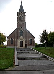 The church of Pontruet | |
Location of Pontruet  | |
 Pontruet | |
| Coordinates: 49°54′37″N 3°13′54″E / 49.9103°N 3.2317°ECoordinates: 49°54′37″N 3°13′54″E / 49.9103°N 3.2317°E | |
| Country | France |
| Region | Hauts-de-France |
| Department | Aisne |
| Arrondissement | Saint-Quentin |
| Canton | Saint-Quentin-1 |
| Intercommunality | Pays du Vermandois |
| Government | |
| • Mayor (2020–2026) | Jean-Pierre Merlin[1] |
| Area 1 | 6.75 km2 (2.61 sq mi) |
| Population (Jan. 2018)[2] | 348 |
| • Density | 52/km2 (130/sq mi) |
| Time zone | UTC+01:00 (CET) |
| • Summer (DST) | UTC+02:00 (CEST) |
| INSEE/Postal code | 02615 /02490 |
| Elevation | 72–143 m (236–469 ft) (avg. 72 m or 236 ft) |
| 1 French Land Register data, which excludes lakes, ponds, glaciers > 1 km2 (0.386 sq mi or 247 acres) and river estuaries. | |


Pontruet is a commune in the Aisne department in Hauts-de-France in northern France.
Population[]
| Year | Pop. | ±% |
|---|---|---|
| 1962 | 173 | — |
| 1968 | 157 | −9.2% |
| 1975 | 210 | +33.8% |
| 1982 | 274 | +30.5% |
| 1990 | 287 | +4.7% |
| 1999 | 324 | +12.9% |
| 2008 | 345 | +6.5% |
See also[]
References[]
- ^ "Répertoire national des élus: les maires". data.gouv.fr, Plateforme ouverte des données publiques françaises (in French). 9 August 2021.
- ^ "Populations légales 2018". The National Institute of Statistics and Economic Studies. 28 December 2020.
| Wikimedia Commons has media related to Pontruet. |
| Prefecture |
|
|---|---|
| Subprefectures |
|
| Other |
|
This Saint-Quentin arrondissement geographical article is a stub. You can help Wikipedia by . |
Categories:
- Communes of Aisne
- Saint-Quentin arrondissement geography stubs