Rozières-sur-Crise
This article may be expanded with text translated from the corresponding article in French. (December 2008) Click [show] for important translation instructions.
|
Rozières-sur-Crise | |
|---|---|
Commune | |
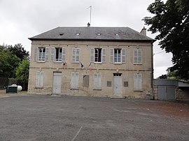 The town hall of Rozières-sur-Crise | |
Location of Rozières-sur-Crise  | |
 Rozières-sur-Crise | |
| Coordinates: 49°19′39″N 3°21′20″E / 49.3275°N 3.3556°ECoordinates: 49°19′39″N 3°21′20″E / 49.3275°N 3.3556°E | |
| Country | France |
| Region | Hauts-de-France |
| Department | Aisne |
| Arrondissement | Soissons |
| Canton | Villers-Cotterêts |
| Intercommunality | Oulchy le Château |
| Government | |
| • Mayor (2020–2026) | Louis-Jean Leclercq[1] |
| Area 1 | 7.32 km2 (2.83 sq mi) |
| Population (Jan. 2018)[2] | 224 |
| • Density | 31/km2 (79/sq mi) |
| Time zone | UTC+01:00 (CET) |
| • Summer (DST) | UTC+02:00 (CEST) |
| INSEE/Postal code | 02663 /02200 |
| Elevation | 57–166 m (187–545 ft) (avg. 70 m or 230 ft) |
| 1 French Land Register data, which excludes lakes, ponds, glaciers > 1 km2 (0.386 sq mi or 247 acres) and river estuaries. | |


Rozières-sur-Crise is a commune in the Aisne department in Hauts-de-France in northern France.
Population[]
| Year | Pop. | ±% |
|---|---|---|
| 1962 | 196 | — |
| 1968 | 166 | −15.3% |
| 1975 | 163 | −1.8% |
| 1982 | 206 | +26.4% |
| 1990 | 271 | +31.6% |
| 1999 | 261 | −3.7% |
| 2008 | 233 | −10.7% |
See also[]
References[]
- ^ "Répertoire national des élus: les maires". data.gouv.fr, Plateforme ouverte des données publiques françaises (in French). 9 August 2021.
- ^ "Populations légales 2018". The National Institute of Statistics and Economic Studies. 28 December 2020.
| Wikimedia Commons has media related to Rozières-sur-Crise. |
| Prefecture |
|
|---|---|
| Subprefectures |
|
| Other |
|
This Soissons arrondissement geographical article is a stub. You can help Wikipedia by . |
Categories:
- Communes of Aisne
- Soissons arrondissement geography stubs