Taillefontaine
This article may be expanded with text translated from the corresponding article in French. (December 2008) Click [show] for important translation instructions.
|
Taillefontaine | |
|---|---|
Commune | |
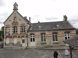 The town hall and school of Taillefontaine | |
Location of Taillefontaine  | |
 Taillefontaine | |
| Coordinates: 49°18′43″N 3°02′36″E / 49.3119°N 3.0433°ECoordinates: 49°18′43″N 3°02′36″E / 49.3119°N 3.0433°E | |
| Country | France |
| Region | Hauts-de-France |
| Department | Aisne |
| Arrondissement | Soissons |
| Canton | Villers-Cotterêts |
| Intercommunality | |
| Government | |
| • Mayor (2020–2026) | Anne-Benoîte Valiergue |
| Area 1 | 10.63 km2 (4.10 sq mi) |
| Population (Jan. 2018)[1] | 277 |
| • Density | 26/km2 (67/sq mi) |
| Time zone | UTC+01:00 (CET) |
| • Summer (DST) | UTC+02:00 (CEST) |
| INSEE/Postal code | 02734 /02600 |
| Elevation | 65–238 m (213–781 ft) (avg. 103 m or 338 ft) |
| 1 French Land Register data, which excludes lakes, ponds, glaciers > 1 km2 (0.386 sq mi or 247 acres) and river estuaries. | |


Taillefontaine is a commune in the Aisne department in Hauts-de-France in northern France.
Population[]
| Year | Pop. | ±% |
|---|---|---|
| 2006 | 276 | — |
| 2007 | 274 | −0.7% |
| 2008 | 274 | +0.0% |
| 2009 | 276 | +0.7% |
| 2010 | 271 | −1.8% |
| 2011 | 267 | −1.5% |
| 2012 | 262 | −1.9% |
| 2013 | 259 | −1.1% |
| 2014 | 258 | −0.4% |
| 2015 | 264 | +2.3% |
| 2016 | 270 | +2.3% |
See also[]
References[]
- ^ "Populations légales 2018". The National Institute of Statistics and Economic Studies. 28 December 2020.
| Wikimedia Commons has media related to Taillefontaine. |
| Prefecture |
|
|---|---|
| Subprefectures |
|
| Other |
|
This Soissons arrondissement geographical article is a stub. You can help Wikipedia by . |
Categories:
- Communes of Aisne
- Soissons arrondissement geography stubs