Le Thuel
This article may be expanded with text translated from the corresponding article in French. (December 2008) Click [show] for important translation instructions.
|
Le Thuel | |
|---|---|
Commune | |
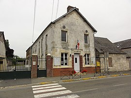 The town hall of Le Thuel | |
Location of Le Thuel  | |
 Le Thuel | |
| Coordinates: 49°39′00″N 4°04′39″E / 49.65°N 4.0775°ECoordinates: 49°39′00″N 4°04′39″E / 49.65°N 4.0775°E | |
| Country | France |
| Region | Hauts-de-France |
| Department | Aisne |
| Arrondissement | Vervins |
| Canton | Vervins |
| Intercommunality | Portes de la Thiérache |
| Government | |
| • Mayor (2020–2026) | David Vandenhende[1] |
| Area 1 | 7.06 km2 (2.73 sq mi) |
| Population (Jan. 2018)[2] | 161 |
| • Density | 23/km2 (59/sq mi) |
| Time zone | UTC+01:00 (CET) |
| • Summer (DST) | UTC+02:00 (CEST) |
| INSEE/Postal code | 02743 /02340 |
| Elevation | 112–172 m (367–564 ft) (avg. 175 m or 574 ft) |
| 1 French Land Register data, which excludes lakes, ponds, glaciers > 1 km2 (0.386 sq mi or 247 acres) and river estuaries. | |


Le Thuel (French pronunciation: [lə tɥɛl]) is a commune in the Aisne department in Hauts-de-France in northern France.
Population[]
| Year | Pop. | ±% |
|---|---|---|
| 1962 | 191 | — |
| 1968 | 175 | −8.4% |
| 1975 | 135 | −22.9% |
| 1982 | 164 | +21.5% |
| 1990 | 154 | −6.1% |
| 1999 | 149 | −3.2% |
| 2008 | 168 | +12.8% |
See also[]
References[]
- ^ "Répertoire national des élus: les maires". data.gouv.fr, Plateforme ouverte des données publiques françaises (in French). 9 August 2021.
- ^ "Populations légales 2018". The National Institute of Statistics and Economic Studies. 28 December 2020.
| Wikimedia Commons has media related to Le Thuel. |
| Prefecture |
|
|---|---|
| Subprefectures |
|
| Other |
|
This Vervins arrondissement geographical article is a stub. You can help Wikipedia by . |
Categories:
- Communes of Aisne
- Vervins arrondissement geography stubs