Monthiers
This article may be expanded with text translated from the corresponding article in French. (December 2008) Click [show] for important translation instructions.
|
Monthiers | |
|---|---|
Commune | |
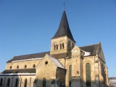 The church of Monthiers | |
Location of Monthiers  | |
 Monthiers | |
| Coordinates: 49°06′14″N 3°17′56″E / 49.1039°N 3.2989°ECoordinates: 49°06′14″N 3°17′56″E / 49.1039°N 3.2989°E | |
| Country | France |
| Region | Hauts-de-France |
| Department | Aisne |
| Arrondissement | Château-Thierry |
| Canton | Villers-Cotterêts |
| Government | |
| • Mayor (2020–2026) | Nicole Sarrouy |
| Area 1 | 7.37 km2 (2.85 sq mi) |
| Population (Jan. 2018)[1] | 159 |
| • Density | 22/km2 (56/sq mi) |
| Time zone | UTC+01:00 (CET) |
| • Summer (DST) | UTC+02:00 (CEST) |
| INSEE/Postal code | 02509 /02400 |
| Elevation | 87–199 m (285–653 ft) (avg. 95 m or 312 ft) |
| 1 French Land Register data, which excludes lakes, ponds, glaciers > 1 km2 (0.386 sq mi or 247 acres) and river estuaries. | |


Monthiers (French pronunciation: [mɔ̃tje]) is a commune in the Aisne department in Hauts-de-France in northern France.
Population[]
| Year | Pop. | ±% |
|---|---|---|
| 1962 | 118 | — |
| 1968 | 126 | +6.8% |
| 1975 | 108 | −14.3% |
| 1982 | 117 | +8.3% |
| 1990 | 111 | −5.1% |
| 1999 | 142 | +27.9% |
| 2008 | 163 | +14.8% |
See also[]
References[]
- ^ "Populations légales 2018". The National Institute of Statistics and Economic Studies. 28 December 2020.
| Wikimedia Commons has media related to Monthiers. |
| Prefecture |
|
|---|---|
| Subprefectures |
|
| Other |
|
This Château-Thierry arrondissement geographical article is a stub. You can help Wikipedia by . |
Categories:
- Communes of Aisne
- Château-Thierry arrondissement geography stubs