Daporijo Airport
Daporijo Airport डपॉरिजी हवाई अड्डे | |||||||||||
|---|---|---|---|---|---|---|---|---|---|---|---|
| |||||||||||
| Summary | |||||||||||
| Airport type | Public | ||||||||||
| Operator | Indian Air Force | ||||||||||
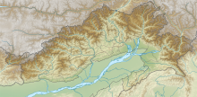
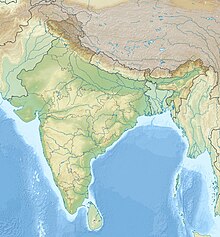
| Location | Daporijo, Arunachal Pradesh, India | ||||||||||
| Elevation AMSL | 229 m / 750 ft | ||||||||||
| Coordinates | 27°59′00″N 094°13′00″E / 27.98333°N 94.21667°ECoordinates: 27°59′00″N 094°13′00″E / 27.98333°N 94.21667°E | ||||||||||
| Map | |||||||||||
 DEP | |||||||||||
| Runways | |||||||||||
| |||||||||||

Daporijo Airport (IATA: DEP, ICAO: VEDZ) is located at Daporijo in the state of Arunachal Pradesh, India. Daporijo used to have scheduled services in the 1980s and early 1990s from Vayudoot. The airport had flights to Guwahati and Dibrugarh on Dornier 228 aircraft. Currently, there is no scheduled commercial air service to the airport, although the airport is used by the Indian Army. The Airports Authority of India (AAI) plans to develop the airport for operation of ATR-42/ATR-72 type of aircraft.[1]
See also[]
- Arunachal Pradesh
- North-East Frontier Agency
- List of people from Arunachal Pradesh
- Religion in Arunachal Pradesh
- Cuisine of Arunachal Pradesh
- Military bases
- List of ALGs
- List of Indian Air Force stations
- India-China military deployment on LAC
- List of disputed India-China areas
- Tianwendian
- Ukdungle
- Borders
- Line of Actual Control (LAC)
- Borders of China
- Borders of India
- Conflicts
- Sino-Indian conflict
- List of disputed territories of China
- List of disputed territories of India
- Other related topics
- India-China Border Roads
- List of extreme points of India
- Defence Institute of High Altitude Research
- Independent Golden Jubilee Government Higher Secondary School, Pasighat
References[]
- ^ http://pib.nic.in/newsite/erelease.aspx?relid=95050 Better Air Connectivity for NE Region
External links[]
This article about an airport in India is a stub. You can help Wikipedia by . |
Categories:
- Airports in Arunachal Pradesh
- Upper Subansiri district
- Indian airport stubs
- Arunachal Pradesh stubs