Donakonda Airport
This article needs additional citations for verification. (December 2021) |
Donakonda Airport Donakoṇḍa Vimānāśrayaṃ | |||||||||||
|---|---|---|---|---|---|---|---|---|---|---|---|
 | |||||||||||
| Summary | |||||||||||
| Airport type | Public | ||||||||||
| Operator | Airports Authority of India | ||||||||||
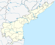
| Location | Donakonda, Andhra Pradesh | ||||||||||
| Elevation AMSL | 467 ft / 142 m | ||||||||||
| Coordinates | 15°49′28″N 079°29′12″E / 15.82444°N 79.48667°ECoordinates: 15°49′28″N 079°29′12″E / 15.82444°N 79.48667°E | ||||||||||
| Map | |||||||||||
 VODK | |||||||||||
| Runways | |||||||||||
| |||||||||||


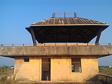
Donakonda Airport (ICAO: VODK) is located at Donakonda in the Prakasam district of Andhra Pradesh, India. It was constructed during the Second World War by the British to refuel its aircraft.[1] It is owned by the Airports Authority of India and is closed.[citation needed]
Airlines and destinations[]
There are no scheduled commercial air services.[citation needed]
References[]
- ^ S., Murali (21 March 2014). "Debates take Donakonda turn". The Hindu. Retrieved 31 March 2014.
External links[]
| Wikimedia Commons has media related to Donakonda Airport. |
This article about an airport in India is a stub. You can help Wikipedia by . |
This article about a location in Prakasam district, Andhra Pradesh is a stub. You can help Wikipedia by . |
Categories:
- Airports in Andhra Pradesh
- Buildings and structures in Prakasam district
- Transport in Prakasam district
- 1940s establishments in India
- Airports established in the 1940s
- Indian airport stubs
- Prakasam district geography stubs