Lalgarh Airport
Sri Ganganagar Airport | |||||||||||
|---|---|---|---|---|---|---|---|---|---|---|---|
| |||||||||||
| Summary | |||||||||||
| Airport type | Public | ||||||||||
| Operator | Rajasthan Government | ||||||||||
| Serves | Sri Ganganagar | ||||||||||
| Location | Sri Ganganagar , India | ||||||||||
| Elevation AMSL | 178 m / 584 ft | ||||||||||
| Coordinates | 29°50′59″N 074°01′28″E / 29.84972°N 74.02444°ECoordinates: 29°50′59″N 074°01′28″E / 29.84972°N 74.02444°E | ||||||||||
| Map | |||||||||||
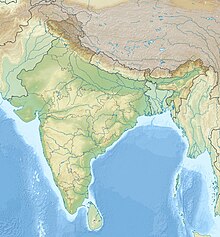
 Sri Ganganagar Airport Location of airport in India | |||||||||||
| Runways | |||||||||||
| |||||||||||

Sri Ganganagar Airport is located at Lalgarh jattan, 21 kilometres South-East of Sri Ganganagar, in the state of Rajasthan, India.[1] It is owned and operated by the State Government of Rajasthan. The airport is spread over 65 acres, has a 1300 metre long runway and a 4410 square metre apron for two small aircraft. A 125 square metre rest house serves as a terminal building.
The district administration plans to expand the airport at a cost of 28.5 crore to enable the operation of larger aircraft.[2] The State Civil Aviation Department signed a Memorandum of Understanding (MoU) with the Indian Army in November 2017, allowing the Army to use the airstrip for 10 years.[3]
References[]
- ^ "National Register of Airports - Lalgarh" (PDF). Airports Authority of India. Retrieved 15 July 2018.
- ^ "Ganganagar expands airstrip to connect with Jaipur, Delhi". The Times of India. 29 June 2017. Retrieved 15 July 2018.
- ^ "Army, Raj govt sign MoU to improve infrastructure near border". Business Standard. 30 November 2017. Retrieved 15 July 2018.
This article about an airport in India is a stub. You can help Wikipedia by . |
- Airports in Rajasthan
- Sri Ganganagar district
- Indian airport stubs