Denton, Maryland
Denton, Maryland | |
|---|---|
Town | |
| Town of Denton | |
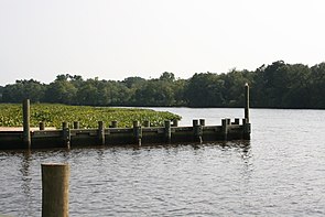 The Choptank River in July 2008 | |
 Seal | |
| Motto(s): "The Garden of America"[1] | |
 Location in Caroline County and the U.S. state of Maryland | |
 Denton Location within the U.S. state of Maryland | |
| Coordinates: 38°53′2″N 75°49′36″W / 38.88389°N 75.82667°WCoordinates: 38°53′2″N 75°49′36″W / 38.88389°N 75.82667°W | |
| Country | |
| State | |
| County | |
| Founded | 1781 |
| Incorporated | 1802[2] |
| Government | |
| • Mayor | Abigail W. McNinch |
| • Town Admin. | Donald Mulrine |
| Area | |
| • Total | 5.35 sq mi (13.86 km2) |
| • Land | 5.27 sq mi (13.64 km2) |
| • Water | 0.09 sq mi (0.22 km2) |
| Elevation | 43 ft (13 m) |
| Population | |
| • Total | 4,418 |
| • Estimate (2019)[5] | 4,512 |
| • Density | 856.65/sq mi (330.73/km2) |
| Time zone | UTC−5 (Eastern (EST)) |
| • Summer (DST) | UTC−4 (EDT) |
| ZIP code | 21629 |
| Area code(s) | 410 |
| FIPS code | 24-22725 |
| GNIS feature ID | 0590087 |
| Website | www.DentonMaryland.com |


Denton is a town in Caroline County, Maryland, United States. The population of Denton was 4,418 as of the 2010 United States Census, and it is the county seat of Caroline County.[6]
History[]
Denton was established in 1781.[7] It was first called Eden Town, for Sir Robert Eden, the last royal governor of Maryland, and over time Eden Town was shortened to Denton.[8][9] The town was incorporated in 1802.[10]
The interprets the ag-based heritage of the town and surrounding area.
Geography[]
Denton is located at 38°53′2″N 75°49′36″W / 38.88389°N 75.82667°W (38.883853, -75.826556).[11]
According to the United States Census Bureau, the town has a total area of 5.50 square miles (14.24 km2), of which 5.28 square miles (13.68 km2) is land and 0.22 square miles (0.57 km2) is water.[12]
Climate[]
The climate in this area is characterized by hot, humid summers and generally mild to cool winters. According to the Köppen Climate Classification system, Denton has a humid subtropical climate, abbreviated "Cfa" on climate maps.[13]
Demographics[]
| Historical population | |||
|---|---|---|---|
| Census | Pop. | %± | |
| 1870 | 431 | — | |
| 1880 | 469 | 8.8% | |
| 1890 | 641 | 36.7% | |
| 1900 | 900 | 40.4% | |
| 1910 | 1,481 | 64.6% | |
| 1920 | 1,570 | 6.0% | |
| 1930 | 1,604 | 2.2% | |
| 1940 | 1,572 | −2.0% | |
| 1950 | 1,806 | 14.9% | |
| 1960 | 1,938 | 7.3% | |
| 1970 | 1,561 | −19.5% | |
| 1980 | 1,927 | 23.4% | |
| 1990 | 2,977 | 54.5% | |
| 2000 | 2,960 | −0.6% | |
| 2010 | 4,418 | 49.3% | |
| 2019 (est.) | 4,512 | [5] | 2.1% |
| U.S. Decennial Census[14] | |||
2010 census[]
As of the census[4] of 2010, there were 4,418 people, 1,606 households, and 1,034 families living in the town. The population density was 836.7 inhabitants per square mile (323.1/km2). There were 1,791 housing units at an average density of 339.2 per square mile (131.0/km2). The racial makeup of the town was 71.8% White, 22.9% African American, 0.4% Native American, 0.6% Asian, 1.0% from other races, and 3.1% from two or more races. Hispanic or Latino of any race were 3.3% of the population.
There were 1,606 households, of which 38.6% had children under the age of 18 living with them, 40.7% were married couples living together, 18.7% had a female householder with no husband present, 4.9% had a male householder with no wife present, and 35.6% were non-families. 29.3% of all households were made up of individuals, and 13% had someone living alone who was 65 years of age or older. The average household size was 2.56 and the average family size was 3.17.
The median age in the town was 35.8 years. 26.6% of residents were under the age of 18; 8.2% were between the ages of 18 and 24; 27.1% were from 25 to 44; 23.1% were from 45 to 64; and 15.1% were 65 years of age or older. The gender makeup of the town was 46.7% male and 53.3% female.
2000 census[]
As of the census[15] of 2000, there were 2,960 people, 1,140 households, and 697 families living in the town. The population density was 1,205.0 people per square mile (464.6/km2). There were 1,264 housing units at an average density of 514.6 per square mile (198.4/km2). The racial makeup of the town was 71.66% White, 25.44% African American, 0.34% Native American, 0.37% Asian, 0.24% from other races, and 1.96% from two or more races. Hispanic or Latino of any race were 1.86% of the population.
There were 1,140 households, out of which 31.1% had children under the age of 18 living with them, 37.7% were married couples living together, 17.7% had a female householder with no husband present, and 38.8% were non-families. 33.5% of all households were made up of individuals, and 15.0% had someone living alone who was 65 years of age or older. The average household size was 2.29 and the average family size was 2.90.
In the town, the population was spread out, with 23.3% under the age of 18, 8.3% from 18 to 24, 26.8% from 25 to 44, 19.6% from 45 to 64, and 22.0% who were 65 years of age or older. The median age was 39 years. For every 100 females, there were 87.3 males. For every 100 females age 18 and over, there were 80.4 males.
The median income for a household in the town was $34,936, and the median income for a family was $42,583. Males had a median income of $27,475 versus $20,504 for females. The per capita income for the town was $18,631. About 6.6% of families and 8.1% of the population were below the poverty line, including 7.4% of those under age 18 and 7.6% of those age 65 or over.
Government[]
Town officials and staff[]

- Mayor: Abigail W. McNinch[16]
- Town Council Members: Lester L. Branson, Dallas Lister, Walter Keith Johnson, Doncella Wilson[16]
- Town Administrator: Donald H. Mulrine Jr.[16]
- Clerk Treasurer: Karen L. Monteith[16]
- Chief of Police: Rodney R. Cox[16]
- Superintendent of Public Works: Philip E. Clark Sr.[16]
- Superintendent of Water and Wastewater Treatment: Mark Chandler.[16]

Media[]
Denton is home to WKDI radio (840 AM). It also is served by a weekly newspaper, the Times-Record, and a monthly magazine, the Caroline Review.
Infrastructure[]
Transportation[]
The town is served by Maryland Routes 404, 313, 328, 16, and 619. MD 404 bypasses Denton to the north and east and serves as the main route between the Chesapeake Bay Bridge to the west and the Delaware Beaches to the east. A business route, MD 404 Business, passes through the center of Denton. MD 313 follows MD 404 around the east side of Denton and runs north to Greensboro and south to Federalsburg. MD 328 begins at MD 404 in West Denton and heads southwest to Easton. MD 16 passes to the south of Denton and heads west to Preston and Cambridge and east along MD 404 toward the Delaware border. MD 619 heads from MD 404 Business in the center of Denton north to MD 313 and MD 404 on the northern part of the town. Denton borders the Choptank River.[17] Delmarva Community Transit provides bus service to Denton along multiple routes offering service to Easton, Federalsburg, Preston, and Greensboro.[18]
The American Discovery Trail runs through the town.
Utilities[]
Delmarva Power, a subsidiary of Exelon, provides electricity to Denton.[19] Chesapeake Utilities provides natural gas to the town.[20] Denton Public Works provides water and sewer service along with trash collection to the town. The town's public works department provides water service to about 1,600 customers and can handle over 1,000,000 gallons in a day.[21] The town operates the Denton Wasterwater Treatment Plant, which has an average daily flow of 800,000 gallons and can handle a peak hourly flow of 2.67 million gallons.[22] Curbside trash collection is provided once a week to households in Denton.[23]
Notable people[]
- Anna Murray-Douglass, Abolitionist
- Harry Hughes, former Maryland governor
- Sophie Kerr, author
- Sherman W. Tribbitt, former Delaware governor
Neighborhoods[]
- Anthony
- Bureau
- Calvert Acres
- [24]
- [25]
- [26]
- [27]
- [28]
- [29]
- Mallard Landing
- Oil City
- Pealiquor Landing[30]
- Riding Acres
- [31]
- Savannah Overlook
- [32]
- [33]
- [34]
- West Denton
- [35]
- Williston
References[]
- ^ "Town of Denton, Maryland". Town of Denton, Maryland. Retrieved August 25, 2012.
- ^ "Denton". Maryland Manual. Retrieved 25 June 2017.
- ^ "2019 U.S. Gazetteer Files". United States Census Bureau. Retrieved July 25, 2020.
- ^ Jump up to: a b "U.S. Census website". United States Census Bureau. Retrieved 2013-01-25.
- ^ Jump up to: a b "Population and Housing Unit Estimates". United States Census Bureau. May 24, 2020. Retrieved May 27, 2020.
- ^ "Find a County". National Association of Counties. Archived from the original on 2011-05-31. Retrieved 2011-06-07.
- ^ "Town of Denton, Maryland". Town of Denton, Maryland. Retrieved August 25, 2012.
- ^ "Profile for Denton, Maryland, MD". ePodunk. Retrieved August 24, 2012.
- ^ Gannett, Henry (1905). The Origin of Certain Place Names in the United States. Govt. Print. Off. pp. 104.
- ^ "Denton, Maryland. A free online web forum was established for the Town of Denton at www.dentontalks.com in 2015". City-Data.com. Retrieved August 24, 2012.
- ^ "US Gazetteer files: 2010, 2000, and 1990". United States Census Bureau. 2011-02-12. Retrieved 2011-04-23.
- ^ "US Gazetteer files 2010". United States Census Bureau. Archived from the original on 2012-01-25. Retrieved 2013-01-25.
- ^ Climate Summary for Denton, Maryland
- ^ "Census of Population and Housing". Census.gov. Retrieved June 4, 2015.
- ^ "U.S. Census website". United States Census Bureau. Retrieved 2008-01-31.
- ^ Jump up to: a b c d e f g "Town Council and Staff - Government". The Official Town of Denton Website. Retrieved 11 May 2011.
- ^ Maryland State Highway Administration (2013). Maryland: Official Highway Map (Map) (2013–2014 ed.). Baltimore: Maryland State Highway Administration.
- ^ "Schedule" (PDF). Maryland Upper Shore Transit. Retrieved August 27, 2017.
- ^ "Company Information". www.delmarva.com. Retrieved 2018-01-23.
- ^ "Delmarva Service Territory". Chesapeake Utilities. Retrieved August 14, 2017.
- ^ "Water Systems". Denton Public Works. Retrieved May 29, 2018.
- ^ "Wastewater Treatment Works For You". Denton Public Works. Retrieved May 29, 2018.
- ^ "Refuse Collection". Denton Public Works. Retrieved May 29, 2018.
- ^ "Chapel Branch". Geographic Names Information System. United States Geological Survey.
- ^ "Country Club Estates". Geographic Names Information System. United States Geological Survey.
- ^ "Double Hills Estates". Geographic Names Information System. United States Geological Survey.
- ^ "Fairways". Geographic Names Information System. United States Geological Survey.
- ^ "Garland Lake". Geographic Names Information System. United States Geological Survey.
- ^ "Lor-J Estates". Geographic Names Information System. United States Geological Survey.
- ^ "Pealiquor Landing". Geographic Names Information System. United States Geological Survey.
- ^ "Riverview Gardens". Geographic Names Information System. United States Geological Survey.
- ^ "Stafford Heights". Geographic Names Information System. United States Geological Survey.
- ^ "Tower Mobile Home Park". Geographic Names Information System. United States Geological Survey.
- ^ "Tuckahoe Springs". Geographic Names Information System. United States Geological Survey.
- ^ "Wayman Wharf". Geographic Names Information System. United States Geological Survey.
External links[]

|
Ridgely |
Greensboro |
| ||||
| Queen Anne |
Harrington, Delaware | ||||||
| Easton |
Preston |
Bridgeville, Delaware |

| show Municipalities and communities of Caroline County, Maryland, United States |
|---|

| show Authority control |
|---|
- Denton, Maryland
- Towns in Maryland
- Populated places in Caroline County, Maryland
- County seats in Maryland
- Populated places established in 1781
- 1781 establishments in Maryland