Doazit
Doazit | |
|---|---|
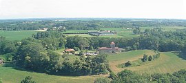 Camp du Mus | |
 Coat of arms | |
show Location of Doazit | |
 Doazit | |
| Coordinates: 43°41′29″N 0°38′42″W / 43.6914°N 0.645°WCoordinates: 43°41′29″N 0°38′42″W / 43.6914°N 0.645°W | |
| Country | France |
| Region | Nouvelle-Aquitaine |
| Department | Landes |
| Arrondissement | Dax |
| Canton | Coteau de Chalosse |
| Government | |
| • Mayor (2020–2026) | Denis Langlade |
| Area 1 | 22.16 km2 (8.56 sq mi) |
| Population (Jan. 2018)[1] | 857 |
| • Density | 39/km2 (100/sq mi) |
| Time zone | UTC+01:00 (CET) |
| • Summer (DST) | UTC+02:00 (CEST) |
| INSEE/Postal code | 40089 /40700 |
| Elevation | 57–127 m (187–417 ft) (avg. 112 m or 367 ft) |
| 1 French Land Register data, which excludes lakes, ponds, glaciers > 1 km2 (0.386 sq mi or 247 acres) and river estuaries. | |


Doazit (French pronunciation: [dɔazi]; Occitan: Doasit) is a commune in the Landes department in Nouvelle-Aquitaine in southwestern France.
Population[]
|
|
See also[]
References[]
- ^ "Populations légales 2018". INSEE. 28 December 2020.
| Wikimedia Commons has media related to Doazit. |
This Landes geographical article is a stub. You can help Wikipedia by . |
Categories:
- Communes of Landes (department)
- Landes (department) geography stubs