Mano, Landes
Mano | |
|---|---|
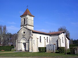 Church at Mano | |
show Location of Mano | |
 Mano | |
| Coordinates: 44°25′05″N 0°40′15″W / 44.4181°N 0.6708°WCoordinates: 44°25′05″N 0°40′15″W / 44.4181°N 0.6708°W | |
| Country | France |
| Region | Nouvelle-Aquitaine |
| Department | Landes |
| Arrondissement | Mont-de-Marsan |
| Canton | Grands Lacs |
| Intercommunality | Cœur Haute Lande |
| Government | |
| • Mayor (2020–2026) | Joëlle Boulanger-Banet[1] |
| Area 1 | 32.27 km2 (12.46 sq mi) |
| Population (Jan. 2018)[2] | 120 |
| • Density | 3.7/km2 (9.6/sq mi) |
| Time zone | UTC+01:00 (CET) |
| • Summer (DST) | UTC+02:00 (CEST) |
| INSEE/Postal code | 40171 /40410 |
| Elevation | 38–74 m (125–243 ft) (avg. 63 m or 207 ft) |
| 1 French Land Register data, which excludes lakes, ponds, glaciers > 1 km2 (0.386 sq mi or 247 acres) and river estuaries. | |


Mano (French pronunciation: [mano]; Occitan: Manòr) is a commune in the Landes department in Nouvelle-Aquitaine in south-western France.
See also[]
References[]
- ^ "Répertoire national des élus: les maires". data.gouv.fr, Plateforme ouverte des données publiques françaises (in French). 2 December 2020.
- ^ "Populations légales 2018". INSEE. 28 December 2020.
| Wikimedia Commons has media related to Mano (Landes). |
This Landes geographical article is a stub. You can help Wikipedia by . |
Categories:
- Communes of Landes (department)
- Landes (department) geography stubs