Saint-Cricq-du-Gave
Saint-Cricq-du-Gave | |
|---|---|
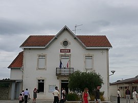 Town hall | |
show Location of Saint-Cricq-du-Gave | |
 Saint-Cricq-du-Gave | |
| Coordinates: 43°32′05″N 1°00′43″W / 43.5347°N 1.0119°WCoordinates: 43°32′05″N 1°00′43″W / 43.5347°N 1.0119°W | |
| Country | France |
| Region | Nouvelle-Aquitaine |
| Department | Landes |
| Arrondissement | Dax |
| Canton | Orthe et Arrigans |
| Intercommunality | Pays d'Orthe et Arrigans |
| Government | |
| • Mayor (2020–2026) | Guy Baubion-Broye |
| Area 1 | 8.7 km2 (3.4 sq mi) |
| Population (Jan. 2018)[1] | 425 |
| • Density | 49/km2 (130/sq mi) |
| Time zone | UTC+01:00 (CET) |
| • Summer (DST) | UTC+02:00 (CEST) |
| INSEE/Postal code | 40254 /40300 |
| Elevation | 6–143 m (20–469 ft) (avg. 13 m or 43 ft) |
| 1 French Land Register data, which excludes lakes, ponds, glaciers > 1 km2 (0.386 sq mi or 247 acres) and river estuaries. | |


Saint-Cricq-du-Gave (French pronunciation: [sɛ̃ kʁik dy ɡav]; Occitan: Sent Cric deu Gave) is a commune in the Landes department in Nouvelle-Aquitaine in southwestern France.
Population[]
|
|
See also[]
References[]
- ^ "Populations légales 2018". INSEE. 28 December 2020.
| Wikimedia Commons has media related to Saint-Cricq-du-Gave. |
This Landes geographical article is a stub. You can help Wikipedia by . |
Categories:
- Communes of Landes (department)
- Landes (department) geography stubs