Arue, Landes
Arue | |
|---|---|
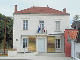 Town hall | |
show Location of Arue | |
 Arue | |
| Coordinates: 44°03′40″N 0°21′01″W / 44.0611°N 0.3503°WCoordinates: 44°03′40″N 0°21′01″W / 44.0611°N 0.3503°W | |
| Country | France |
| Region | Nouvelle-Aquitaine |
| Department | Landes |
| Arrondissement | Mont-de-Marsan |
| Canton | Haute Lande Armagnac |
| Intercommunality | |
| Government | |
| • Mayor (2020–2026) | Frédéric Duprat |
| Area 1 | 48.11 km2 (18.58 sq mi) |
| Population (Jan. 2018)[1] | 353 |
| • Density | 7.3/km2 (19/sq mi) |
| Time zone | UTC+01:00 (CET) |
| • Summer (DST) | UTC+02:00 (CEST) |
| INSEE/Postal code | 40014 /40120 |
| Elevation | 47–113 m (154–371 ft) |
| 1 French Land Register data, which excludes lakes, ponds, glaciers > 1 km2 (0.386 sq mi or 247 acres) and river estuaries. | |


Arue (French pronunciation: [aʁy]; Occitan: Arua) is a commune of the Landes department in Nouvelle-Aquitaine in southwestern France.
Population[]
| Year | Pop. | ±% |
|---|---|---|
| 1962 | 379 | — |
| 1968 | 425 | +12.1% |
| 1975 | 347 | −18.4% |
| 1982 | 294 | −15.3% |
| 1990 | 290 | −1.4% |
| 1999 | 286 | −1.4% |
| 2006 | 295 | +3.1% |
| 2009 | 305 | +3.4% |
| 2015 | 335 | +9.8% |
Transport[]
Between 1907 and 1934, Arue was a station on the 12-kilometre (7.5 mi) long 750 mm (2 ft 5+1⁄2 in) gauge Chemin de fer Économiques Forestiers des Landes railway line, which ran from Roquefort to Lencouacq.[2]
See also[]
References[]
- ^ "Populations légales 2018". INSEE. 28 December 2020.
- ^ Davies, W. J. K. (2000). Minor Railways of France. East Harling: Plateway Press. p. 195. ISBN 1 871980 45 3.
| Wikimedia Commons has media related to Arue (Landes). |
This Landes geographical article is a stub. You can help Wikipedia by . |
Categories:
- Communes of Landes (department)
- Landes (department) geography stubs