Saint-Agnet
Saint-Agnet | |
|---|---|
 | |
show Location of Saint-Agnet | |
 Saint-Agnet | |
| Coordinates: 43°36′26″N 0°16′20″W / 43.6072°N 0.2722°WCoordinates: 43°36′26″N 0°16′20″W / 43.6072°N 0.2722°W | |
| Country | France |
| Region | Nouvelle-Aquitaine |
| Department | Landes |
| Arrondissement | Mont-de-Marsan |
| Canton | Adour Armagnac |
| Intercommunality | Aire-sur-l'Adour |
| Government | |
| • Mayor (2020–2026) | Jean-Paul Doreilh |
| Area 1 | 7.8 km2 (3.0 sq mi) |
| Population (Jan. 2018)[1] | 181 |
| • Density | 23/km2 (60/sq mi) |
| Time zone | UTC+01:00 (CET) |
| • Summer (DST) | UTC+02:00 (CEST) |
| INSEE/Postal code | 40247 /40800 |
| Elevation | 99–196 m (325–643 ft) (avg. 186 m or 610 ft) |
| 1 French Land Register data, which excludes lakes, ponds, glaciers > 1 km2 (0.386 sq mi or 247 acres) and river estuaries. | |


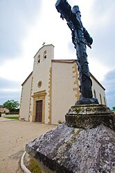
Saint-Agnet (French pronunciation: [sɛ̃.t‿aɲɛ]; Occitan: Sent Anhet) is a commune in the Landes department in Nouvelle-Aquitaine in southwestern France.
Population[]
|
|
See also[]
References[]
- ^ "Populations légales 2018". INSEE. 28 December 2020.
| Wikimedia Commons has media related to Saint-Agnet. |
This Landes geographical article is a stub. You can help Wikipedia by . |
Categories:
- Communes of Landes (department)
- Landes (department) geography stubs