Saint-Paul-lès-Dax
Saint-Paul-lès-Dax | |
|---|---|
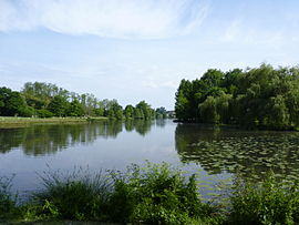 Christus Lake | |
 Coat of arms | |
show Location of Saint-Paul-lès-Dax | |
 Saint-Paul-lès-Dax | |
| Coordinates: 43°43′35″N 1°03′06″W / 43.7264°N 1.0517°WCoordinates: 43°43′35″N 1°03′06″W / 43.7264°N 1.0517°W | |
| Country | France |
| Region | Nouvelle-Aquitaine |
| Department | Landes |
| Arrondissement | Dax |
| Canton | Dax-1 |
| Intercommunality | Grand Dax |
| Government | |
| • Mayor (2020–2026) | Julien Bazus |
| Area 1 | 58.45 km2 (22.57 sq mi) |
| Population (Jan. 2018)[1] | 13,436 |
| • Density | 230/km2 (600/sq mi) |
| Time zone | UTC+01:00 (CET) |
| • Summer (DST) | UTC+02:00 (CEST) |
| INSEE/Postal code | 40279 /40990 |
| Elevation | 2–61 m (6.6–200.1 ft) (avg. 22 m or 72 ft) |
| 1 French Land Register data, which excludes lakes, ponds, glaciers > 1 km2 (0.386 sq mi or 247 acres) and river estuaries. | |


Saint-Paul-lès-Dax (French pronunciation: [sɛ̃ pɔl lɛ daks], literally Saint-Paul near Dax; Gascon: Sent Pau d'Acs) is a commune in the Landes department in Nouvelle-Aquitaine in southwestern France.
Population[]
|
|
See also[]
References[]
- ^ "Populations légales 2018". INSEE. 28 December 2020.
| Wikimedia Commons has media related to Saint-Paul-lès-Dax. |
| show Authority control |
|---|
This Landes geographical article is a stub. You can help Wikipedia by . |
Categories:
- Communes of Landes (department)
- Landes (department) geography stubs