Dobřany
Dobřany | |
|---|---|
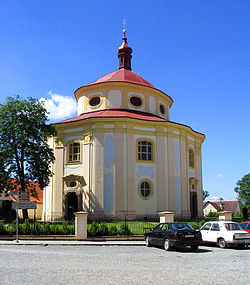 St. Vitus Church in Dobřany | |
 Flag  Coat of arms | |
 Dobřany Location in the Czech Republic | |
| Coordinates: 49°39′14″N 13°17′25″E / 49.65389°N 13.29028°ECoordinates: 49°39′14″N 13°17′25″E / 49.65389°N 13.29028°E | |
| Country | |
| Region | Plzeň |
| District | Plzeň-South |
| First mentioned | 1243 |
| Government | |
| • Mayor | Martin Sobotka |
| Area | |
| • Total | 35.32 km2 (13.64 sq mi) |
| Elevation | 352 m (1,155 ft) |
| Population (2021-01-01)[1] | |
| • Total | 6,169 |
| • Density | 170/km2 (450/sq mi) |
| Time zone | UTC+1 (CET) |
| • Summer (DST) | UTC+2 (CEST) |
| Postal code | 334 41 |
| Website | www |

Dobřany (Czech pronunciation: [ˈdobr̝anɪ]; German: Dobrzan, Wiesengrund) is a town in Plzeň-South District in the Plzeň Region of the Czech Republic. It has about 6,200 inhabitants. It lies on the Radbuza River, some 5 km (3 mi) to the south-west from the region capital of Plzeň. The town centre is well preserved and is protected by law as urban monument zone.
Administrative parts[]
Villages of Šlovice and Vodní Újezd are administrative parts of Dobřany.
History[]
The first written mention of Dobřany is from 1243.[2]
From 1938 to 1945 it belonged to Sudetenland in Nazi Germany; between 1939 and 1945 it was named Wiesengrund.
Infrastructure[]
The town is known for its psychiatric hospital.
Notable people[]
- Jan Josef Ignác Brentner (1689–1742), composer
- Joseph Maria Wolfram (1789–1839), German-Bohemian politician
- Norbert Ormay (1813–1849), colonel in the Hungarian Army
Twin towns – sister cities[]
 Brežice, Slovenia
 Dobřany, Czech Republic
 Obertraubling, Germany
References[]
- ^ "Population of Municipalities – 1 January 2021". Czech Statistical Office. 2021-04-30.
- ^ "Historie města" (in Czech). Město Dobřany. Retrieved 2021-06-07.
- ^ "Partnerská města". dobrany.cz (in Czech). Město Dobřany. Retrieved 2020-07-28.
External links[]
| Wikimedia Commons has media related to Dobřany. |
- Official website (in Czech)
| show Authority control |
|---|
This Plzeň Region location article is a stub. You can help Wikipedia by . |
Categories:
- Cities and towns in the Czech Republic
- Populated places in Plzeň-South District
- Plzeň Region geography stubs