Dolní Město
Dolní Město | |
|---|---|
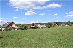 View on Dolní Město | |
 Flag  Coat of arms | |
 Dolní Město Location in the Czech Republic | |
| Coordinates: 49°37′40″N 15°22′56″E / 49.62778°N 15.38222°ECoordinates: 49°37′40″N 15°22′56″E / 49.62778°N 15.38222°E | |
| Country | |
| Region | Vysočina |
| District | Havlíčkův Brod |
| First mentioned | 1386 |
| Area | |
| • Total | 18.80 km2 (7.26 sq mi) |
| Elevation | 440 m (1,440 ft) |
| Population (2020-01-01[1]) | |
| • Total | 912 |
| • Density | 49/km2 (130/sq mi) |
| Time zone | UTC+1 (CET) |
| • Summer (DST) | UTC+2 (CEST) |
| Postal code | 582 33, 582 91, 584 01 |
| Website | www |

Dolní Město (Czech pronunciation: [ˈdolɲiː ˈmɲɛsto]) is a municipality and village in Havlíčkův Brod District in the Vysočina Region of the Czech Republic. It has about 900 inhabitants.
Dolní Město lies approximately 15 kilometres (9 mi) west of Havlíčkův Brod, 30 km (19 mi) north-west of Jihlava, and 86 km (53 mi) south-east of Prague.
Administrative parts[]
Villages and hamlets of Dobrá Voda Lipnická, Loukov, Meziklasí, Rejčkov and Smrčensko are administrative parts of Dolní Město.
References[]
- ^ "Population of Municipalities – 1 January 2020". Czech Statistical Office. 2020-04-30.
| Wikimedia Commons has media related to Dolní Město. |
| Authority control: National libraries |
|---|
This Vysočina Region location article is a stub. You can help Wikipedia by . |
Categories:
- Villages in Havlíčkův Brod District
- Vysočina Region geography stubs