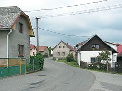
Druhanov
This article includes a list of references, related reading or external links, but its sources remain unclear because it lacks inline citations. (November 2018) |
Druhanov | |
|---|---|
Municipality | |
 | |
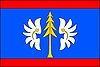 Flag  Coat of arms | |
 Druhanov | |
| Coordinates: 49°41′53″N 15°24′38″E / 49.69806°N 15.41056°ECoordinates: 49°41′53″N 15°24′38″E / 49.69806°N 15.41056°E | |
| Country | |
| Region | Vysočina |
| District | Havlíčkův Brod |
| Area | |
| • Total | 3.91 km2 (1.51 sq mi) |
| Elevation | 496 m (1,627 ft) |
| Population (1.1.2014) | |
| • Total | 161 |
| • Density | 41/km2 (110/sq mi) |
| Postal code | 582 91 |
| Website | http://www.sweb.cz/druhanov/ |

Druhanov is a village and municipality (obec) in Havlíčkův Brod District in the Vysočina Region of the Czech Republic.
The municipality covers an area of 3.91 square kilometres (1.51 sq mi), and has a population of 156 (as at 3 July 2006).
Druhanov lies approximately 16 kilometres (10 mi) north-west of Havlíčkův Brod, 36 km (22 mi) north of Jihlava, and 84 km (52 mi) south-east of Prague.
References[]
| Wikimedia Commons has media related to Druhanov. |
| Authority control: National libraries |
|---|
This Vysočina Region location article is a stub. You can help Wikipedia by . |
Categories:
- Villages in Havlíčkův Brod District
- Vysočina Region geography stubs